Stage 3. Rifugio Lagazuoi – Rifugio Nuvolau
Distance: 24.61 km · Elevation Gain: +1848 m · Elevation Loss: −2023 m · Technical Difficulty: Difficult
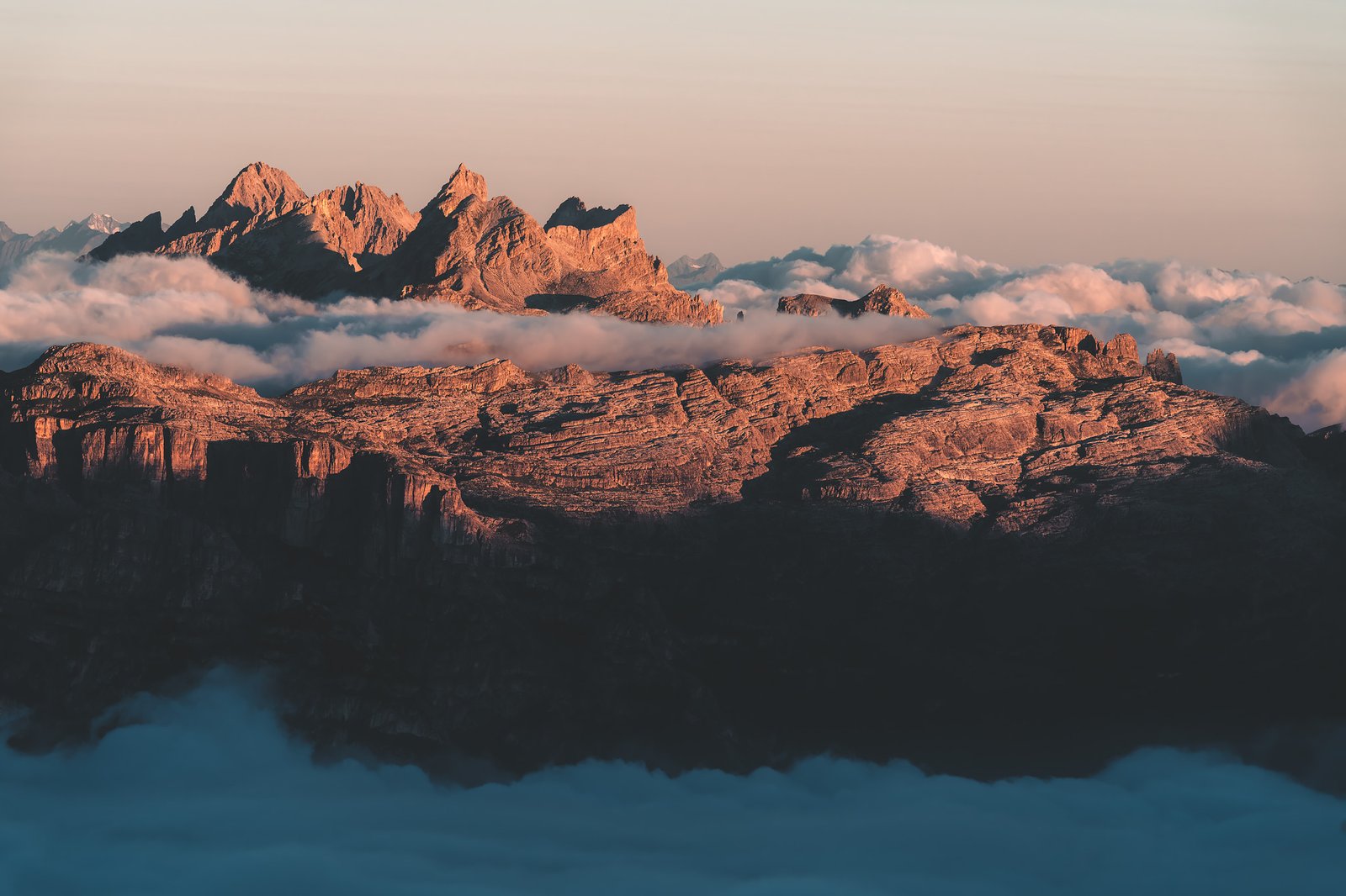
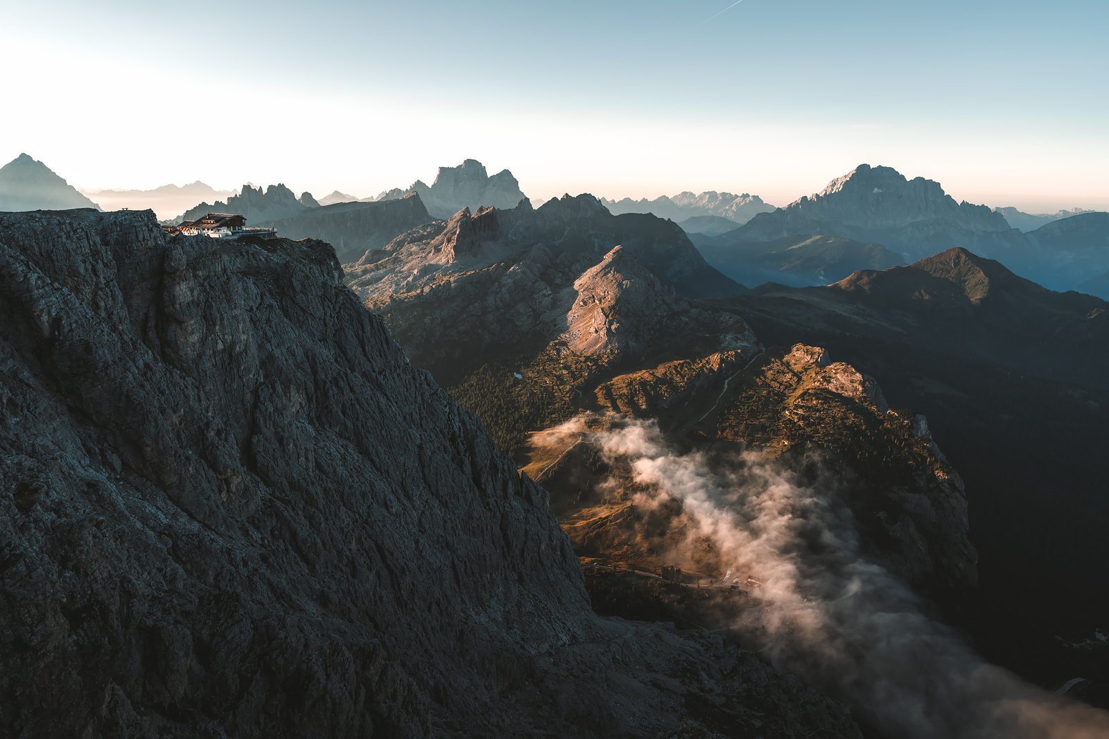
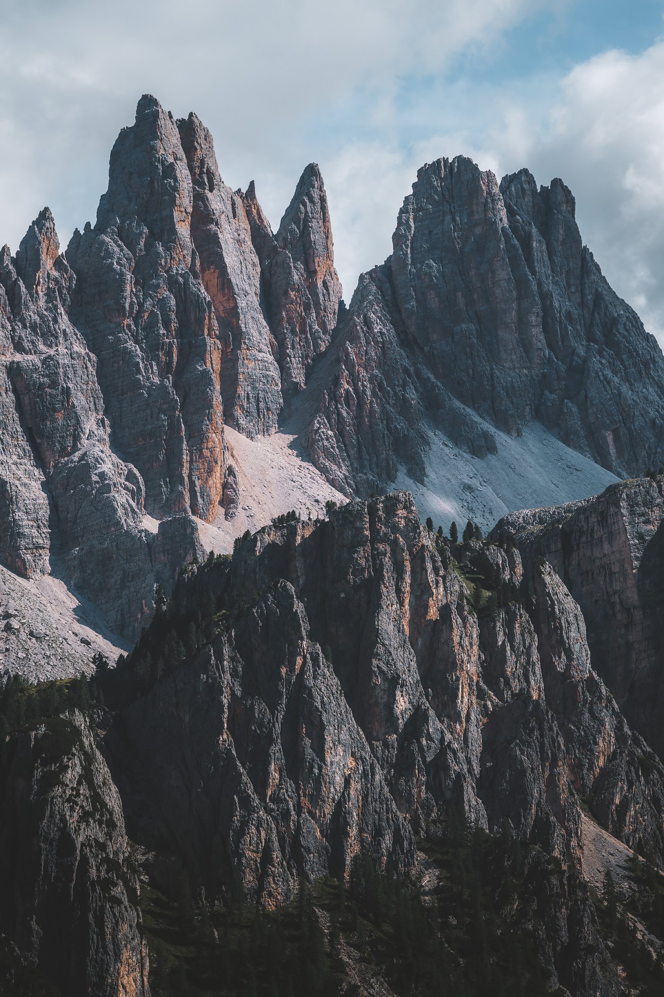
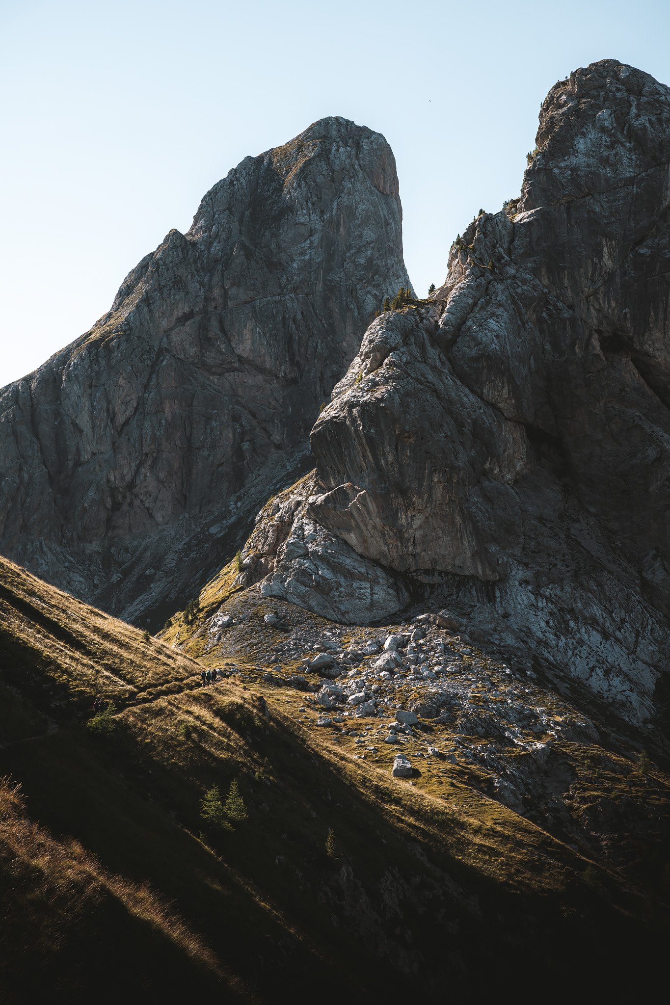
On a clear day in the Dolomites, the sun rises with a clarity that is unlike anything in lower elevations. It’s a little more intense, a little more vibrant. The landscape unfolds in all directions, the horizon stretching farther and farther.
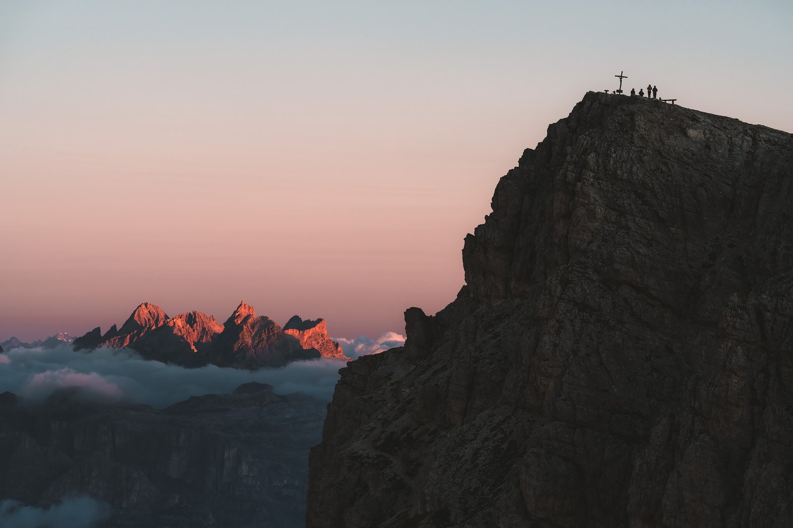
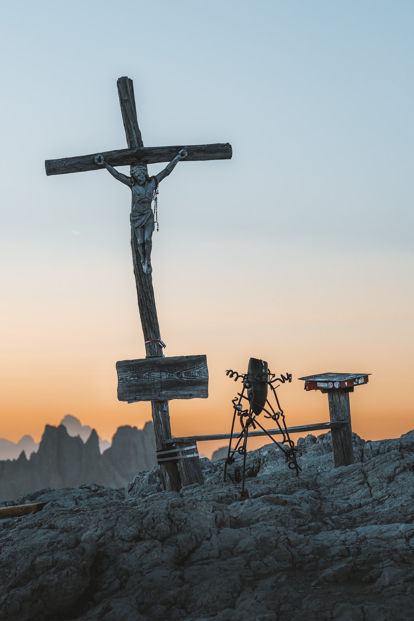
From the cross that sat atop the rifugio, the light spread across the Dolomites with remarkable clarity. It was a clean light, with edges and shadows defined, and the tones were incredible.
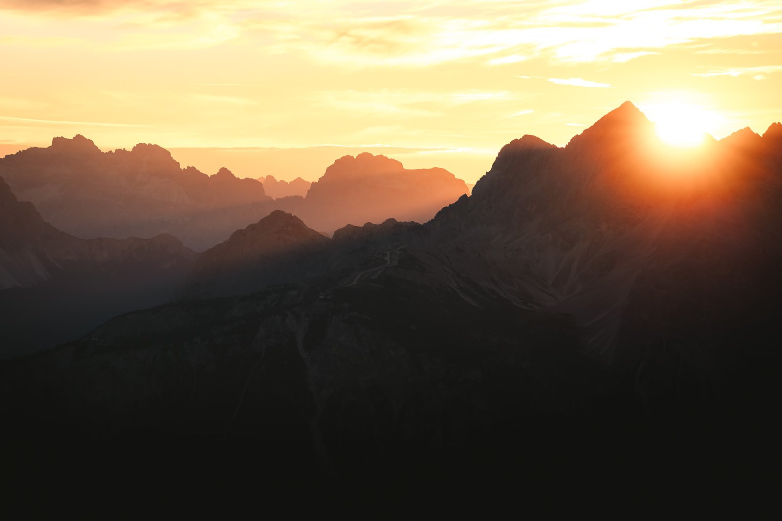
For a brief moment, the peaks in the distance turned a soft pink and orange hue known locally as Enrosadira (alpenglow). This would be followed by a much cooler light.
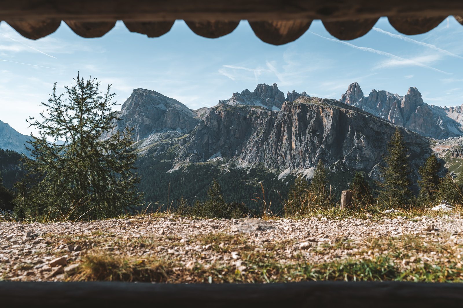
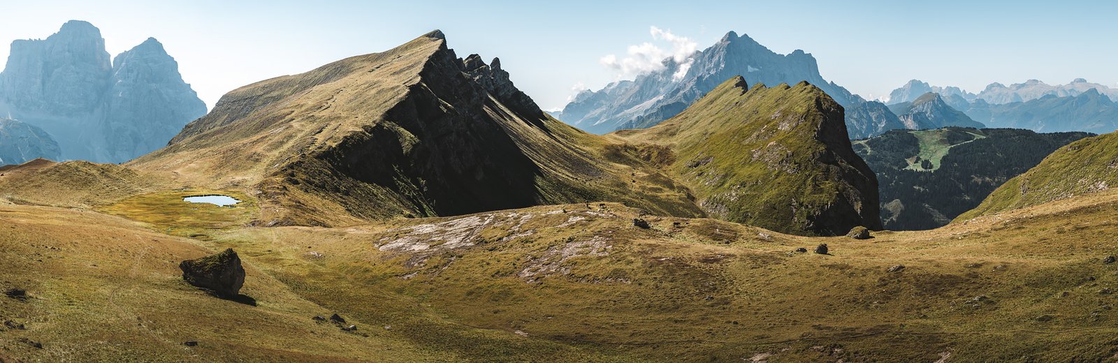
Some of the most recognizable massifs in the Dolomites were visible from the cross on the rifugio. Civetta and Pelmo could be seen in the distance. The Tofane group filled the skyline nearby. Farther away, layers of mountains stretched out endlessly. Also, the Cinque Torri could be seen in the distance, though smaller than elsewhere on the route.
Then, quite quickly, a mass of mist rolled into the valley. It moved with a kind of intention, behind the cliff that sustained the rifugio. The mist came from below and began filling the space between the mountains. It swallowed portions of the landscape while leaving others untouched. The entire scene transformed within minutes.
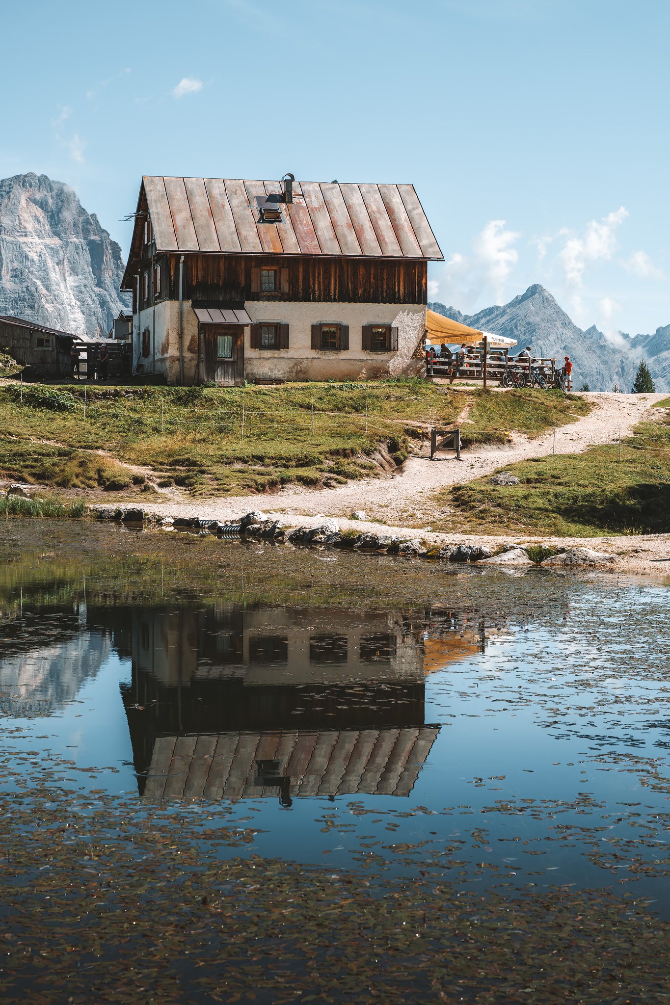
After one of the most extraordinary breakfasts of the route, filled with options, tasty pastries and a warm capuccino, I left the rifugio.

War in the Mountains
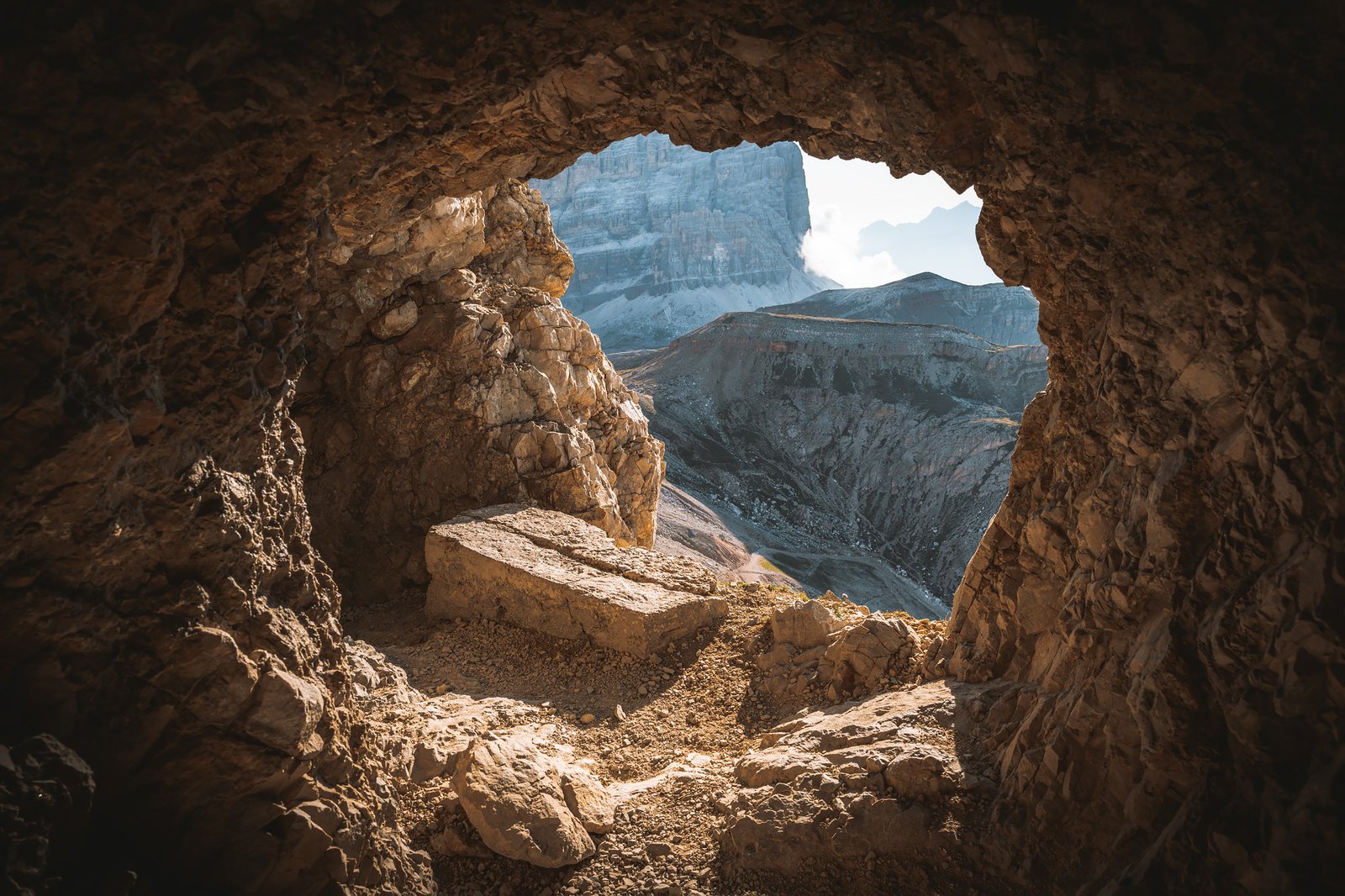
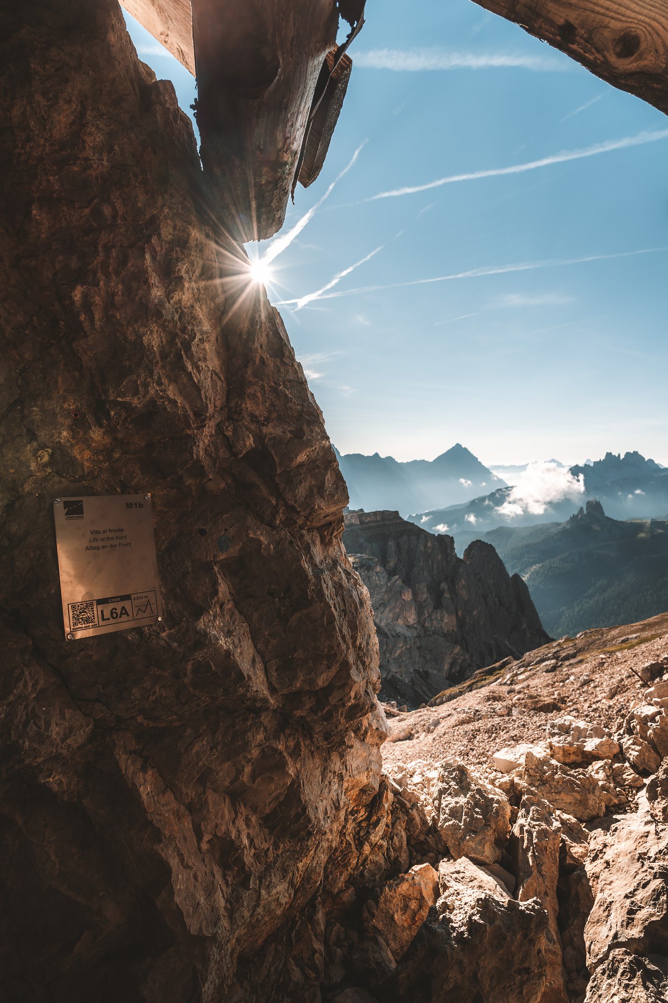
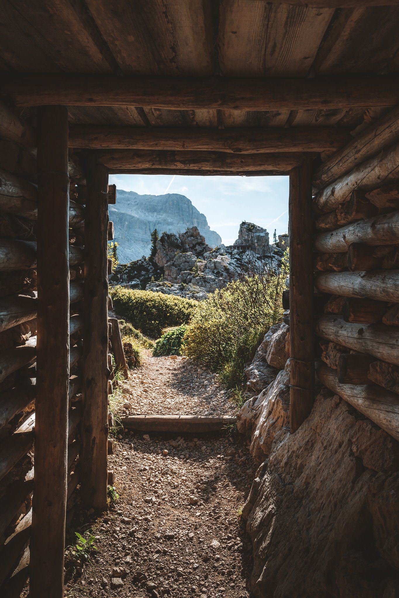
One place cannot be missed before leaving Lagazuoi, the tunnels.
Much of this area was a front line during the Great War. Italian and Austrian troops fought not only across ridges, but inside the mountains themselves. What remains today is an extensive network of tunnels, trenches, and carved passages.
Finding the area was quite straightforward, but locating the correct entrance takes some effort. It is easy to take a longer route than necessary, I did. But that detour led to something unexpected. A marmot emerged cautiously from its burrow. For a brief moment, curiosity overcame fear, and it stepped out just enough to allow for a close encounter before disappearing again.
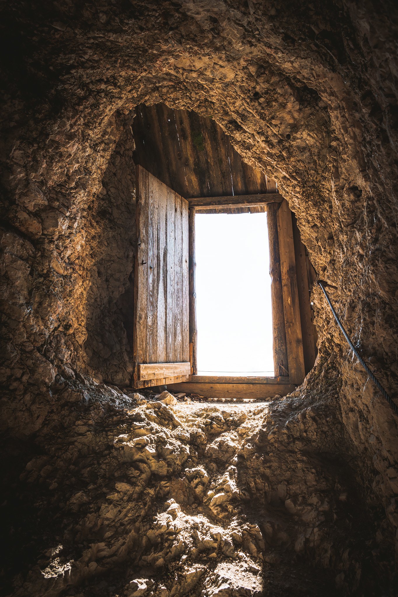
Once inside, the tunnels are cold, wet, steep, and disorienting. Some sections of the floor are submerged, and in places the tunnels feel more like channels than walkable paths.
Hundreds of stairs carved into the rock lead upward through narrow corridors, making orientation difficult. Small openings appear along the walls, once used as observation posts or firing positions. In some sections, the tunnels branch into separate spaces, storage areas, living quarters, defensive positions, some still fitted with old machine guns pointing outward.
It is easy to lose your sense of direction. Reaching the lower sections and then making your way back up is physically demanding. The return to Lagazuoi is long and exhausting, especially after navigating the darkness below.
Still, it is worth it. This entire area is also a hub for via ferrata routes, something that feels like a natural extension of the experience, even if left for another time.
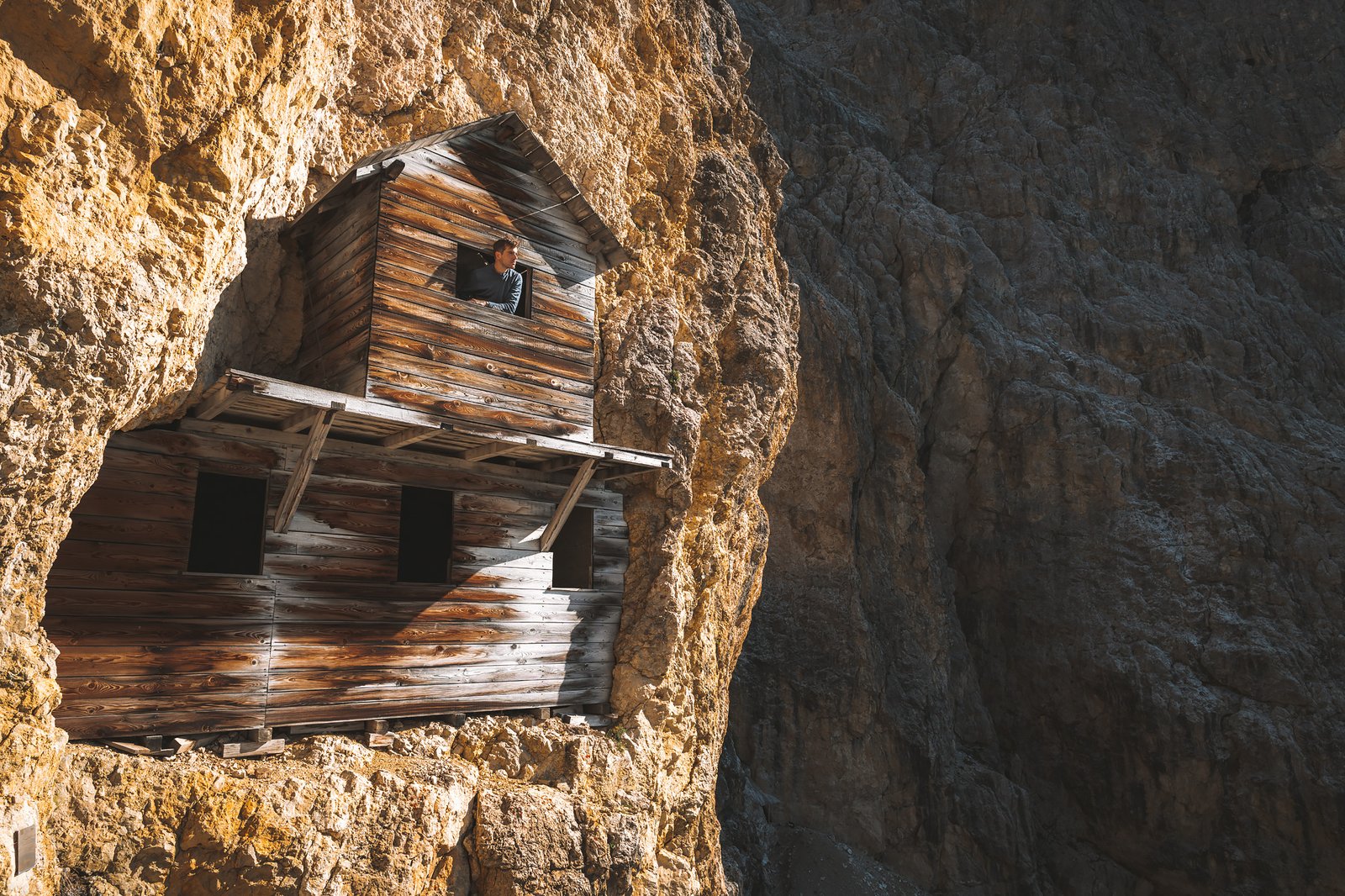
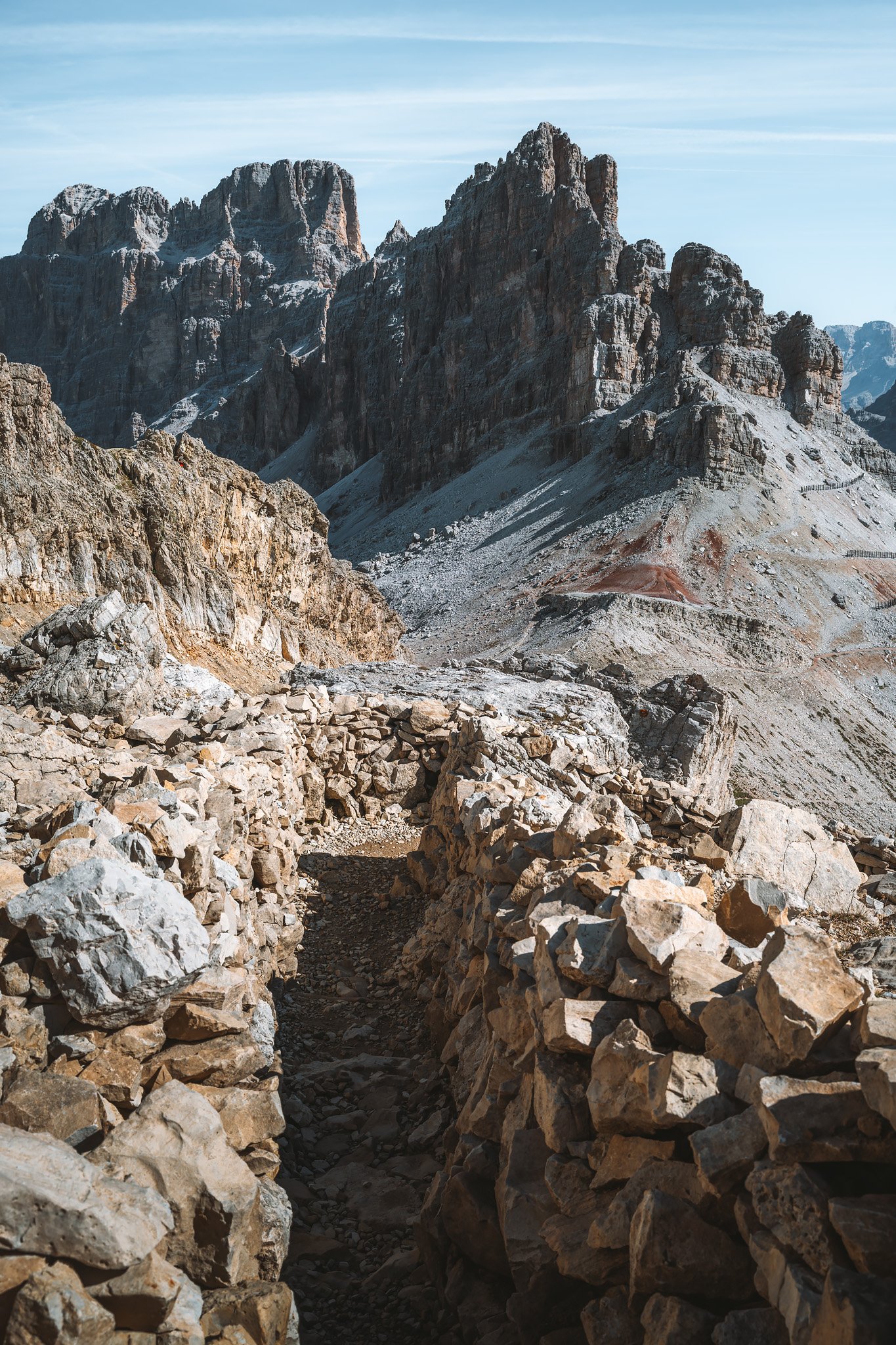
Near the bottom of the tunnel system, after a detour, lies Cengia Martini. From a distance, it is striking, a narrow ledge cutting across a steep rock face. Reaching it is another matter. Parts of the path have collapsed, and other sections are loose and exposed. Still, I managed to get there.
Up close, it reveals something different. The ledge is wider than it appears in places, and carved into the rock are the remains of simple wooden rooms, basic shelters once used by soldiers. Standing inside them changes your perspective entirely.
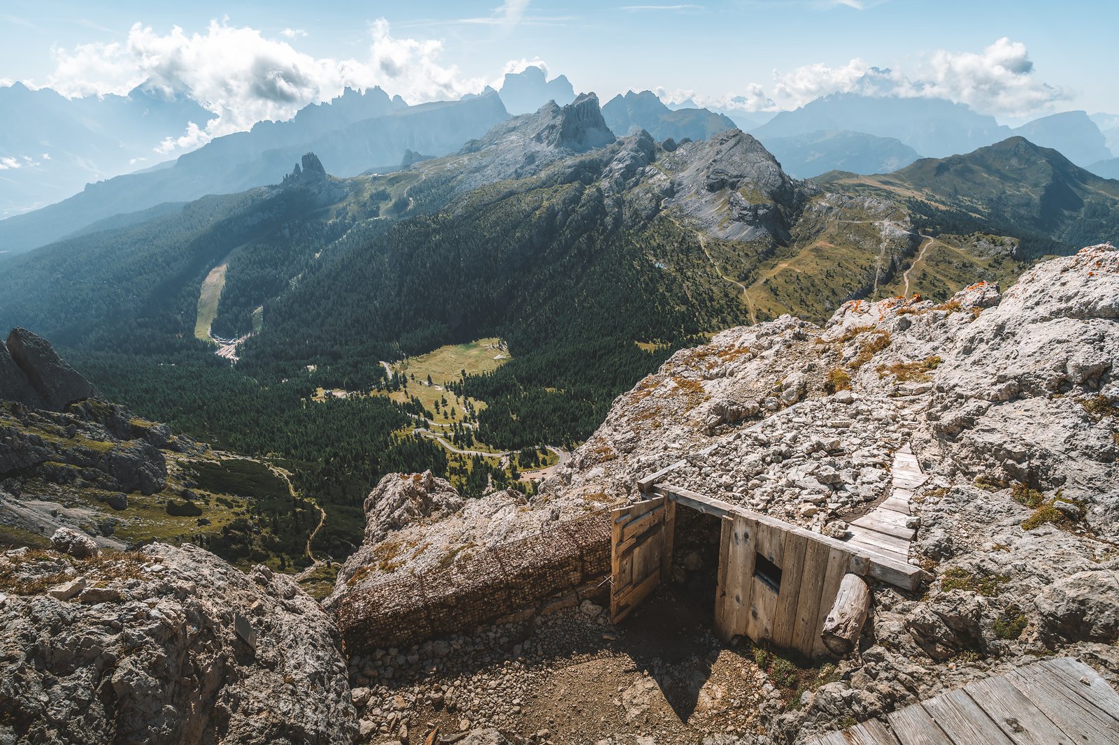
And then there is the climb itself back to the summit, long, in complete darkness, with no clear sense of distance or direction. The tunnels seem endless, splitting into multiple branches, making it easy to get lost. Eventually, after longer than expected and several attempts, the exit appears, quietly, almost unexpectedly, just behind the rifugio itself, surrounded by rocky trenches.
Toward Cinque Torri
The descent from Lagazuoi is long and continuous. As you go down, the terrain softens. The forest returns.
The transition between the Tofane and Cinque Torri passes through dense woodland, mainly spruce and larch. Light filters unevenly through the canopy, creating alternating bands of brightness and shadow. The ground shifts between soft layers of needles and exposed rock.
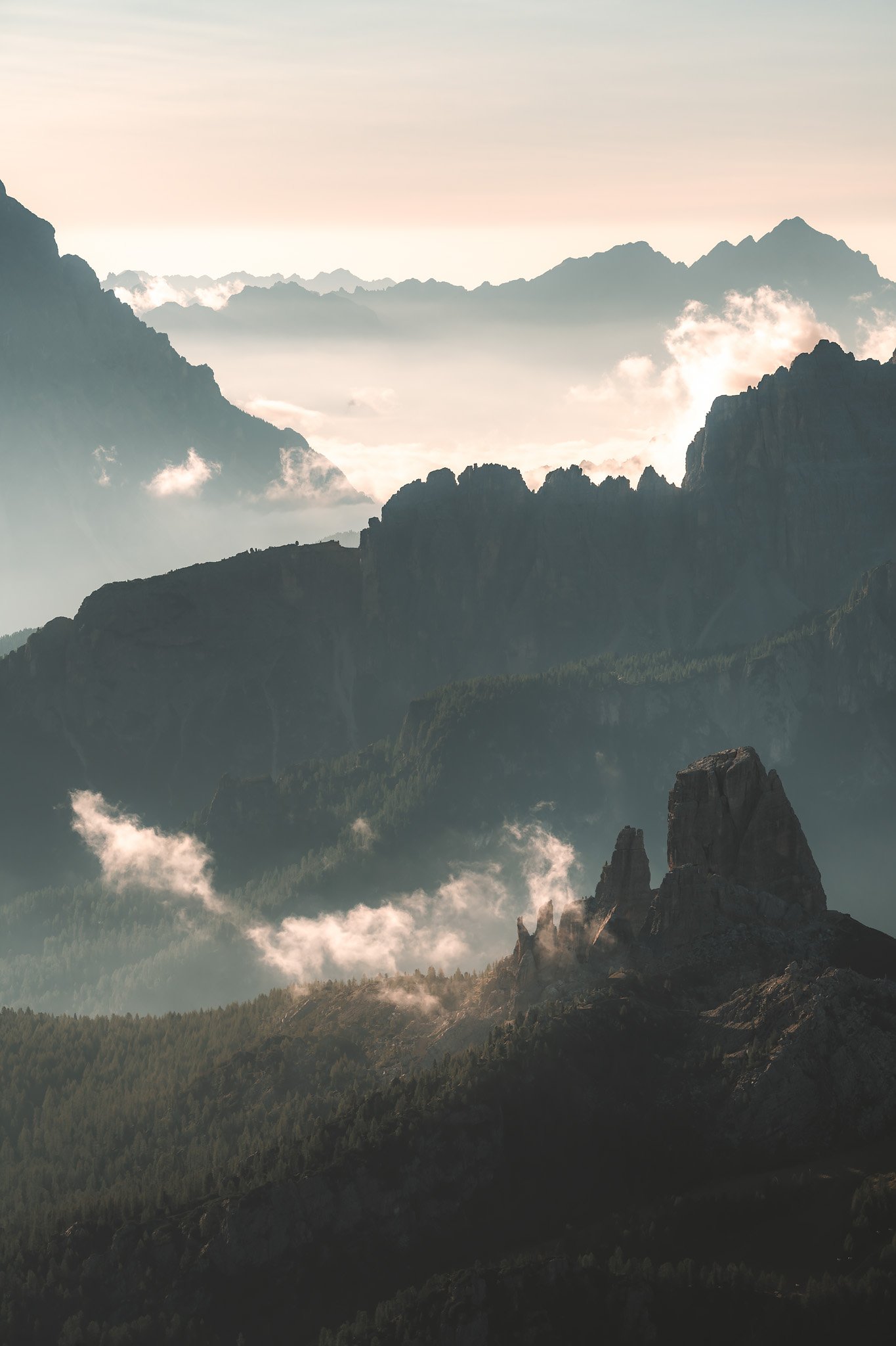
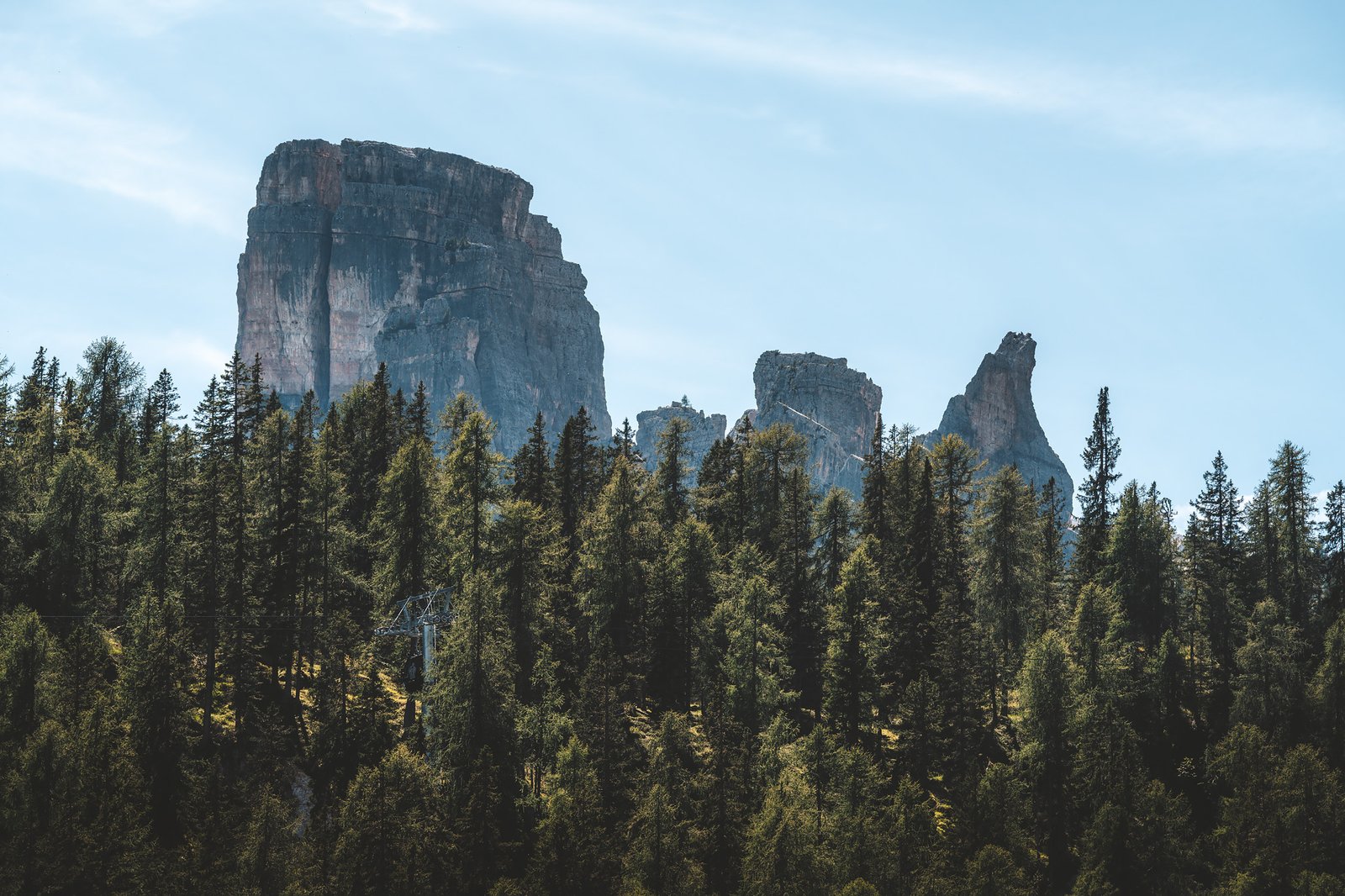
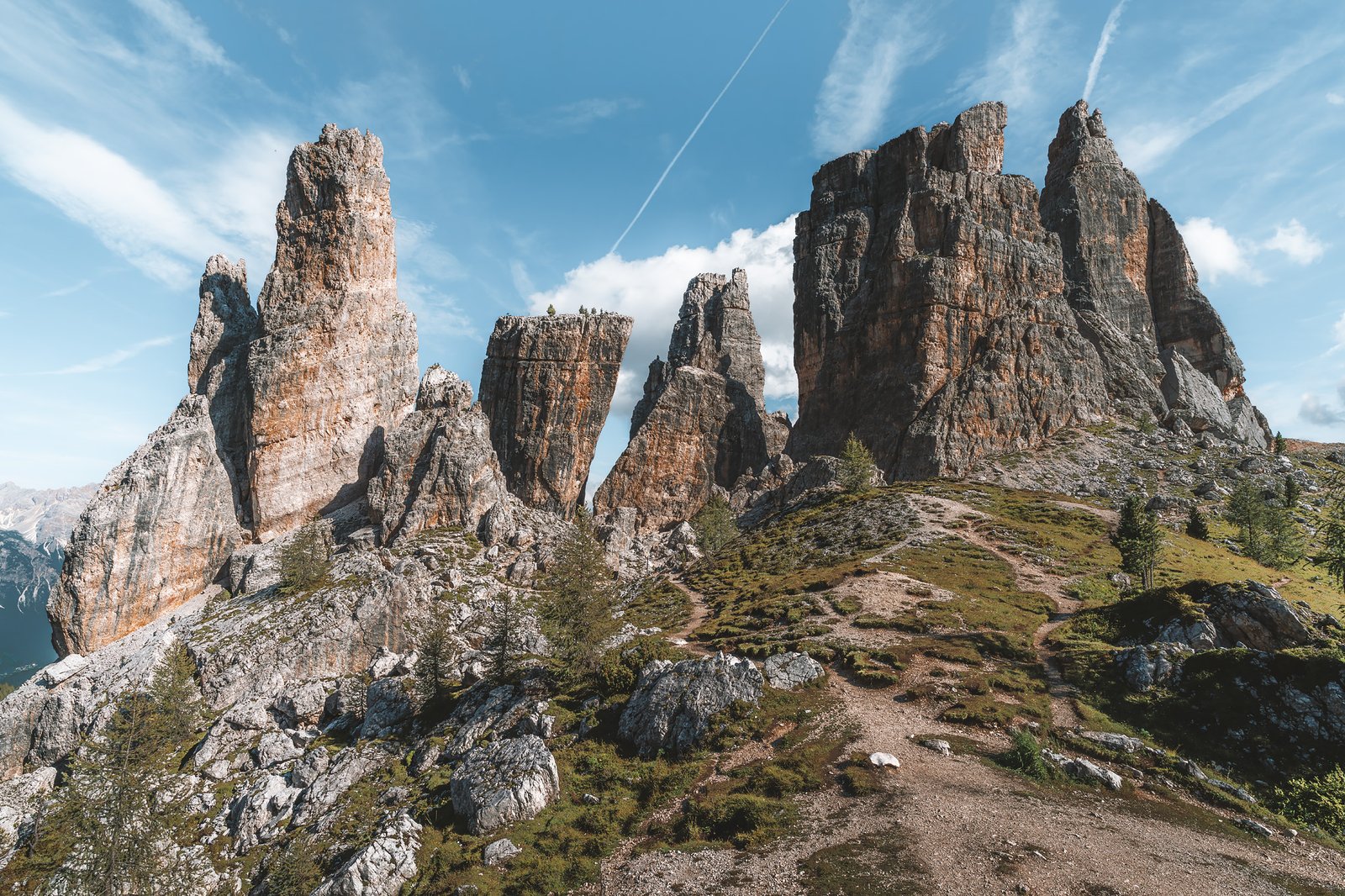
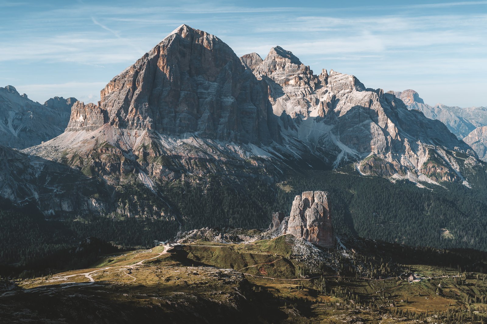
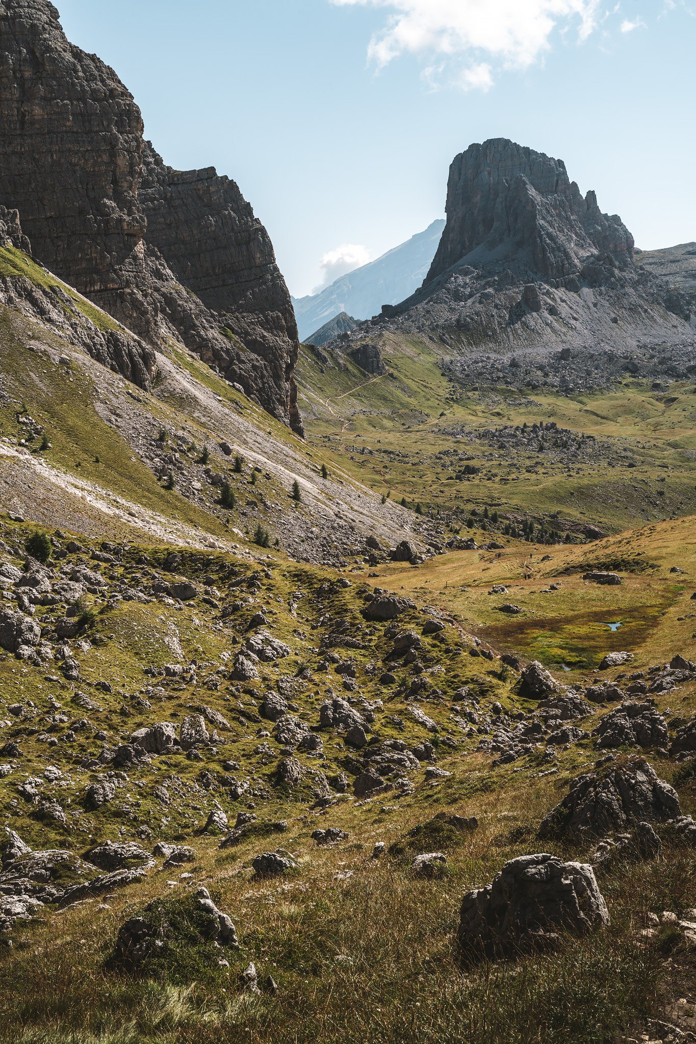
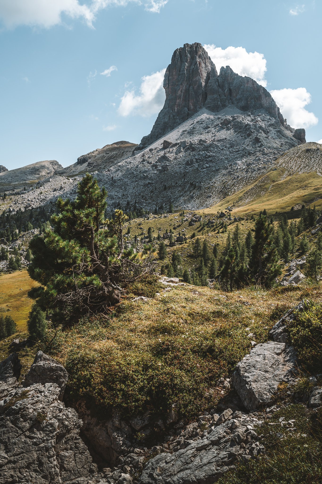
This section feels quieter, more enclosed. And then the landscape opens and Cinque Torri emerges to your right.
Five vertical towers rise from the ground, each distinct in shape and structure. From below, they are easier to distinguish than in most photographs.
What stands out is how much they change depending on perspective. From one angle, they appear compact. From another, separated and independent. The time of day reshapes them completely, light defines everything here.
An open-air museum spreads across the slope. You can walk through trenches, wooden structures, and reconstructed positions. You follow the same lines once used in war, understanding how the terrain shaped movement and strategy.
Meanwhile, rock climbers move along the rock faces, giving scale to the towers.
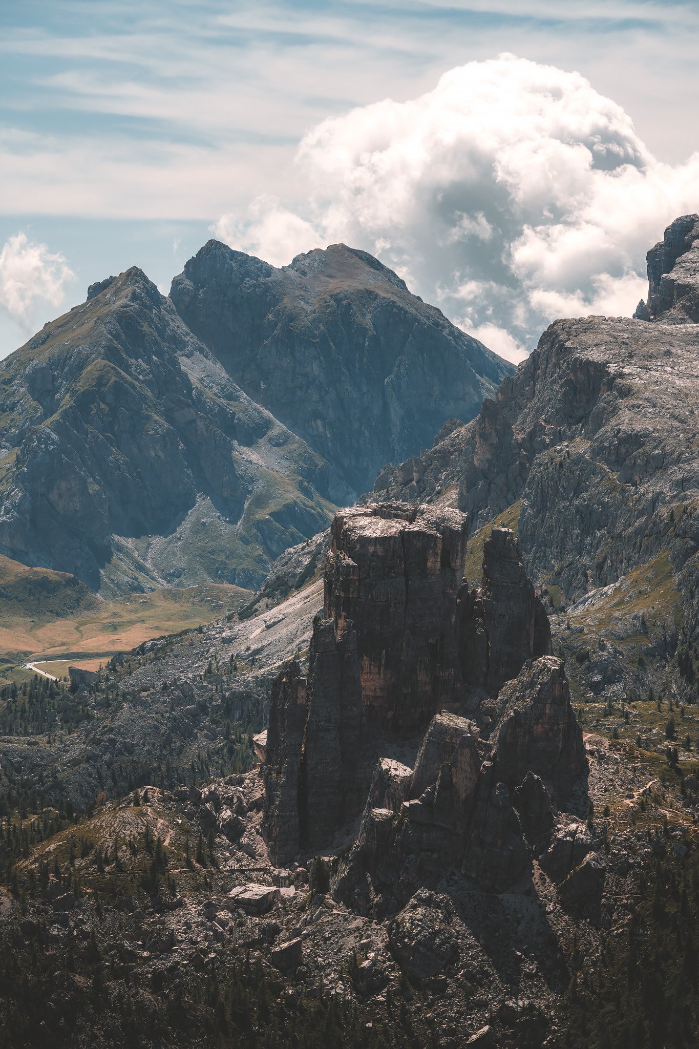
Nuvolau
From Cinque Torri, the trail climbs again, first to Averau, then to Nuvolau. The final stretch is relatively short and exposed.
Nuvolau sits on a rocky summit with no gradual transition. One moment you are climbing, the next you are completely exposed to the horizon. The views are overwhelming.
From the terrace, Cinque Torri lies below. Behind, the Tofane dominate. In the distance, opposite to the towers, Civetta and Pelmo appear once again. Mountains extend in layers in every direction.
Once in the rifugio, after yet another fantastic dinner with a great conversation with an Austrian I had met the night before and a Swedish couple on their honeymoon, sunset gathers everyone outside. The light moves constantly across the peaks. There is no single focal point, only shifting compositions depending on where you look.
Stage 4. Rifugio Nuvolau – Rifugio Venezia
Distance: 24.30 km · Elevation Gain: +1076 m · Elevation Loss: −1870 m · Technical Difficulty: Very Difficult
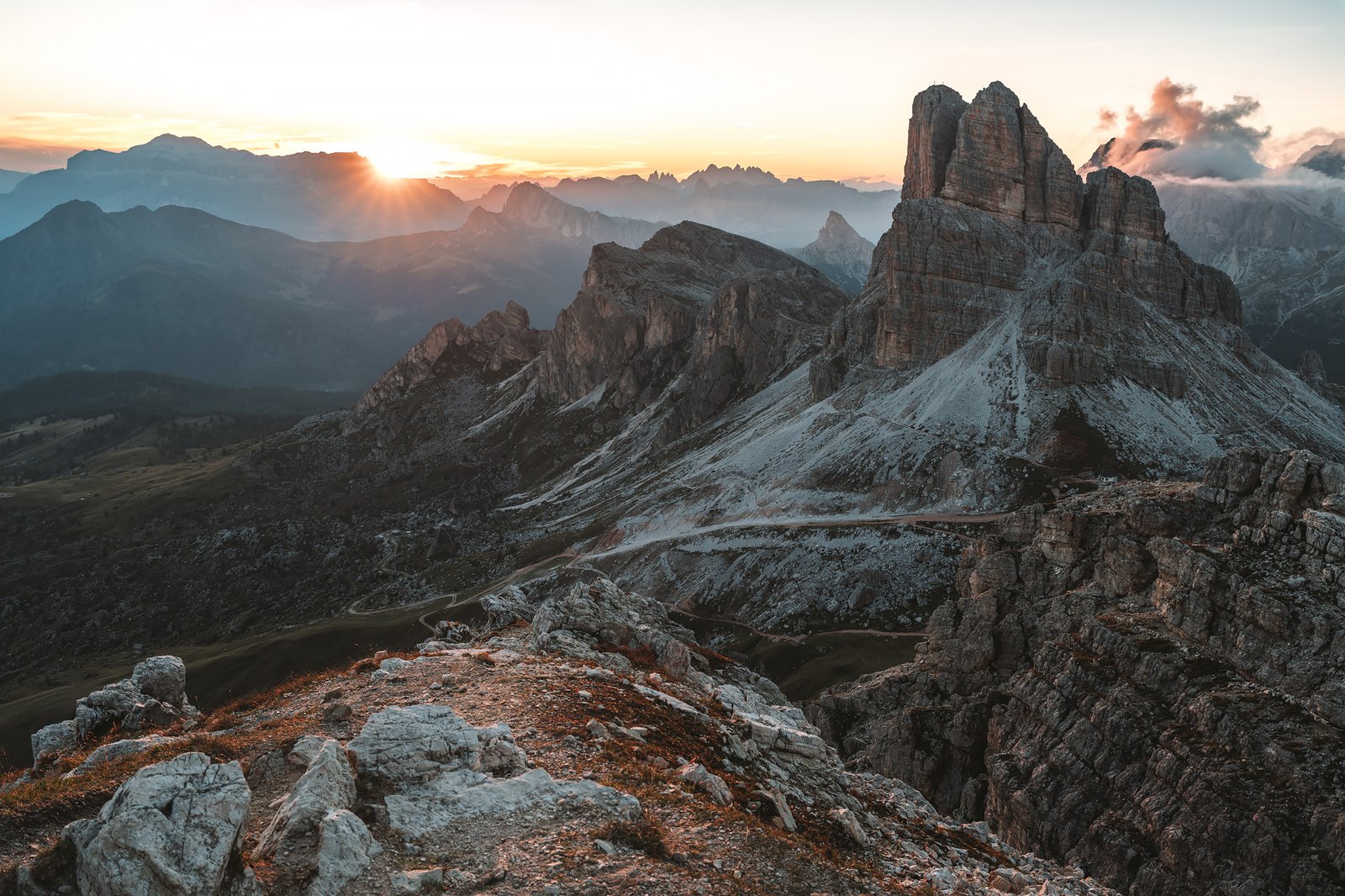
The following morning is just as striking. The sunrise is sharp and clear. Light reveals textures and details of the Averau massif that were hidden the evening before.
The descent toward Passo Giau is quick but challenging. Rock gives way to open grasslands, with occasional narrow and exposed sections.
Passo Giau is one of the few places along the Alta Via 1 accessible by road. People arrive by car or bicycle, bypassing sections of the trail entirely. And yet, it loses none of its impact.
From here toward Lago Federa, the route crosses one of the most beautiful meadows of the entire journey. Wide open spaces bordered by steep cliffs. Horses grazing freely around Lago delle Baste. There is also a small Neolithic settlement, now largely abandoned and difficult to reach, but another layer of history in the landscape.
A detour leads down to Lago Federa. The lake sits beneath steep slopes and reflects the surrounding peaks with near-perfect clarity when the water is still. The rifugio there serves as a great spot for a quick snack and some rest.
This is also a well-known cycling route, with riders making their way up the rocky tracks.
From above, the entire basin opens up.

A lunar Landscape – The Trans-Pelmo Route
After coming back from a short hike around Lago Federa, the route changes completely. The Trans-Pelmo AV1 alternative is less traveled, and far more technical.
It begins in forest with a steep initial climb, then quickly turns into unstable terrain. Poles become essential. In some sections, cables provide support, and many hikers use via ferrata gear.
The markings are not always clear. It is easy to miss them, I did, more than once. Even when paying attention, it is possible to lose the path, and sometimes you have to stay calm and focus to minimize risk.
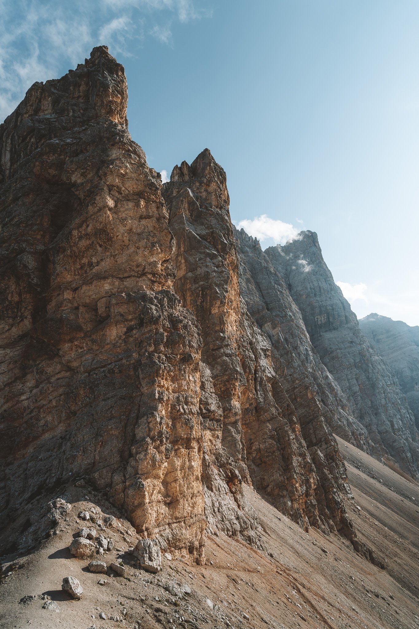
Higher up, the landscape becomes almost entirely rock. Pale, irregular, with almost no vegetation. A lunar terrain where orientation depends entirely on the red and white markings and, if you are lucky, other hikers showing the way.
The highest point is the Passo Val d’Arcia. From there, the descent begins.
The zigzag path to the right, slippery, irregular, and easy to miss, is still the better option. The alternative on the left is more exposed, more technical, and significantly more demanding, despite appearing more direct. Two hikers ahead chose the latter and arrived at the rifugio two hours after me, in complete darkness.
Even on the correct route, the descent is long and physically draining.
The Far Side of Pelmo
Rifugio Venezia appears late. It is partially hidden behind Monte Pelmo, only revealing itself when you are already close. Compared to previous refugios, it feels quieter and less crowded.
Most hikers arrive from the easier side. Approaching from the Trans-Pelmo route changes that completely.
At some point during these days, something shifts. This is no longer just a hiking route. Lagazuoi makes that clear first, through the tunnels, the trenches, the physical traces of what happened here. But it is way more than that. Cinque Torri, Nuvolau, Passo Giau, Pelmo… Each place offers something distinct. Together, they build a different understanding about the Dolomites and its true nature.
You begin to realize this is not just another hiking destination. It is a place where history remains present, embedded in the rock, in the paths, and in everything around you.