The trip to Dobbiaco was marked by many small uncertainties, timing, delays, the type of details that seem insignificant at first, but can have a disproportionate impact. A delayed departure, a short layover in Venice, figuring out if there would be enough time to catch the bus… In the end, all went smoothly. Just enough margin to arrive without rushing.
We made a brief stop in Cortina d’Ampezzo, one of the most important ski resorts in the world and host of the last Winter Olympics. It is noticeable how much more different everything is to the rest of Italy, even from a quick stop. The atmosphere is also a bit more polished, more focused on high-end tourism.
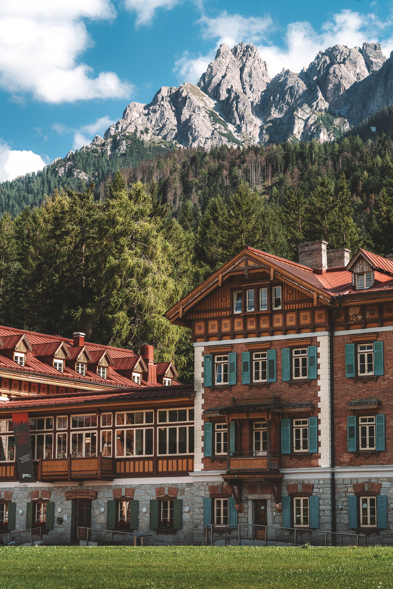
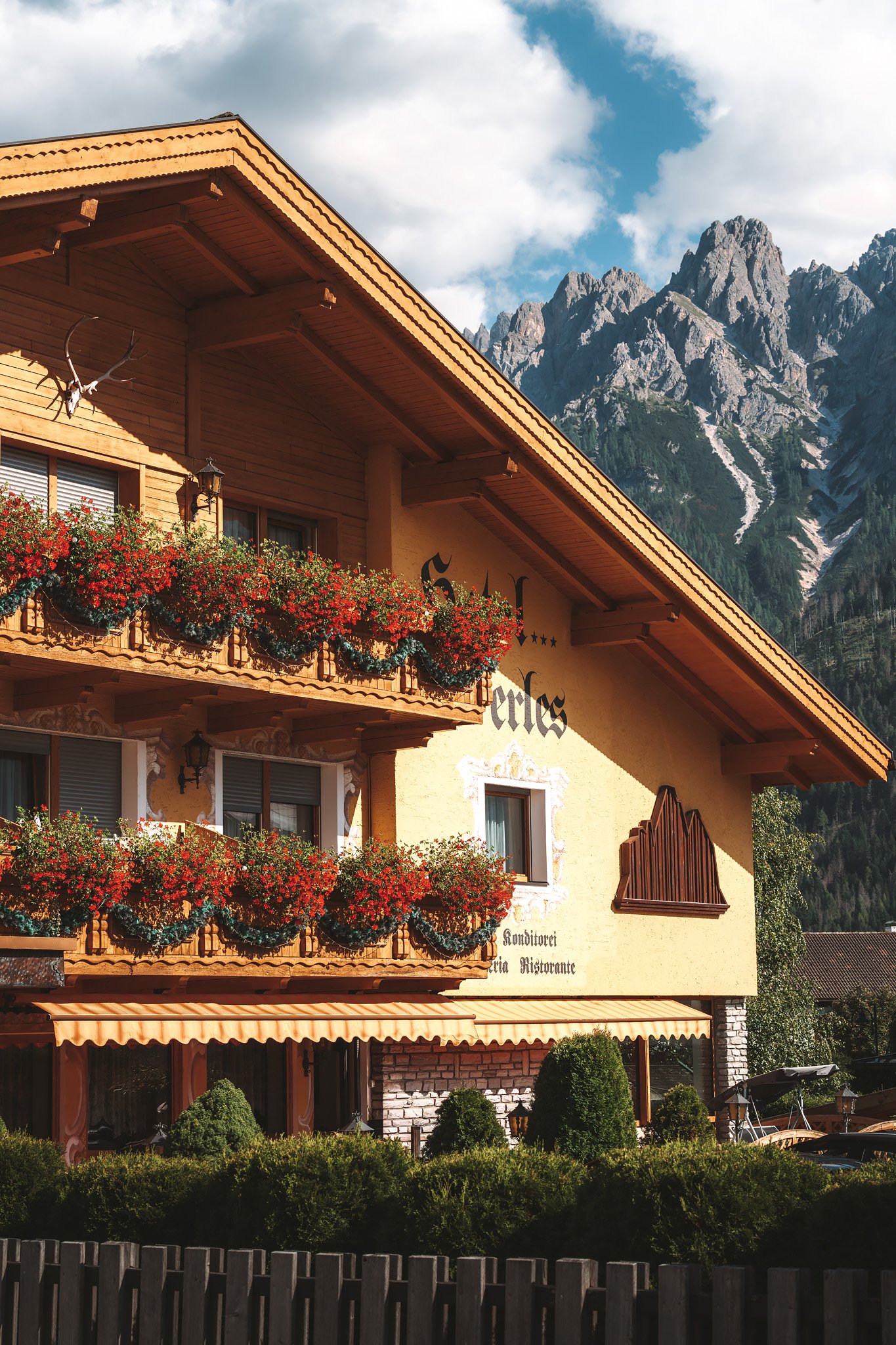
Dobbiaco is a very popular tourist town, and that is apparent immediately. Restaurants fill up fast, especially in the evenings, and unless you have made a reservation, it may be difficult to find a place to dine. It’s the kind of place where logistics matter more than you expect.
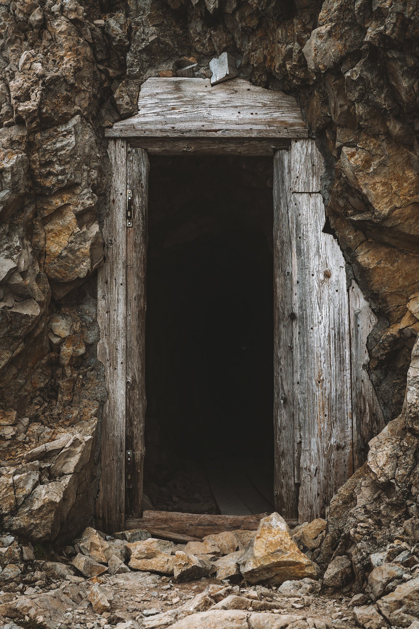
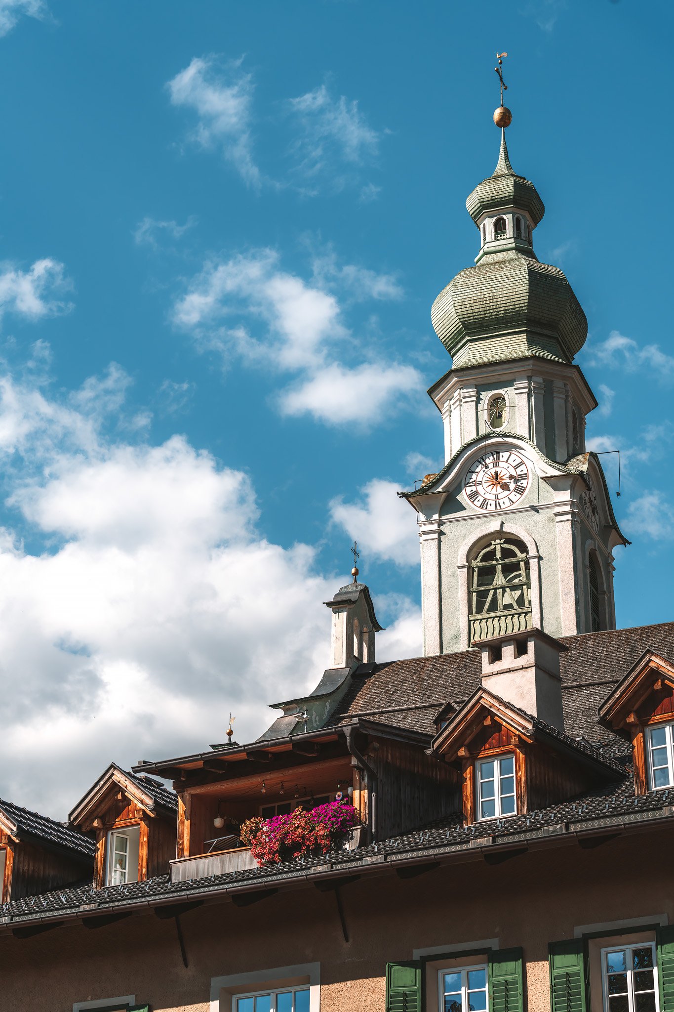
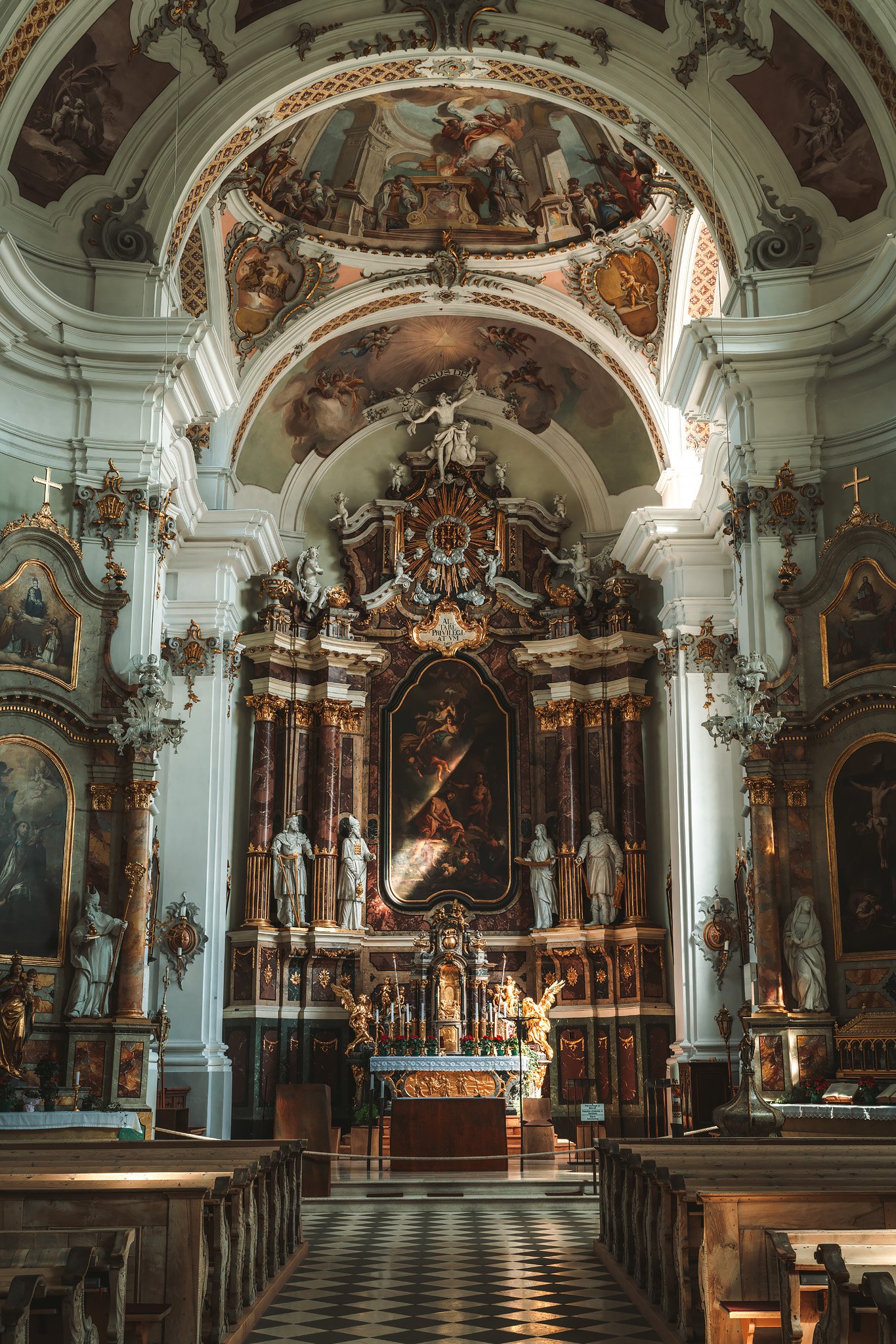
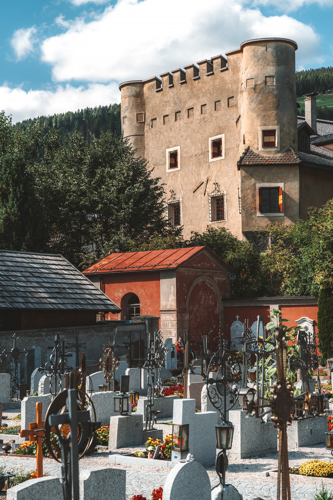
The first afternoon was pretty low-key. A short walk through the town center, a few stops for photos, mountain gear shops, church, small streets and references to one of its most famous neighbors, Gustav Mahler. The composer spent his summers here at the beginning of the 20th century, finding in these landscapes the stillness he needed to work.
As you head towards the lake, the path opens. Lago di Dobbiaco appears gradually, framed by trees, with the Hotel Baur am See quietly situated on the main shore.
It’s a calm place. Very easy to photograph. Reflections are clean. Compositions are fairly straightforward. Along the lake, groups of coots quietly cut through the water. Small details, but they add movement to the scene.
A family cycled along the path leading from the village to the lake, the atmosphere remained very relaxed and natural. The first afternoon wasn’t about standout moments. It was more about getting used to the flow, the light and the weather.
The next morning changed all of that.
Stage 1. Lago di Braies – Rifugio Pederü
Distance: 18.07 km · Elevation Gain: +1343 m · Elevation Loss: −1242 m · Technical Difficulty: Difficult
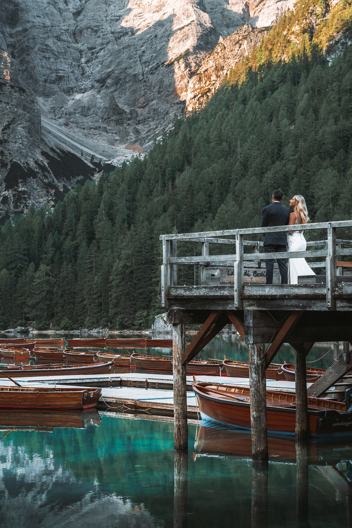
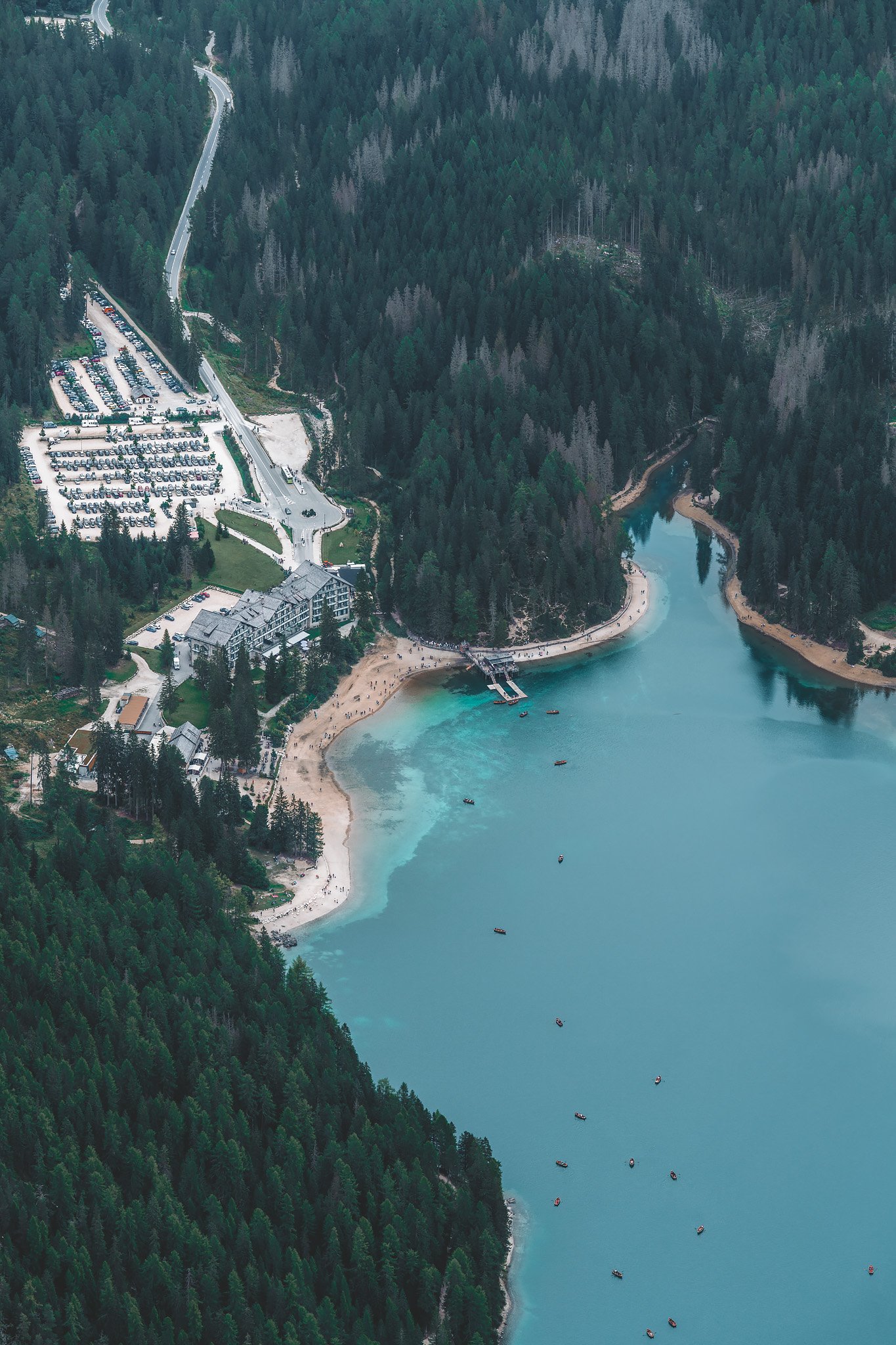
The bus to Lago di Braies left quite early, around 7:15 AM, and took approximately 30 minutes. Getting on the first bus allowed me to arrive before most people, and before the lake becomes what it usually is, a hotspot for tourists.
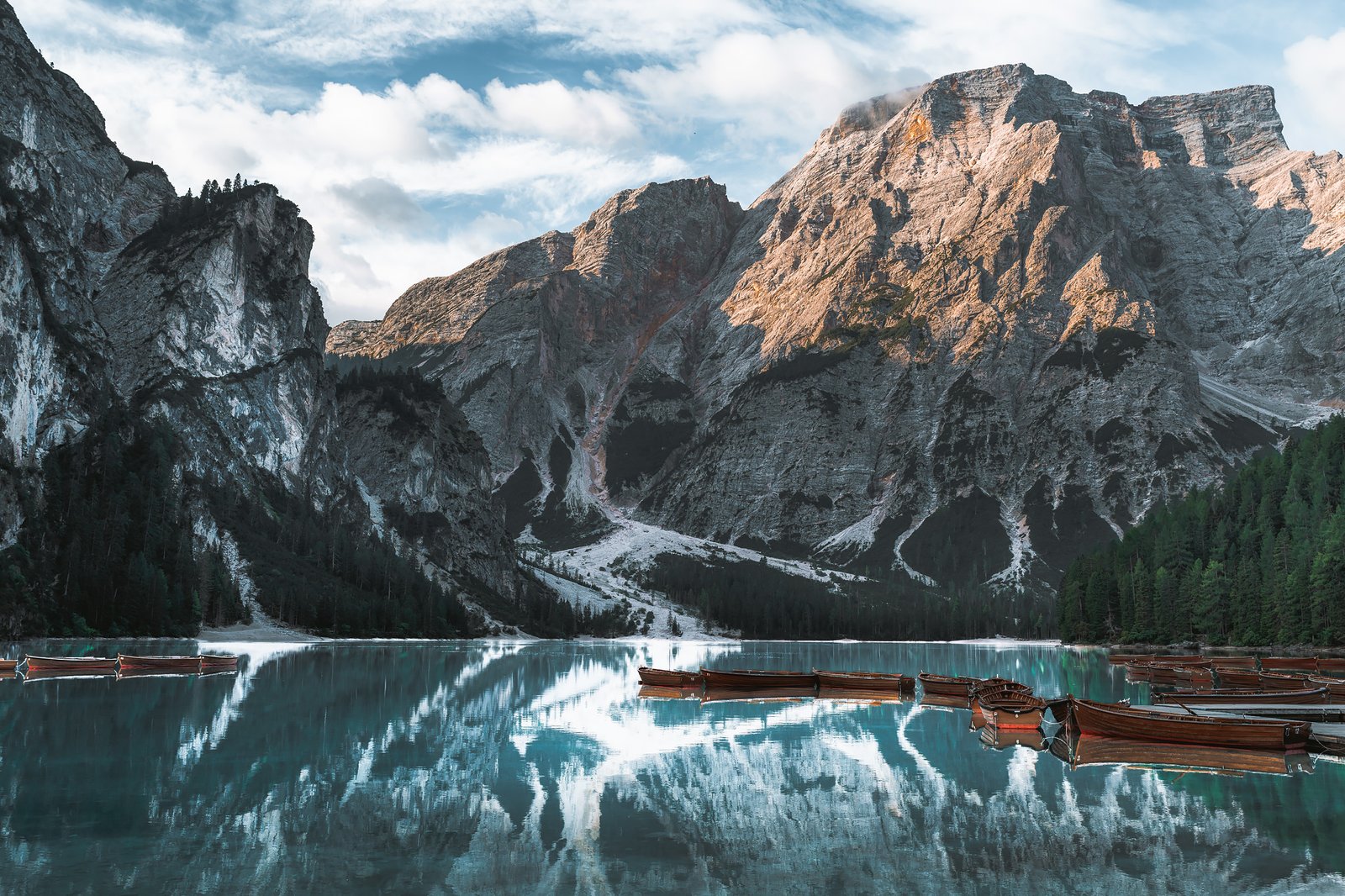
At that hour, Braies was empty.
The pier was closed. The boats were tied up. The lake was absolutely still. And because of the clear sky, the lake showed its full range of colors, deep turquoise, almost surreal. This color comes from fine minerals, dolomitic sediment, suspended in the water that scatter the light, a common phenomenon throughout the entire region.
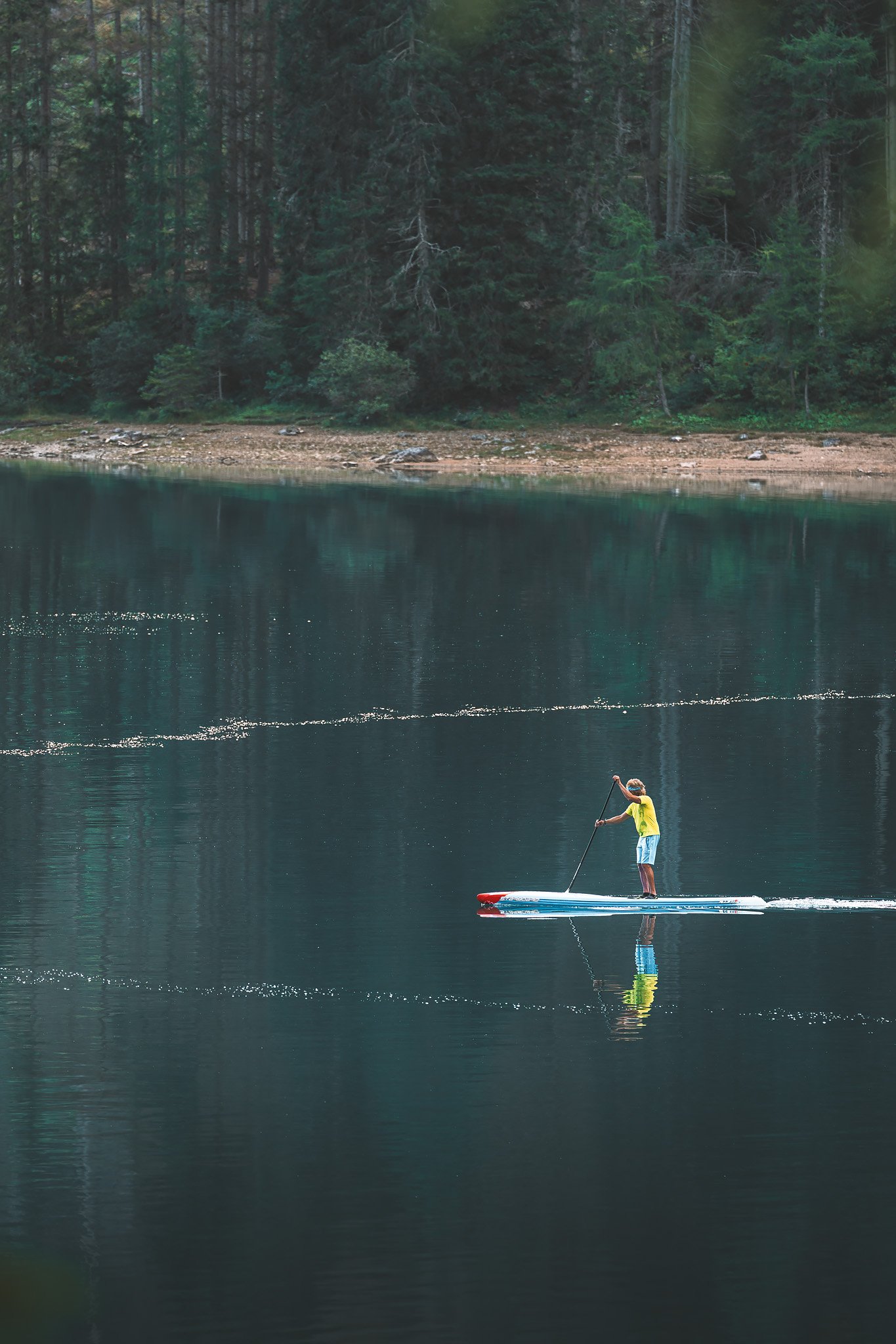
There is a very short period of time when nothing moves. As I walked around the lake, a single paddle surfer crossed the water, the only disturbance in the most absolute quietness.
Later, from the top of Seekofel, the same lake would look completely different, the boats were moving, people were everywhere, and the whole atmosphere had been transformed.
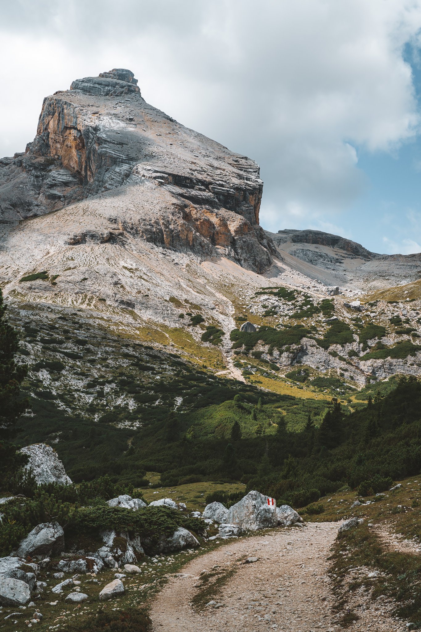
Many visitors treat Braies as an endpoint. Most visit the lake alone and depart. The Alta Via 1 begins precisely where most people stop. After the lake, the route goes along the right-hand side and then turns upwards. The first part of the route is relatively flat. Then the climb begins.
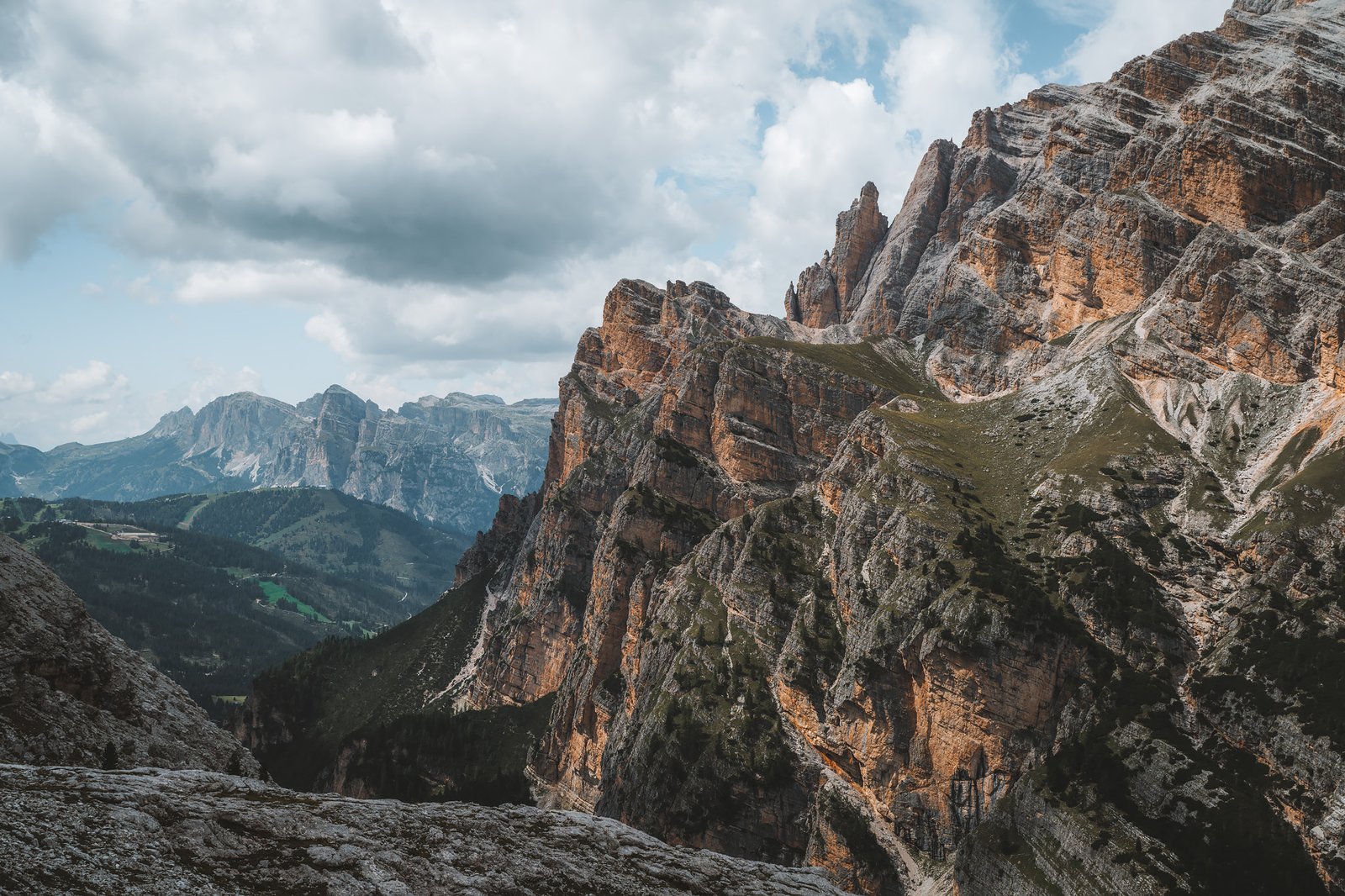
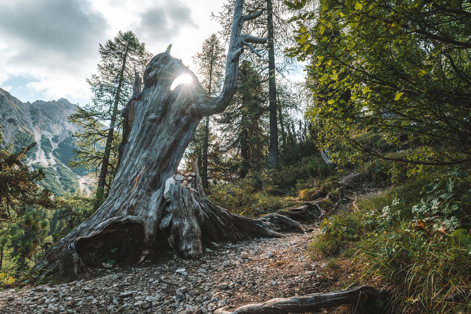
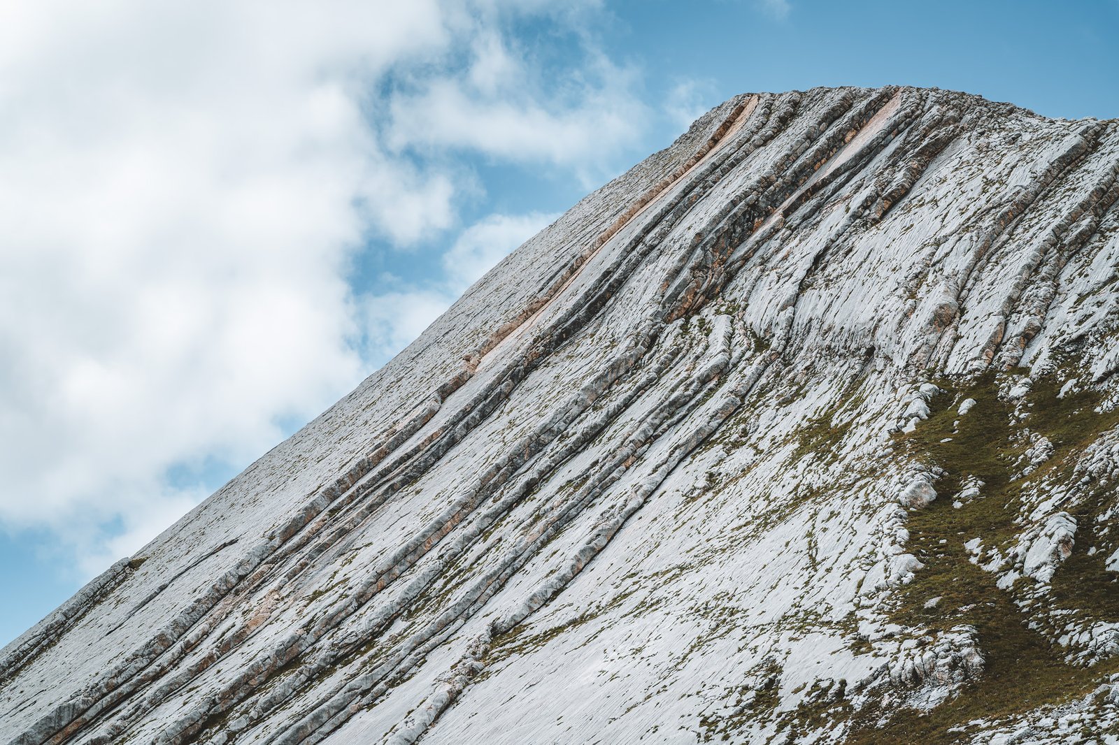
It is a steep climb. Forest, rocks, roots. Predominantly spruce and pine. The forest is dense enough to keep the light out. The path is clear, but constantly climbing. Further up the mountain, the terrain opens up. The forest is replaced by rock and lower-growing vegetation. The temperature drops rapidly and the Seekofel becomes visible.
The View from Seekofel
It is optional, but one of the best parts of this leg of the route. When going to the summit, it is highly recommended to leave the backpack at the bottom of the mountain. The route will return to the same spot, and the climb to the summit will be much easier without the extra load.
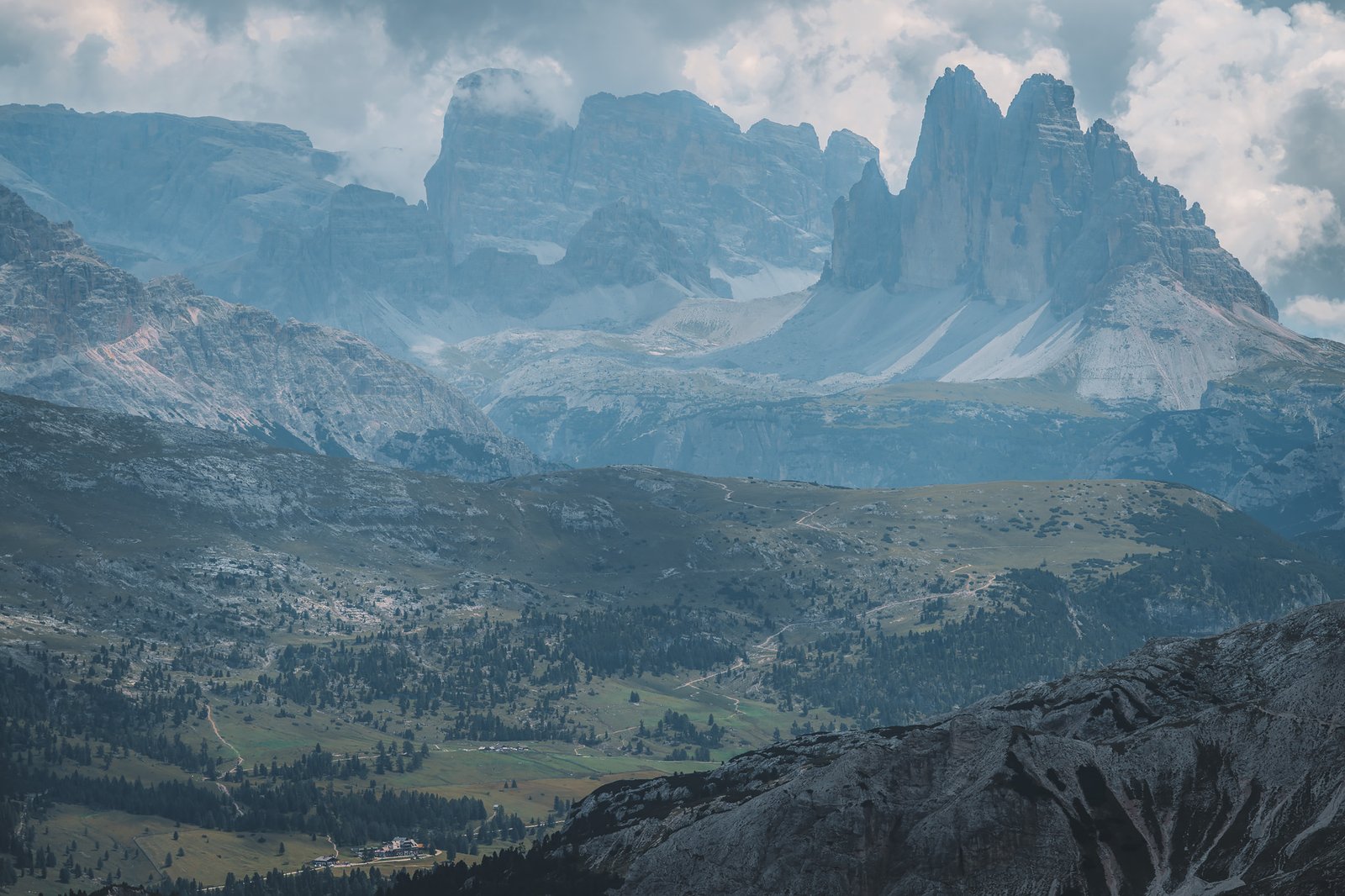
At the summit, the landscape transforms. The terrain is pale and fractured. The scale of the land expands below you. Lago di Braies lies below, and in the distance the Tre Cime can be seen. They stand out enough even from a great distance, and you know you can’t leave the Dolomites without seeing them.
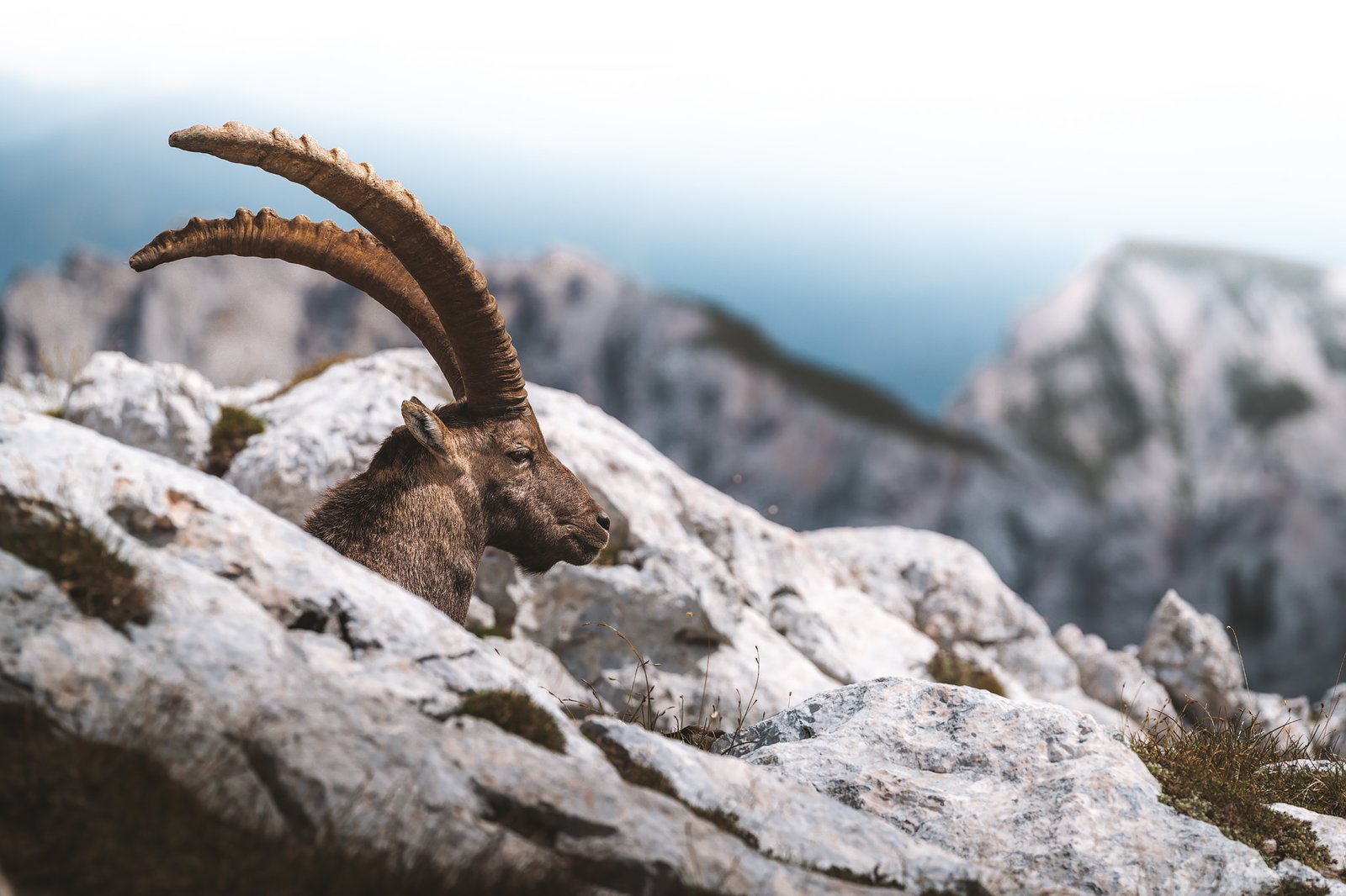
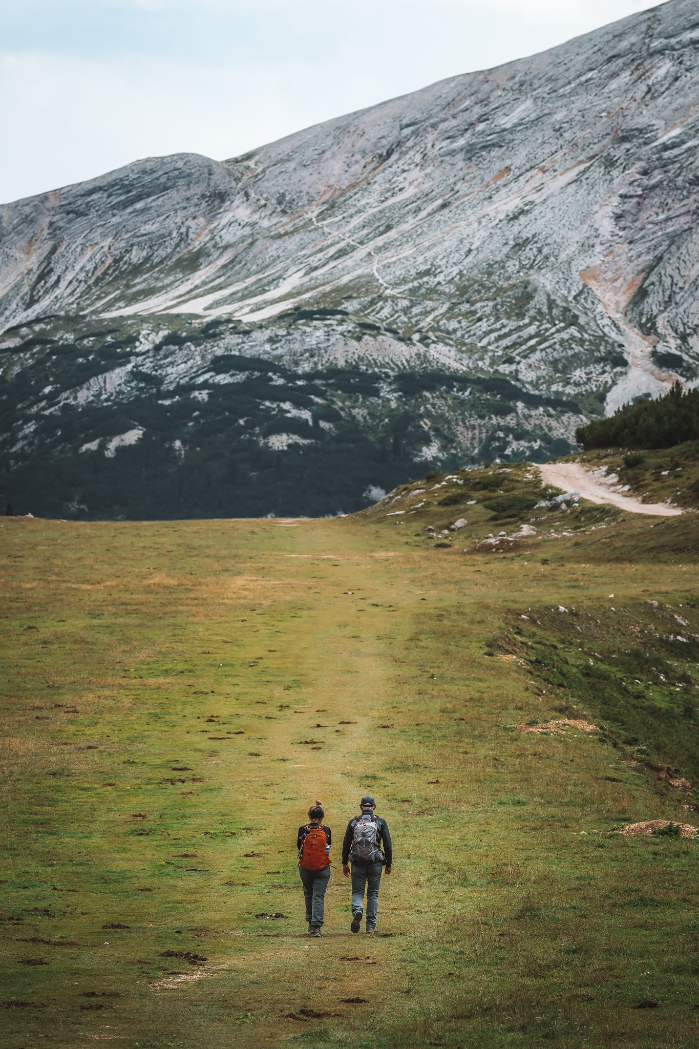
Alpine ibexes roam freely at the summit, gliding across the rocky terrain with the ease of walking on flat ground. The air feels thinner and the views leave you speechless.
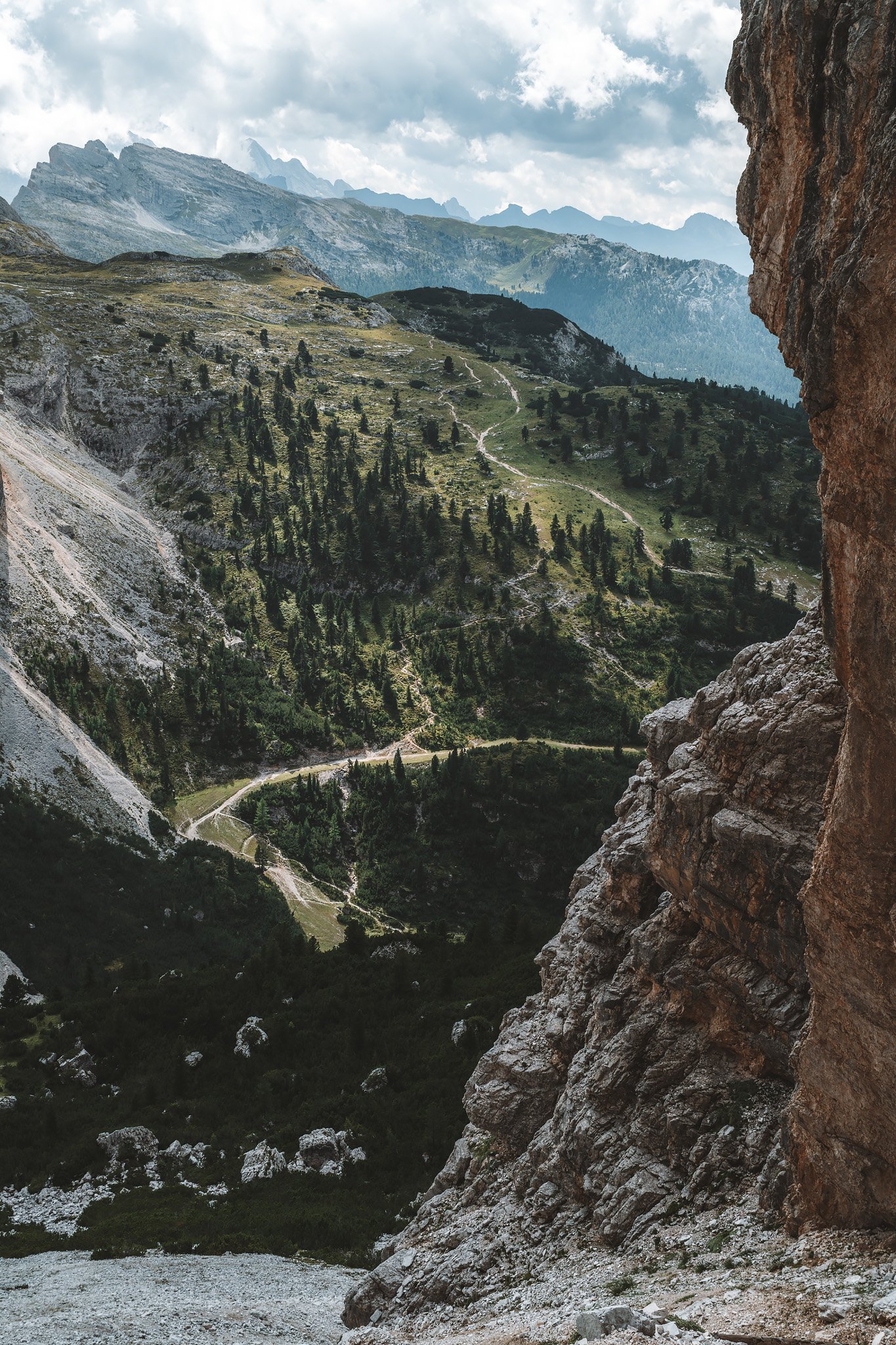
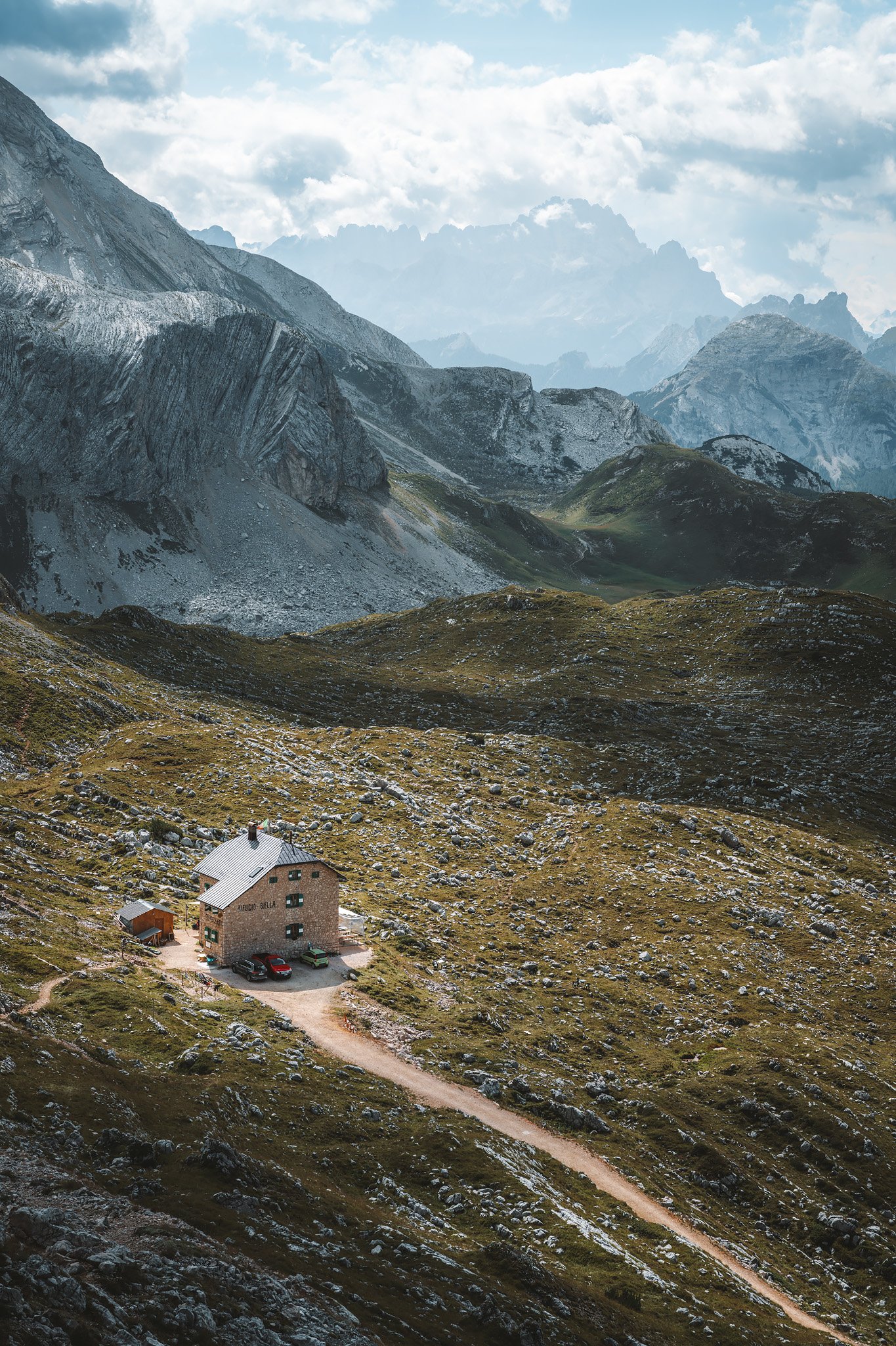
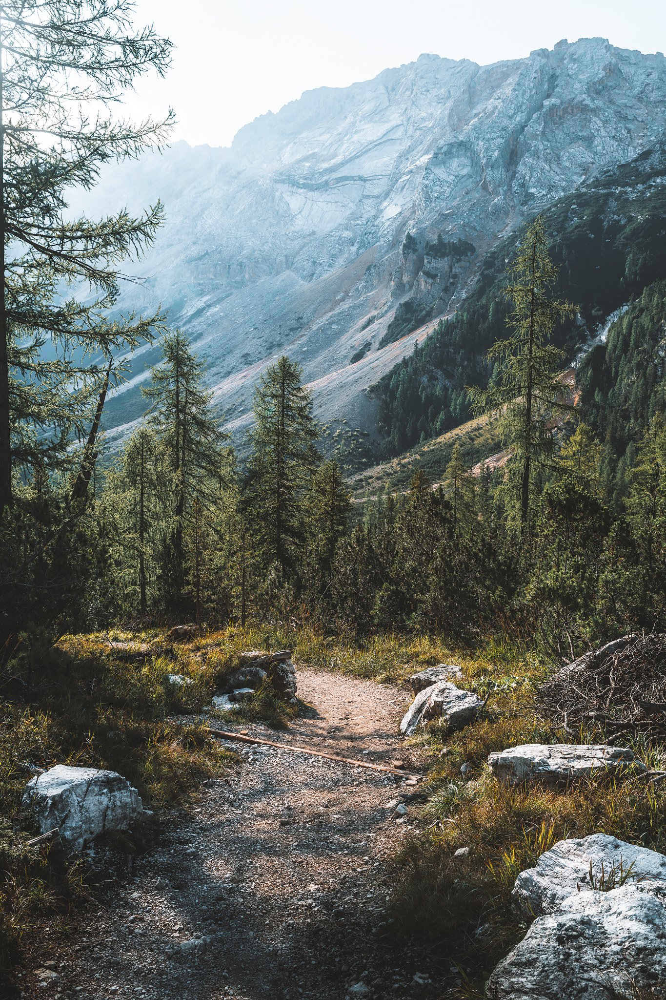
Going down from Seekofel is quicker. The weather changes, less sunlight, stronger winds, cooler temperatures and an uneven rocky terrain. Back at the base, Rifugio Biella indicates that we are returning to the primary route. After that, the route becomes easier, the paths expand and branch out into a range of alternatives. More people.
Along the way, there are some short conversations about the route, the weather, where you’ll go next or how many days will it take for you to complete the route. They don’t last long. But each conversation brings little bits of new information. Little perspectives that enhance the journey.
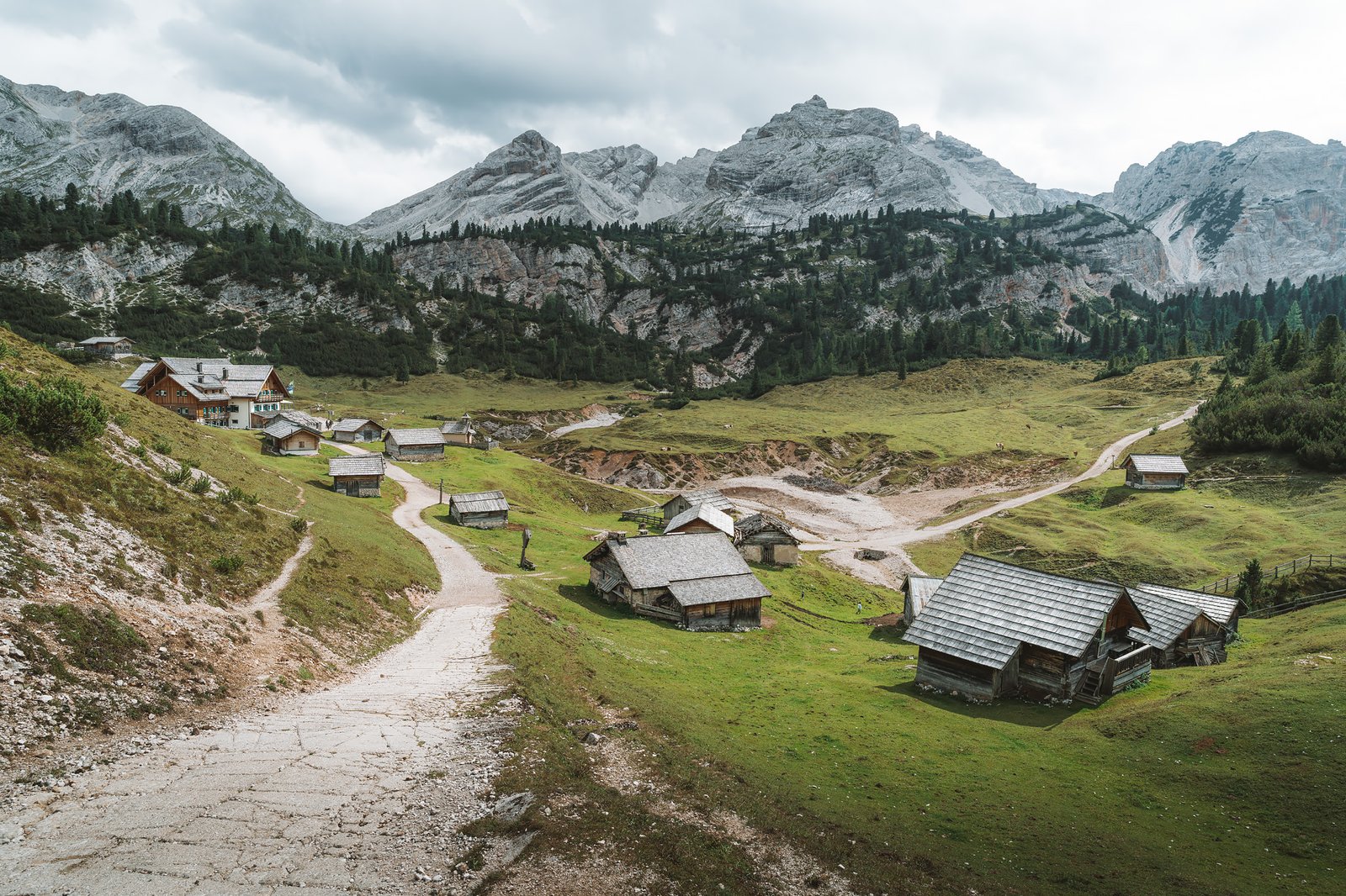
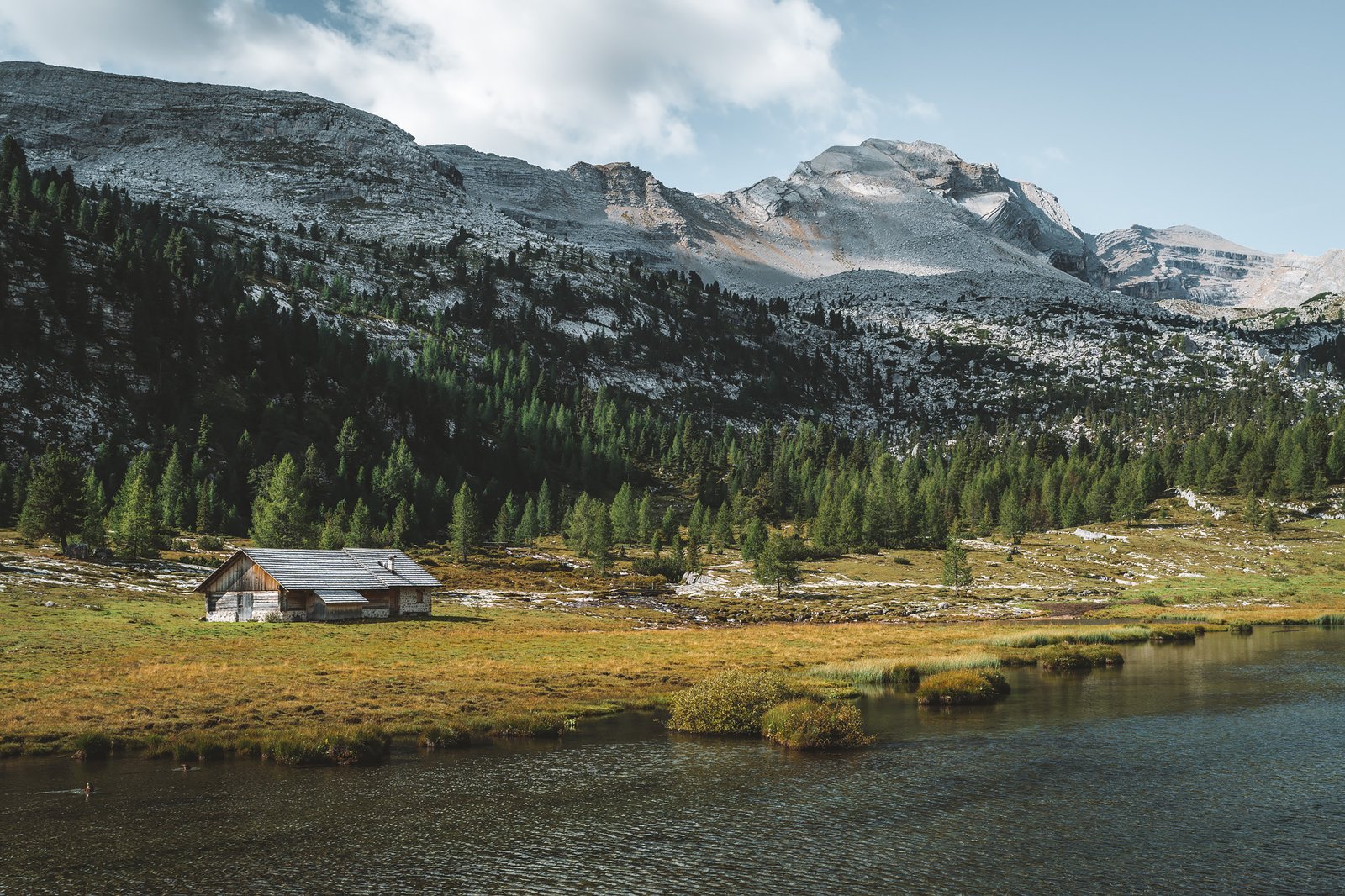
The landscape begins to turn green again, meadows and scattered refuges. We arrive to Fodara Vedla, a collection of buildings, a church, animals grazing nearby. Voices can be heard in Ladin, German or Italian, some in English too, mostly from tourists or locals giving indications.
The route down to Pederü is long, steep, slippery and unstable. The strain builds in the legs.
Pederü feels more like a rural hotel than a mountain hut, larger and more comfortable. It’s also the last place on the route where you’ll find this level of comfort. Special mention goes to Pederü’s à la carte menu, an incredible end for the first stage.
Stage 2. Rifugio Pederü – Rifugio Lagazuoi
Distance: 18.79 km · Elevation Gain: +1627 m · Elevation Loss: −425 m · Technical Difficulty: Moderate
The second day started early. The first section was through forest, mostly shaded and dominated by conifers. It was a while before the scenery opened up.
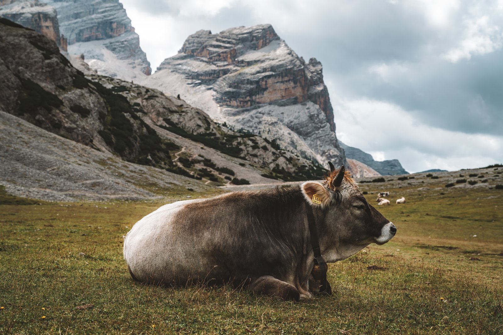
And when it did, it was the Fanes Valley. Large open fields and a river cutting through the land. Animals roaming freely, goats, cows and distant cabins. One of the most well-rounded sections of the route. A detour to Lavarella is worth doing.
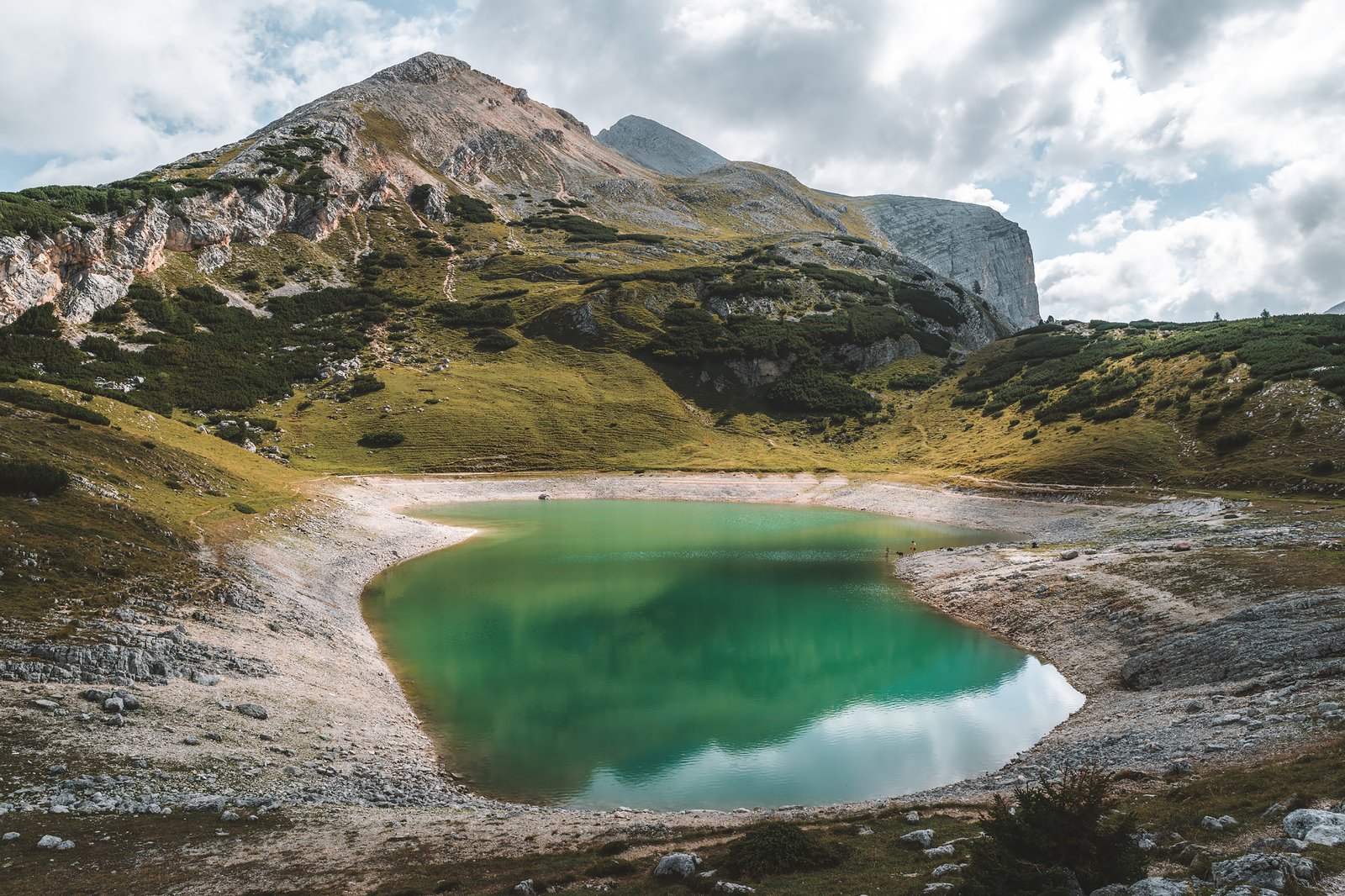
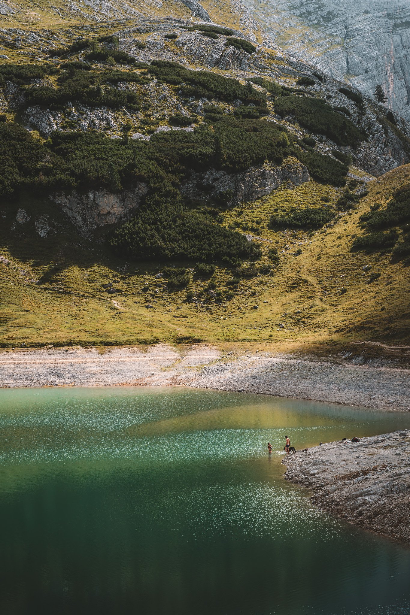
Lavarella is a small occupied village. It provides a human element to the route. A sense of continuity beyond the trail itself with incredible morning light. Further along, back into the main route, Lago di Limo. The water displayed the same tones as earlier, slightly greener, shaped by the same minerals in suspension. Under the right lighting, the green intensified. In one moment, a couple attempted to bathe their dog, and the scene became strangely memorable.
The route continued through smaller valleys. Some wildlife, marmots, horses crossing the path. The terrain remained manageable.
A Lake Between Stone Walls
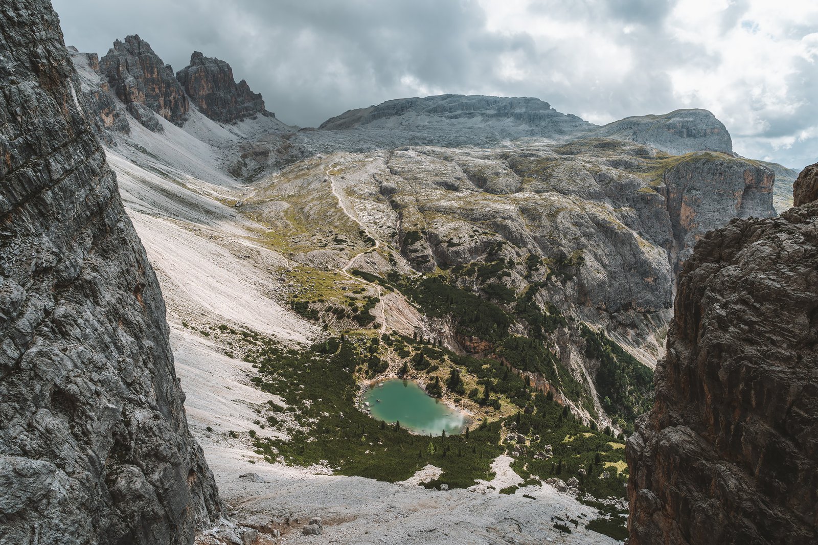
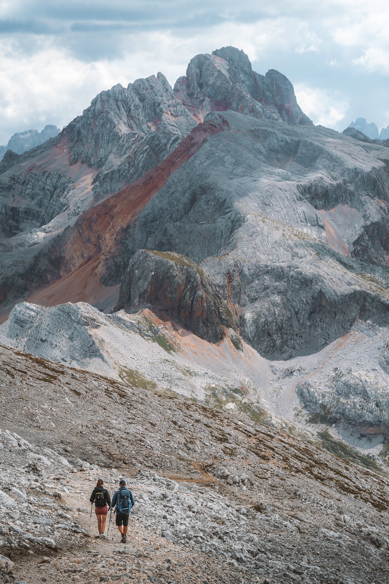
The final section to Lagazuoi was different. The climb started gradually from the Fanes plateau and became progressively steeper. Vegetation almost disappeared and led to a more rocky terrain. And suddenly the view opened up.
The first sight of Lago Lagazuoi after reaching the summit could be seen through a narrow passageway formed by steep rock walls. At first glance, the area seemed confined, until the landscape gradually unfolded into one of the most striking views of the Alta Via 1.
The lake sits below, deeply colored, and surrounded by steep inclines. The route down to the lake was direct, a classical zigzag protected by wooden planks, well-structured and visually stunning.
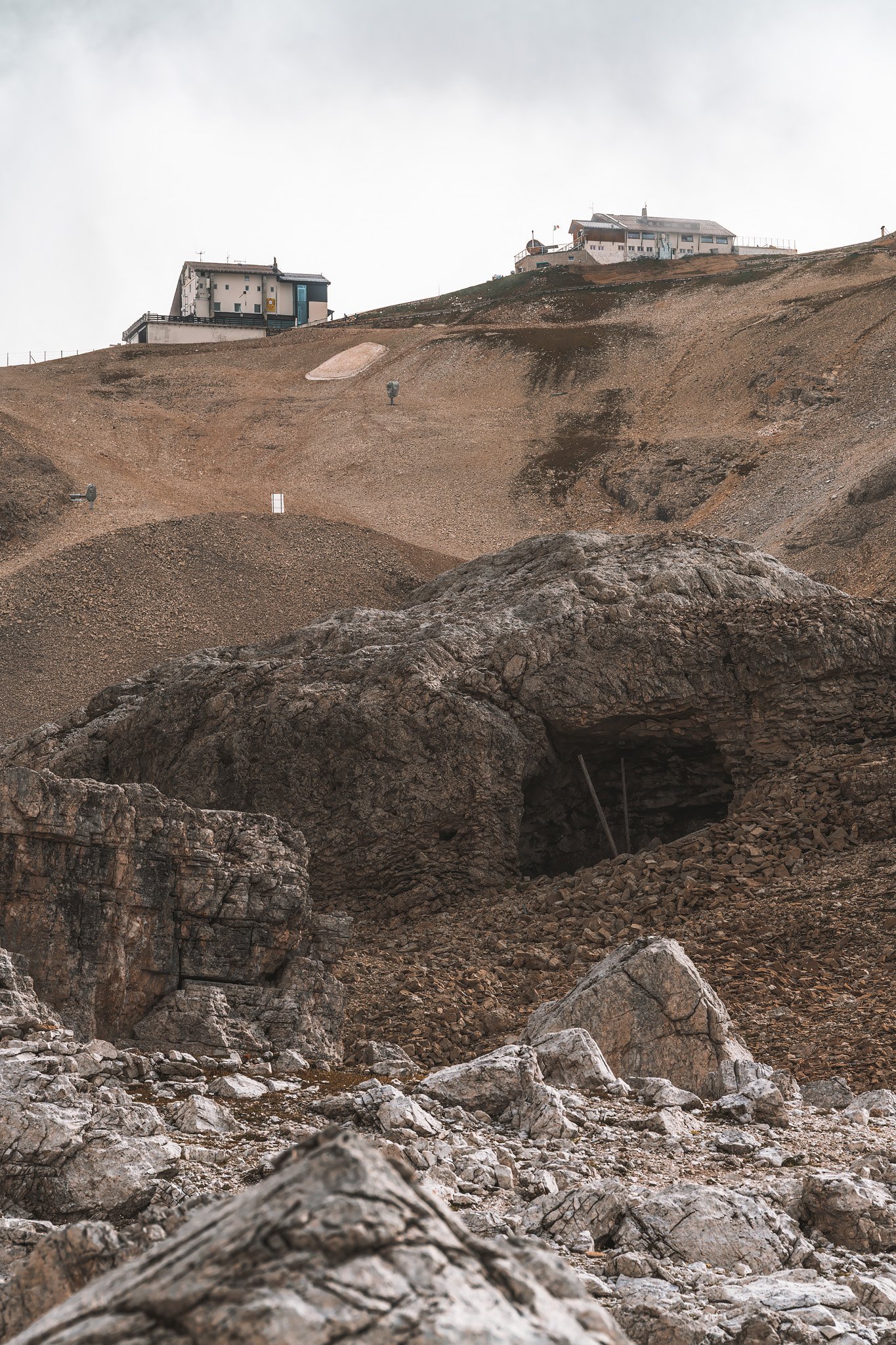
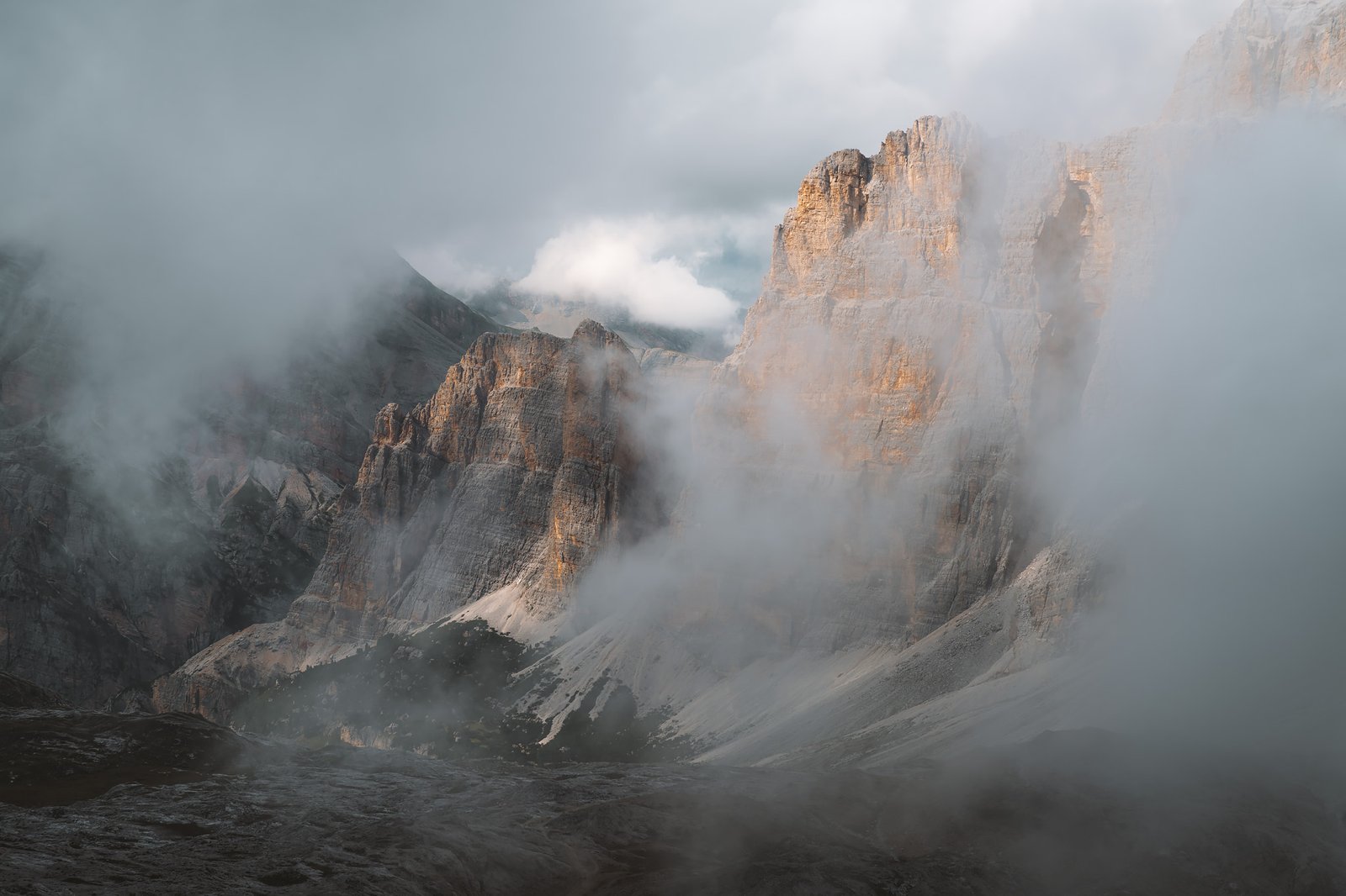
From there, the final climb began to Rifugio Lagazuoi, at 2,752 meters. The fog rolled in quickly and the visibility dropped. The path to the rifugio was broken, turning into a lunar landscape, and could only be followed by the white and red markings found along the route.
Many of the tunnels from WWI could be seen from the outside. Hinting at a deeper story that would be revealed the day after. Despite the fog, there were a few times when the mist allowed for a quick photo. And through the haze, one could see the silhouettes of the Civetta and Pelmo for the first time.
At the top, the surroundings felt almost surreal. The peaks rise and fall behind the layers of mist. Never completely visible, but an incredible thing to witness. Before reaching the refuge, the day had exceeded the expectations of the morning and from the day before.
It had been an incredible journey so far, Braies at dawn, Seekofel, the meadows of Fanes and the descent to Lagazuoi. Each one very different from each other and offering not only great photography, but different feelings as well mixed with sweat and effort.
At 2,752 meters, it was time for a rest.