Madagascar. Part I: Arrival in the 8th Continent
All children love maps.
In my case it all started with one of those Earth globes that glowed softly in the dark. It was actually my brother’s, but we shared most of our toys when we were little kids. I remember him pointing at countries and naming capitals, rivers and mountain ranges. I sat fascinated by places that at the time seemed impossibly far away.
Eventually it became something I would do too. Before long I had memorized all the countries from every continent, rivers, mountain ranges and capitals I probably would never visit. Some names sounded strange, others exotic and a few became unforgettable. One of them was Antananarivo.
At the time Madagascar felt like just another large island near Africa, probably not so different from the rest of the continent. I had no idea it would eventually lead to one of the most unforgettable journeys of our life.
Separated from Africa for tens of millions of years, Madagascar developed into its own world. Species evolved independently, ecosystems adapted in isolation and life followed directions found nowhere else on Earth. Lemurs, baobabs, fossas, giant chameleons and entire forests exist nowhere else on the planet.
Even the people who arrived on this island came from somewhere completely unexpected. Malagasy, the language, belongs to the Austronesian language family and is closer to the languages spoken in various regions of Borneo and Southeast Asia than to those spoken in mainland Africa. These peoples crossed enormous distances across the Indian Ocean using advanced sailing technology, and for hundreds of years these origins intermixed with African, Arabic and European influences and ultimately created one of the most distinct cultures on the continent.
That isolation is still visible today.
Although Madagascar is a huge country, approximately equal in size to the Iberian Peninsula and considered the fourth largest island in the world, infrastructure remains limited across much of the island. Many roads are either broken or only partially paved, though this is changing rapidly. Traveling across the island is long, slow and quickly becomes part of the experience itself.
Africa is often imagined through the lens of safari landscapes, however Madagascar feels totally different. Not solely because of the uniqueness of the wildlife, but because of the sheer diversity of environments concentrated within a single island. Rainforests, dry forests, limestone karst formations, high plateaus, mangrove swamps, tropical coastlines and isolated rural villages separated by roads that seemingly vanish into mud, fog or dust.
For an entire month we would be walking through all of those landscapes, but everything began in that place with a funny name, Antananarivo.
From Tana to Andasibe
After flying from Madrid to Paris and then southward through Eastern Africa we landed at night in Tana, as locals call it.
The airport was already a sign of what awaited us. There were advertisements for the 2023 Indian Ocean Island Games plastered over parts of the terminal while lines formed at currency exchange booths and SIM card vendors. The sounds of Malagasy, French and sporadic English surrounded us while drivers stood outside waiting with handwritten signs beneath fluorescent lights.
Our driver immediately taught us our first Malagasy phrases. Salama = hello. Misaotra = thank you. Azafady = excuse me.
The first night was brief and mostly strategic, as Madagascar didn’t really start in the capital city, but the following day heading east to Andasibe.
Malagasy standards consider Andasibe to be relatively close to Antananarivo. However, even considering the relatively short distance, the drive still takes several hours.
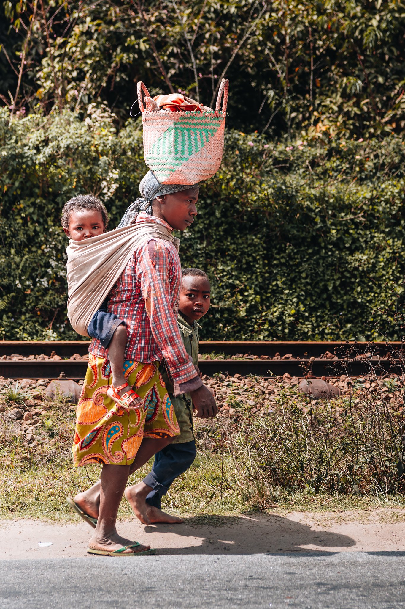
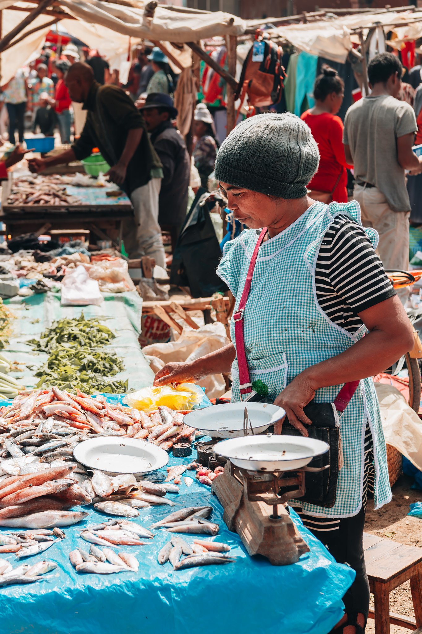
When leaving the capital city, the landscape rapidly transformed from rice terracing to eucalyptus forest and red dirt villages scattered across the highland region. We made several stops along the way.
Roadside markets appeared constantly beside the highway. These were makeshift collections of wooden structures and vegetables placed directly on the ground. Stacks of bananas and unfamiliar fruits were located adjacent to dried fish displayed under the open sky despite being miles away from the coast. People were always on the move between market stalls while overloaded minivans traversed villages trailing clouds of dust.
My first impression was movement occurring everywhere. Life felt really local and authentic.
I could find virtually no evidence of mass tourism anywhere outside of the national parks themselves. Most people around us were merely traveling between villages, carrying products, selling food, or tending rice paddies surrounding the roadway.
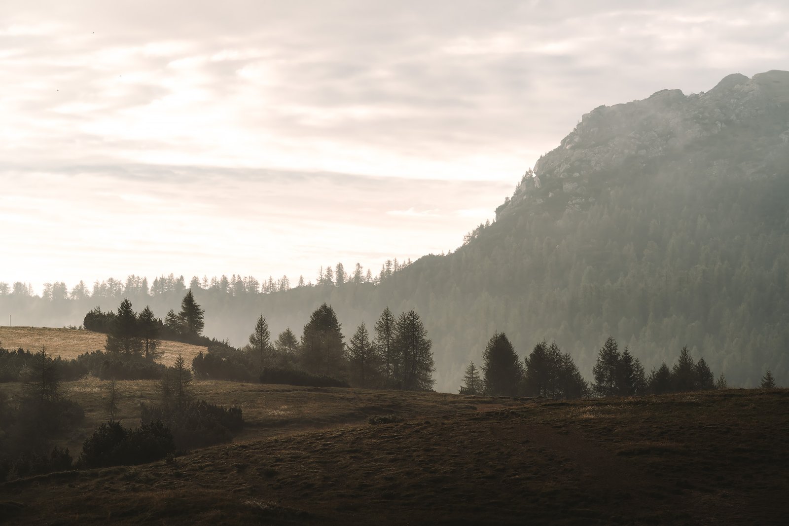
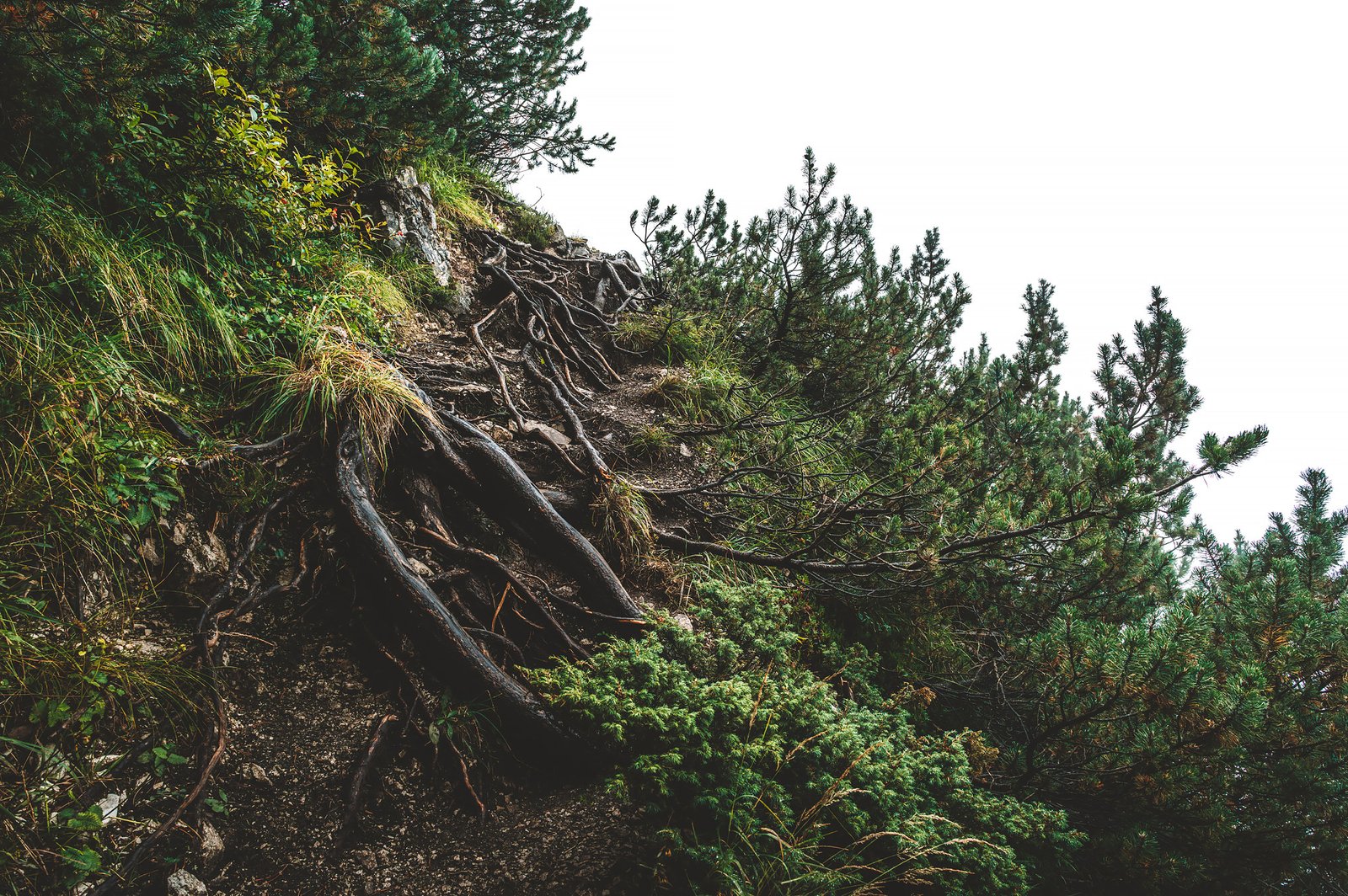
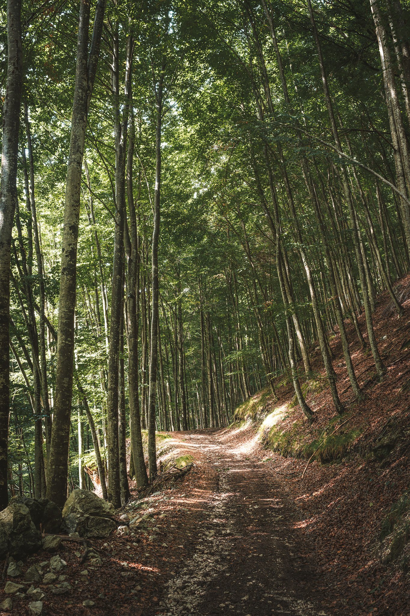
As we traveled further east, the landscape began changing slowly. The air became wetter and fog started developing over the mountains. Trees became thicker along the mountainous slopes while the roads continued to become increasingly muddy and narrow.
It wasn’t long before night fell rapidly. One moment sunlight filtered through cloud cover and the next moment the road had vanished into darkness. By the time we arrived in Andasibe, the rainforest had overtaken the whole landscape.
The Edge of the Rainforest
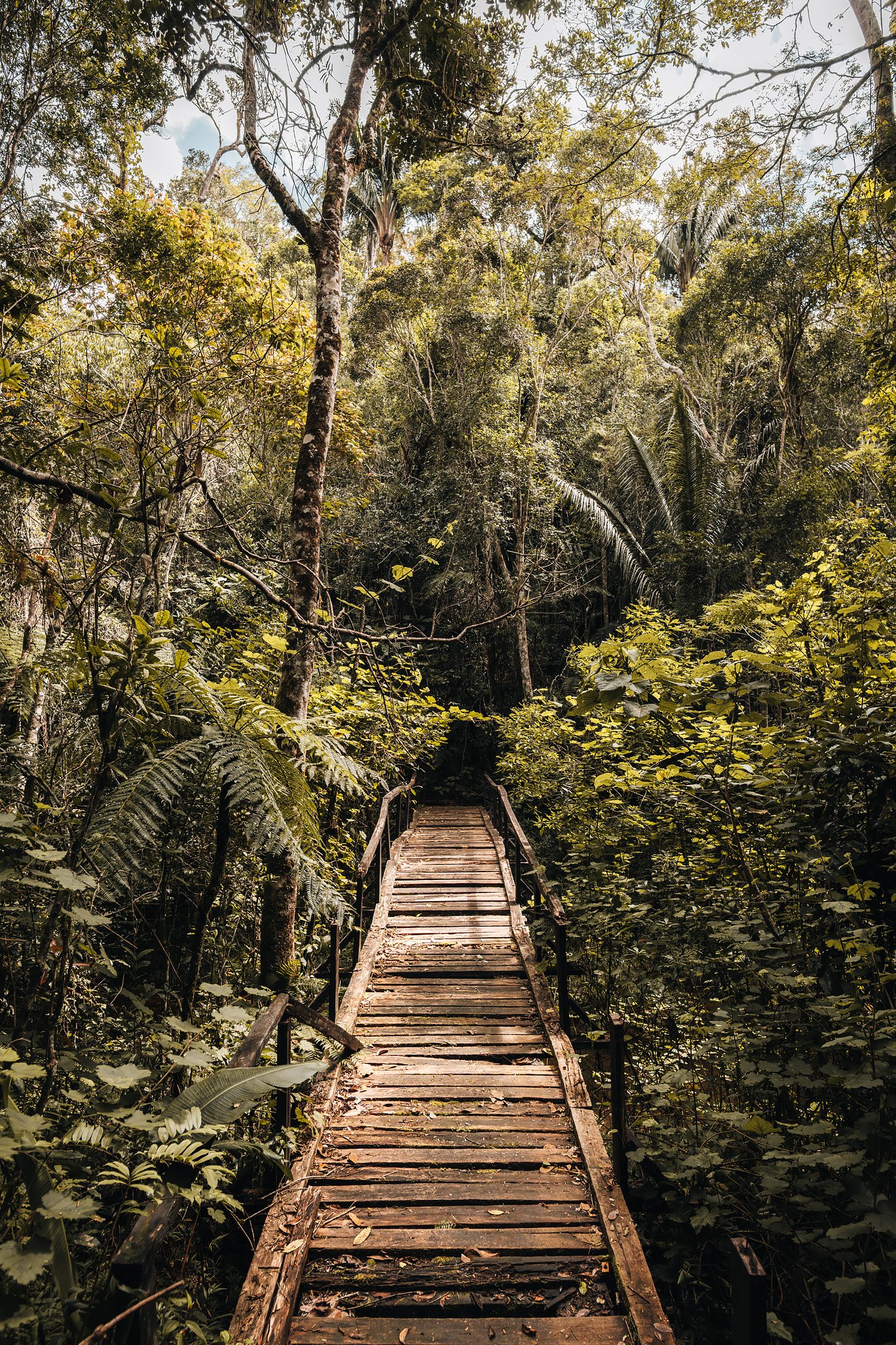
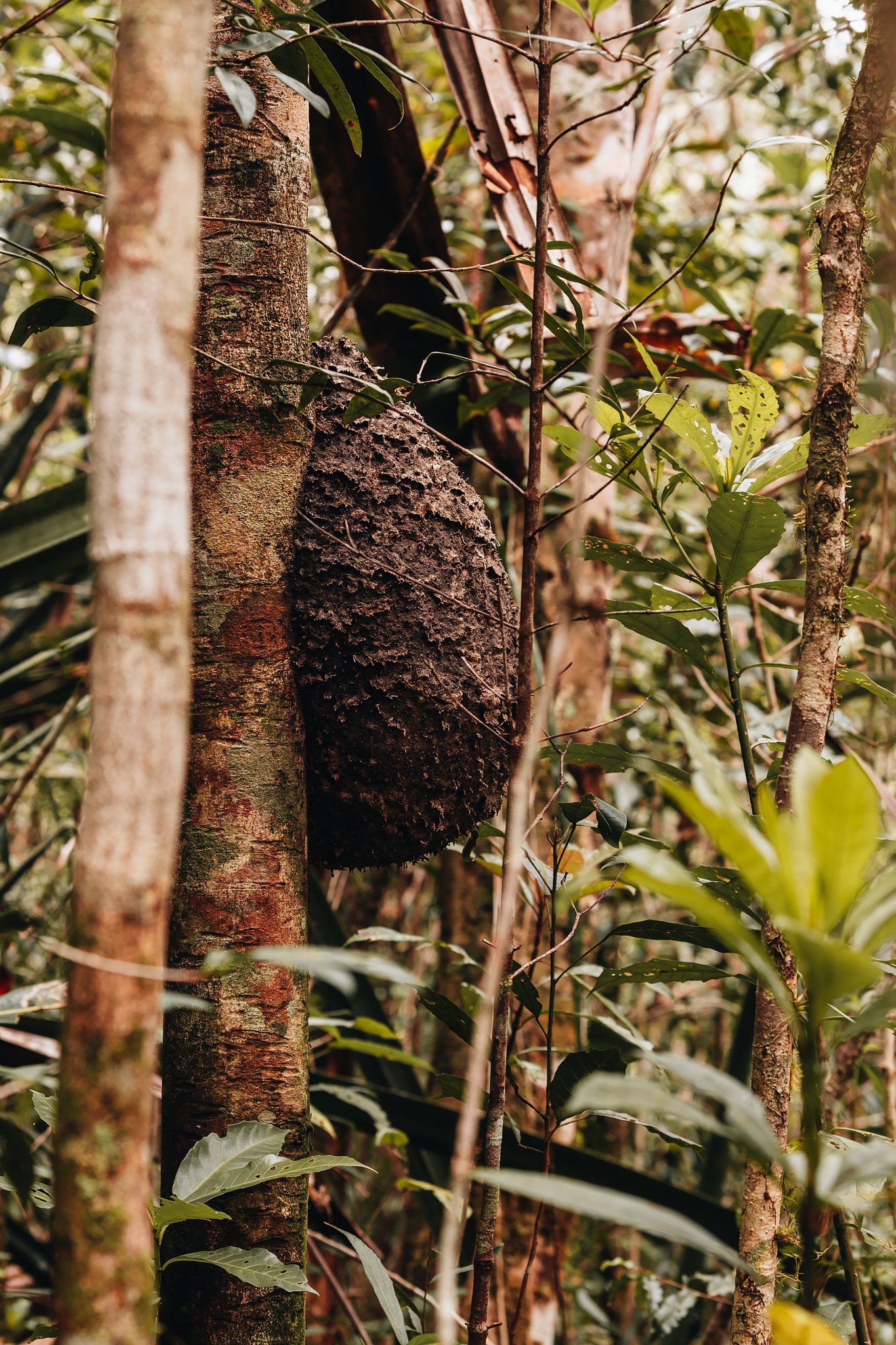
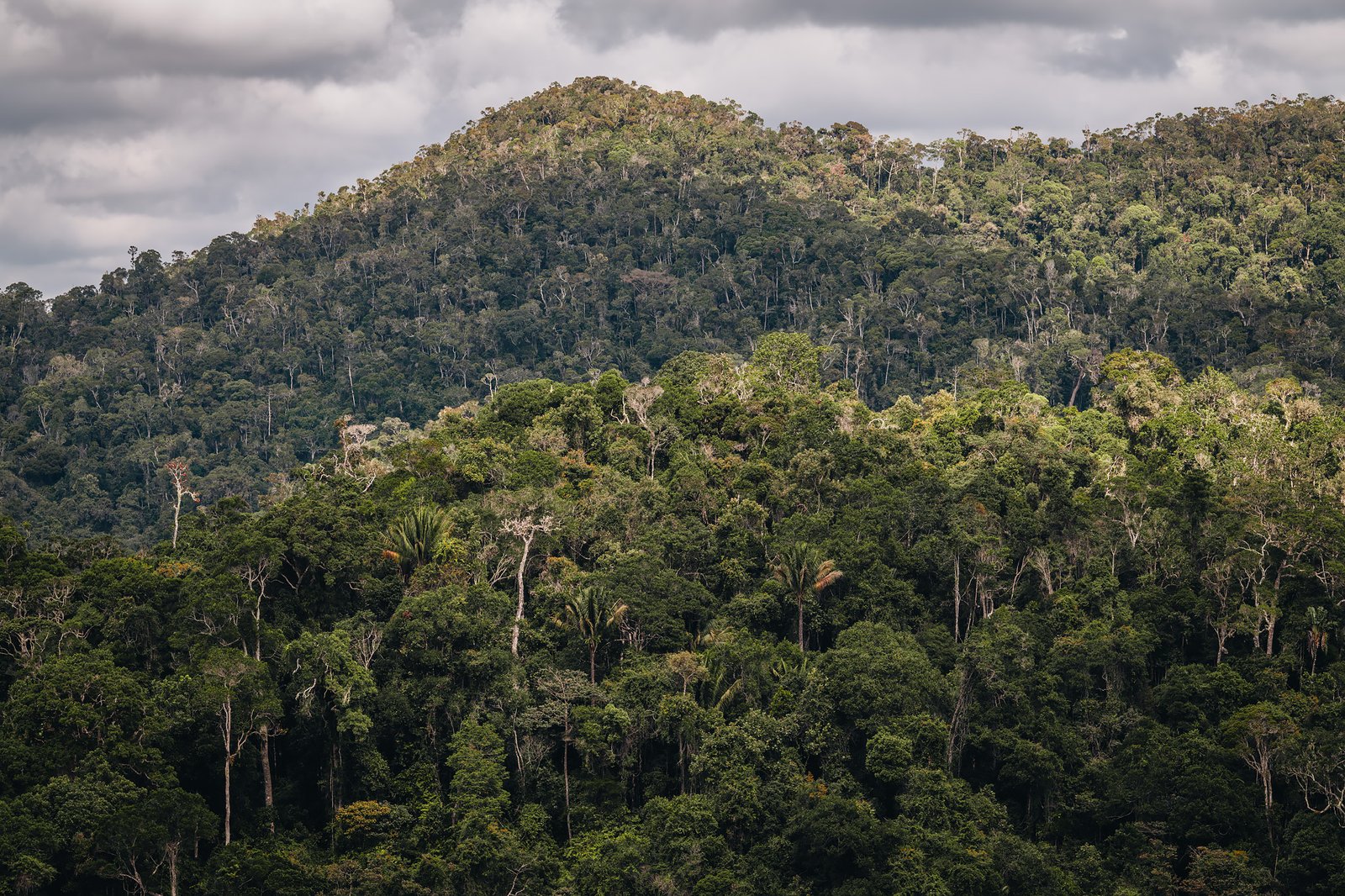
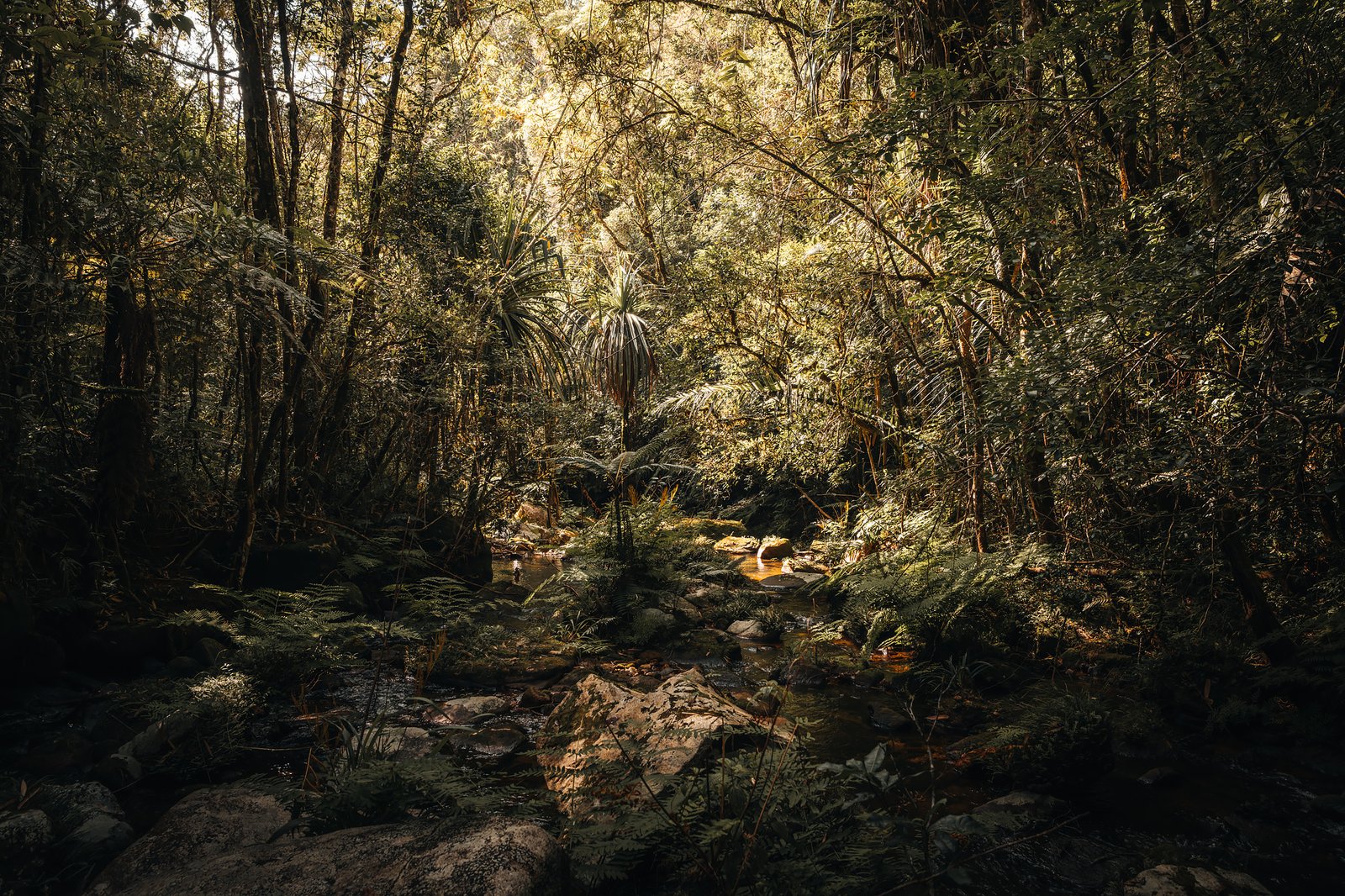
Forests near Andasibe and Mantadia form part of the last remaining eastern rainforests of Madagascar. These represent fragments of much larger ecosystems that once covered far greater portions of the island. These are ancient forests.
Dense, humid and biologically overwhelming environments where life appears to occupy every layer of space. Moss blankets tree trunks and branches while giant ferns rise from beneath the canopy. The air smells permanently of damp earth and vegetation.
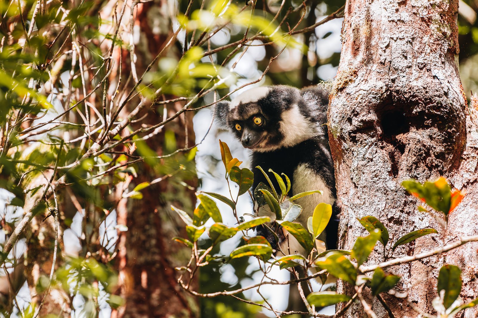
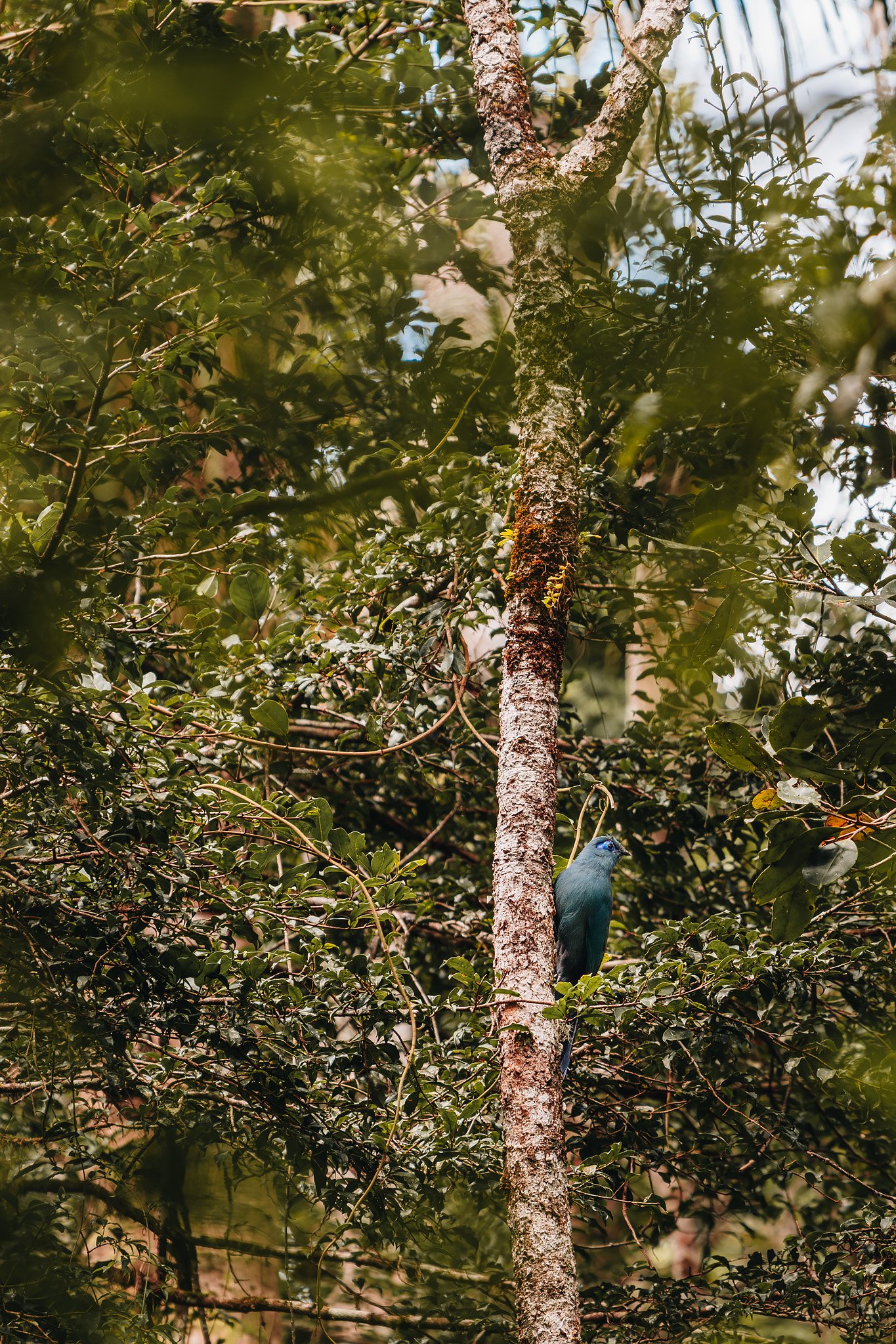
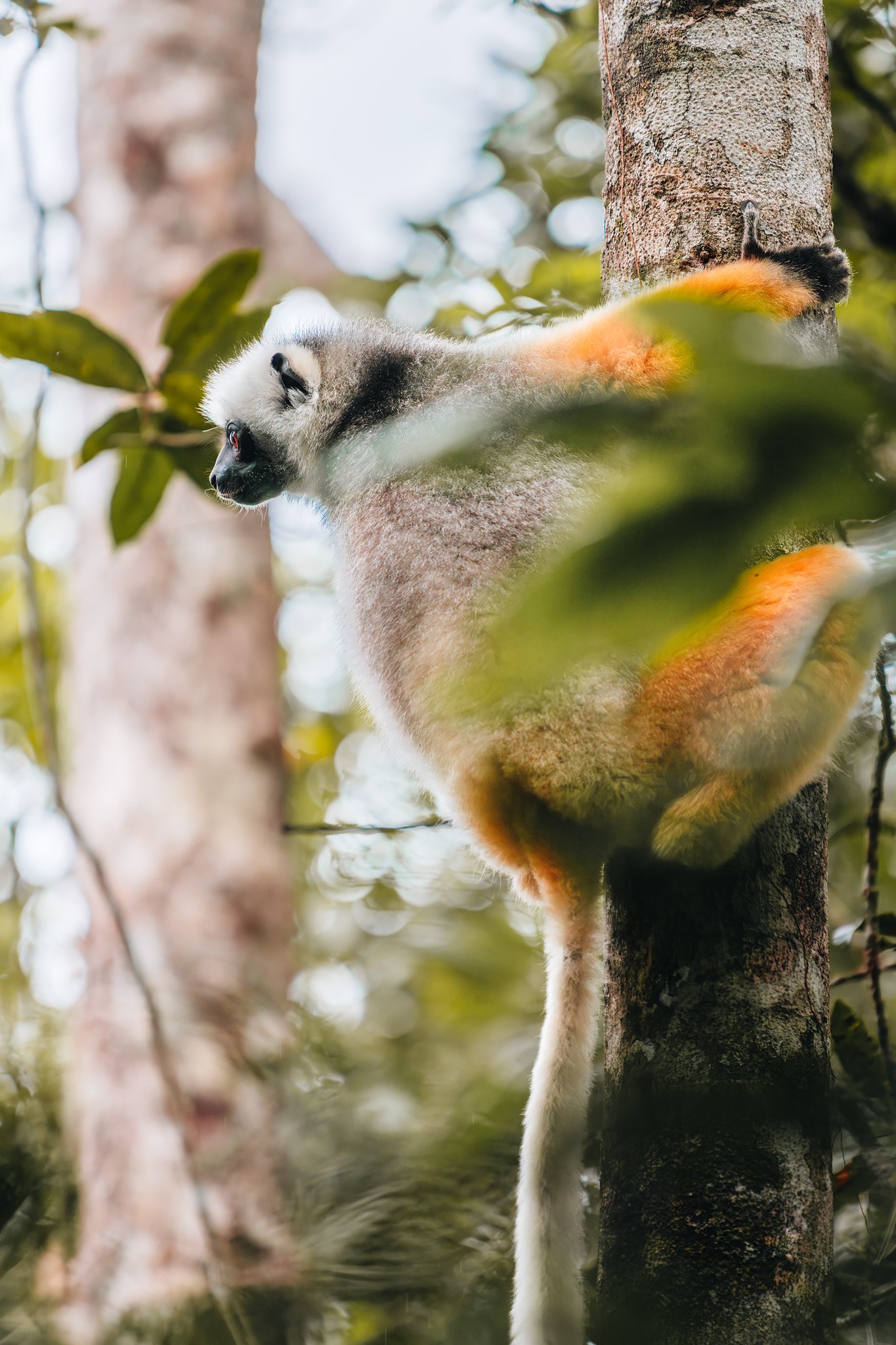
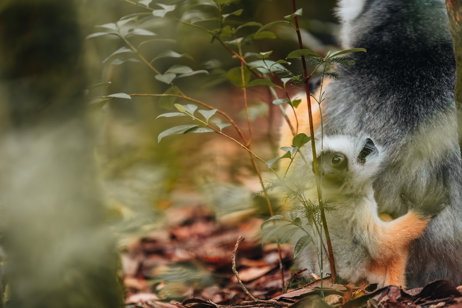
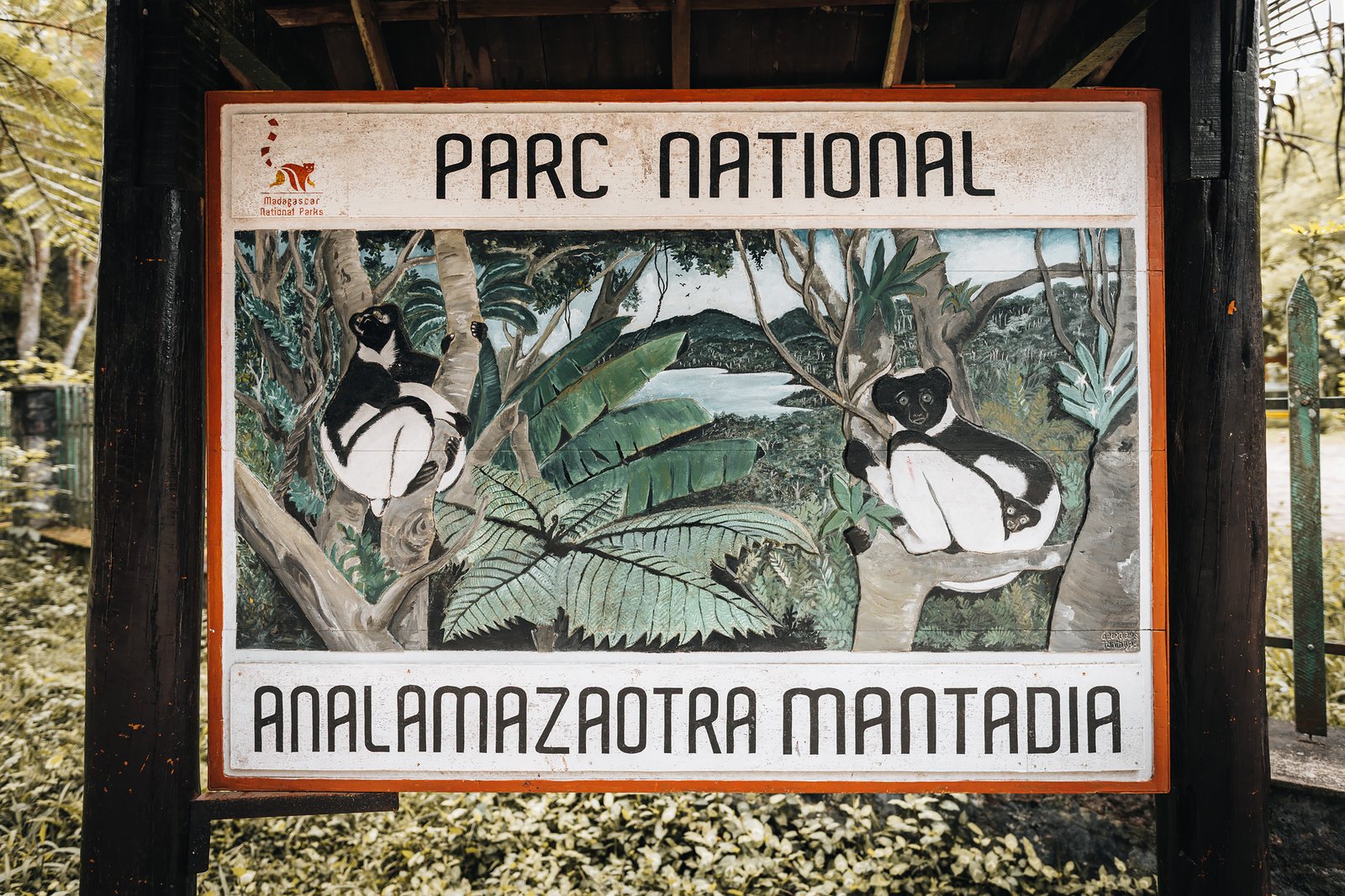
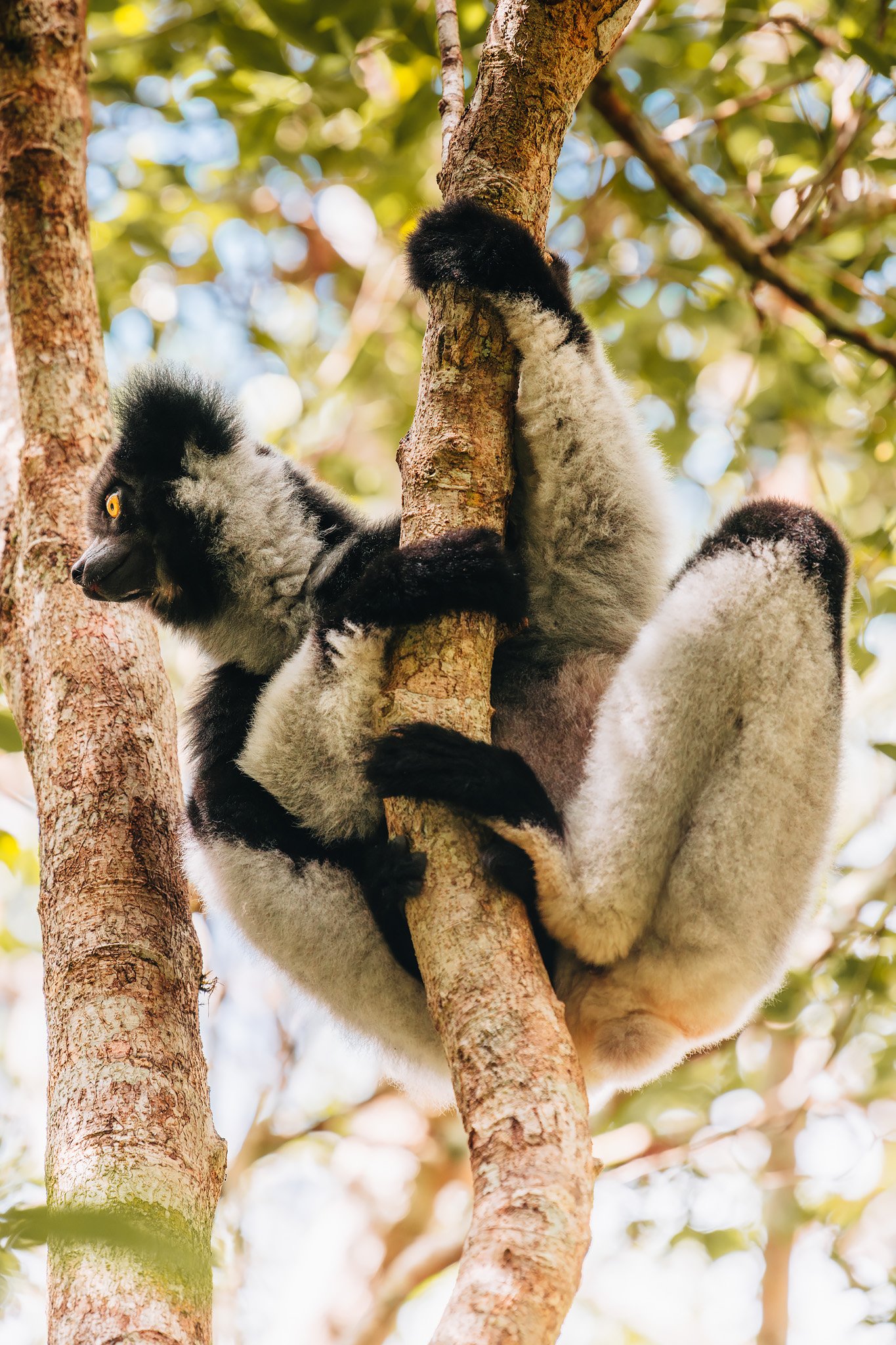
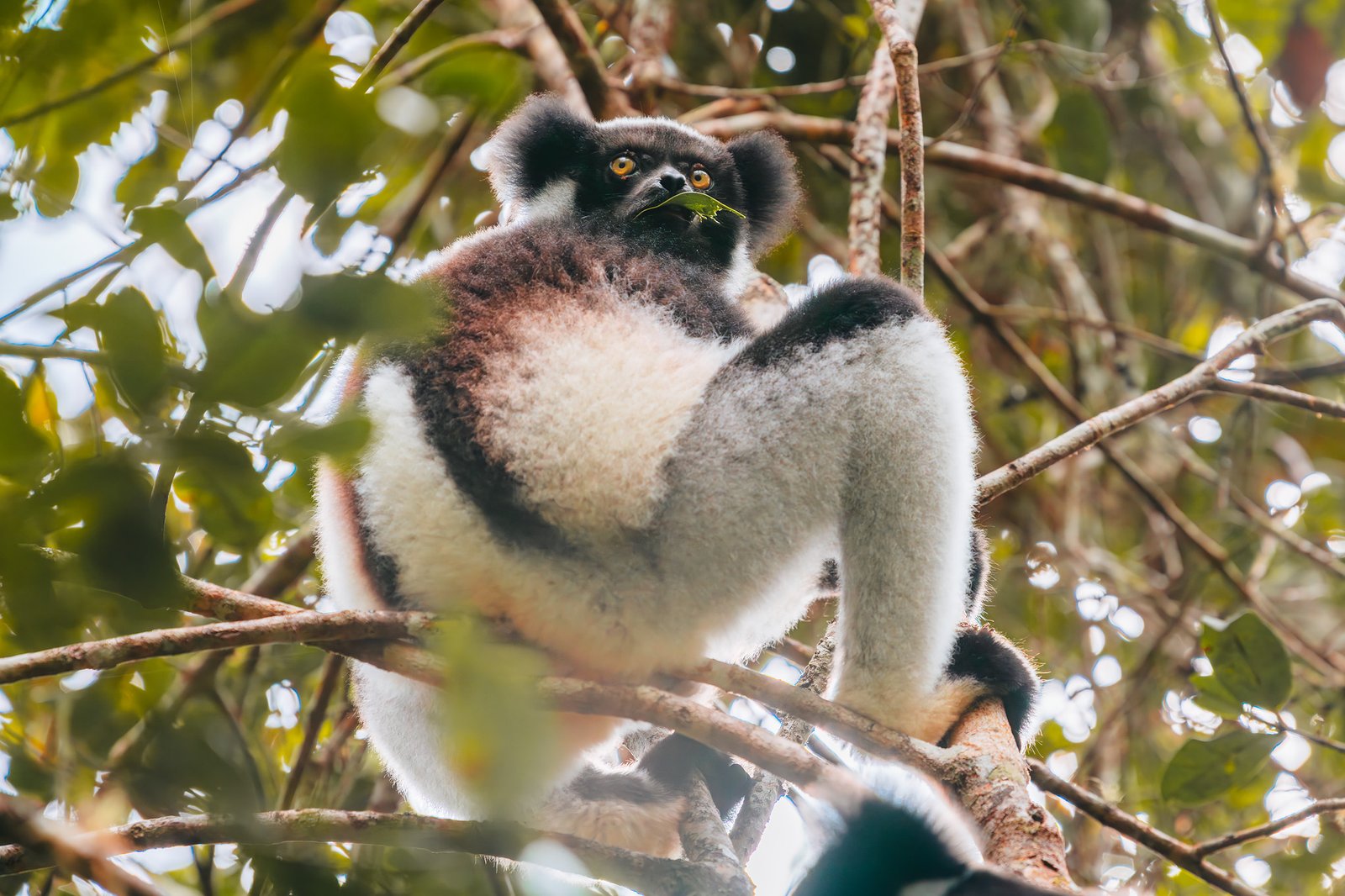
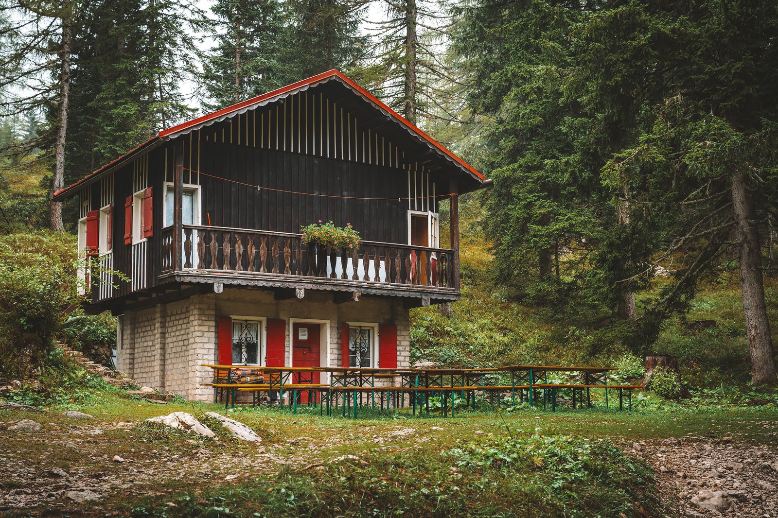
Andasibe is also one of the most-visited protected areas in Madagascar mainly because it is one of the best places in the world to see the Indri, the largest living lemur.
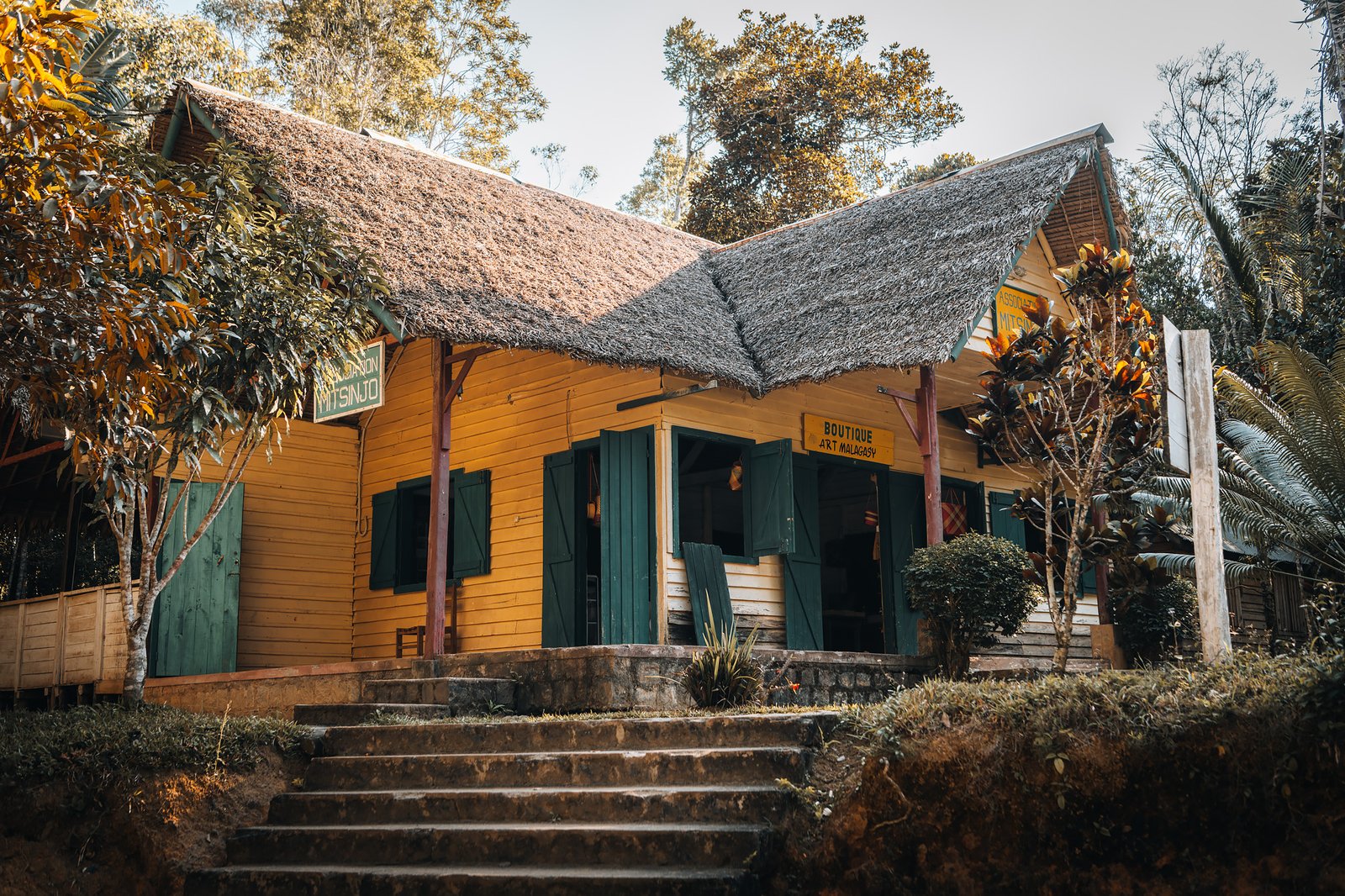
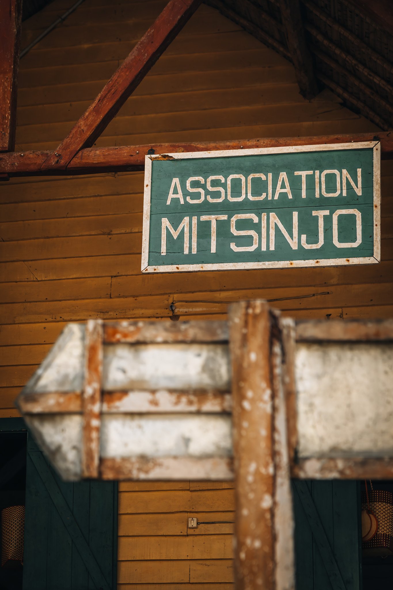
During the next days we spent considerable time exploring several areas surrounding Andasibe including Mitsinjo & V.O.I.M.M.A, primarily consisting of nighttime walks and smaller community-managed rainforests, Mantadia during the day, a denser and rougher primary forest with fewer visitors, and finally Analamazaotra, perhaps the most renowned portion of the park system, particularly popular for resident Indri groups.
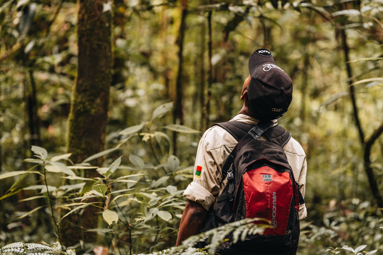
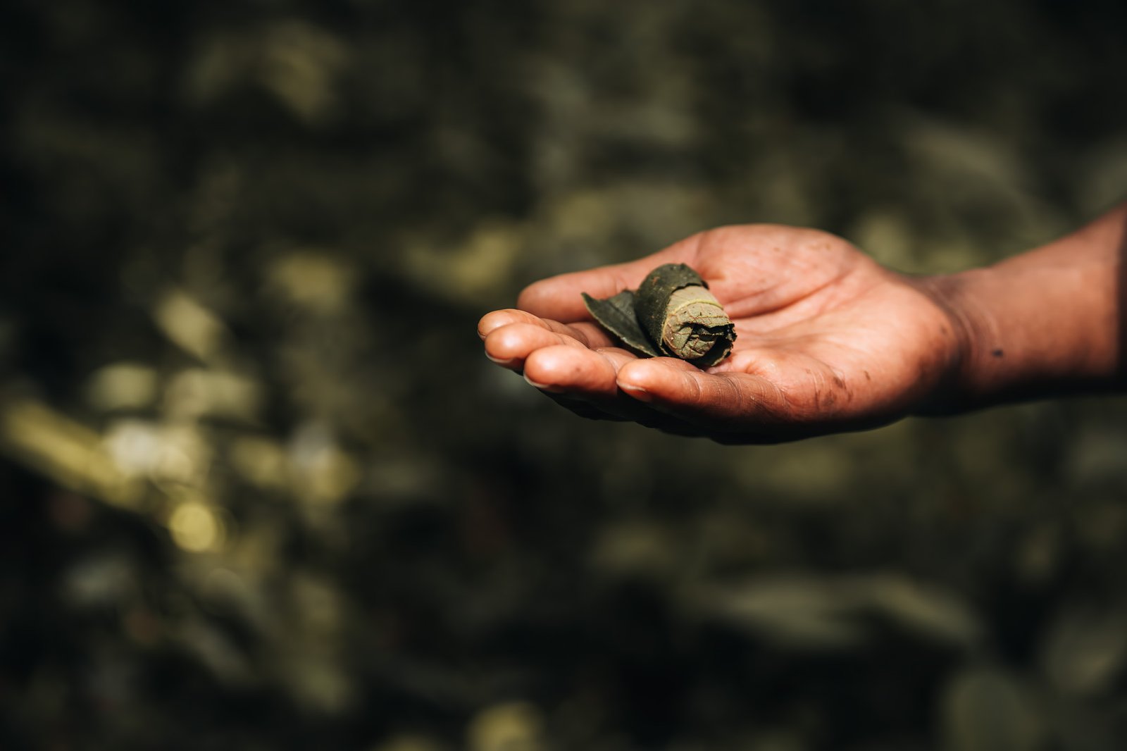
In addition to our driver-guide, Coleggue, accompanying us into reserves, local guides also walked with us once inside the park. These trackers possessed an amazing understanding of their environment. They knew exactly where specific lemur families rested, which trees attracted geckos and insects, and where chameleons slept at night.
Initially it felt staged, but you soon realized it was merely experience. Fano, our primary local guide, and then Flavia during our nighttime walk at V.O.I.M.M.A, consistently demonstrated a great knowledge of biology, local customs, animal behavior and many other things.
After Dark
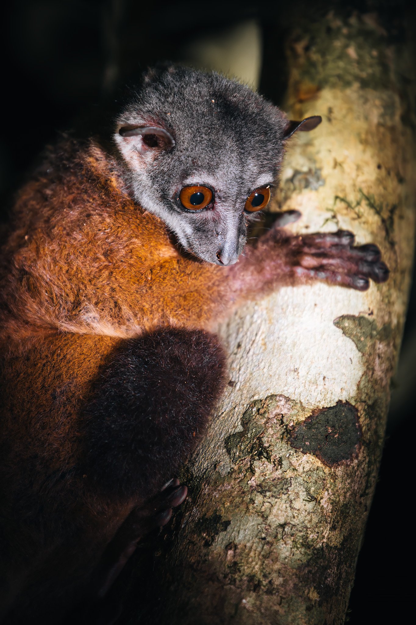
If visiting the rainforest during daylight already felt kind of alien, things became even more surreal at night. Nighttime walks revealed an entirely different ecosystem hidden within essentially the same forest.
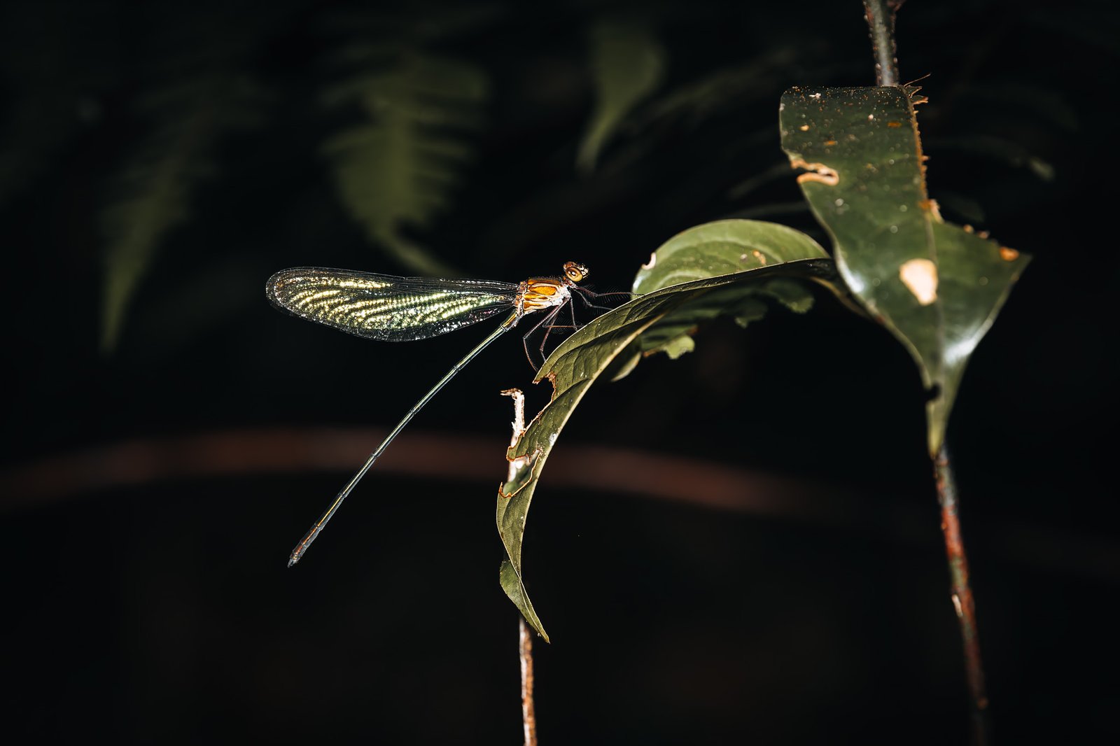
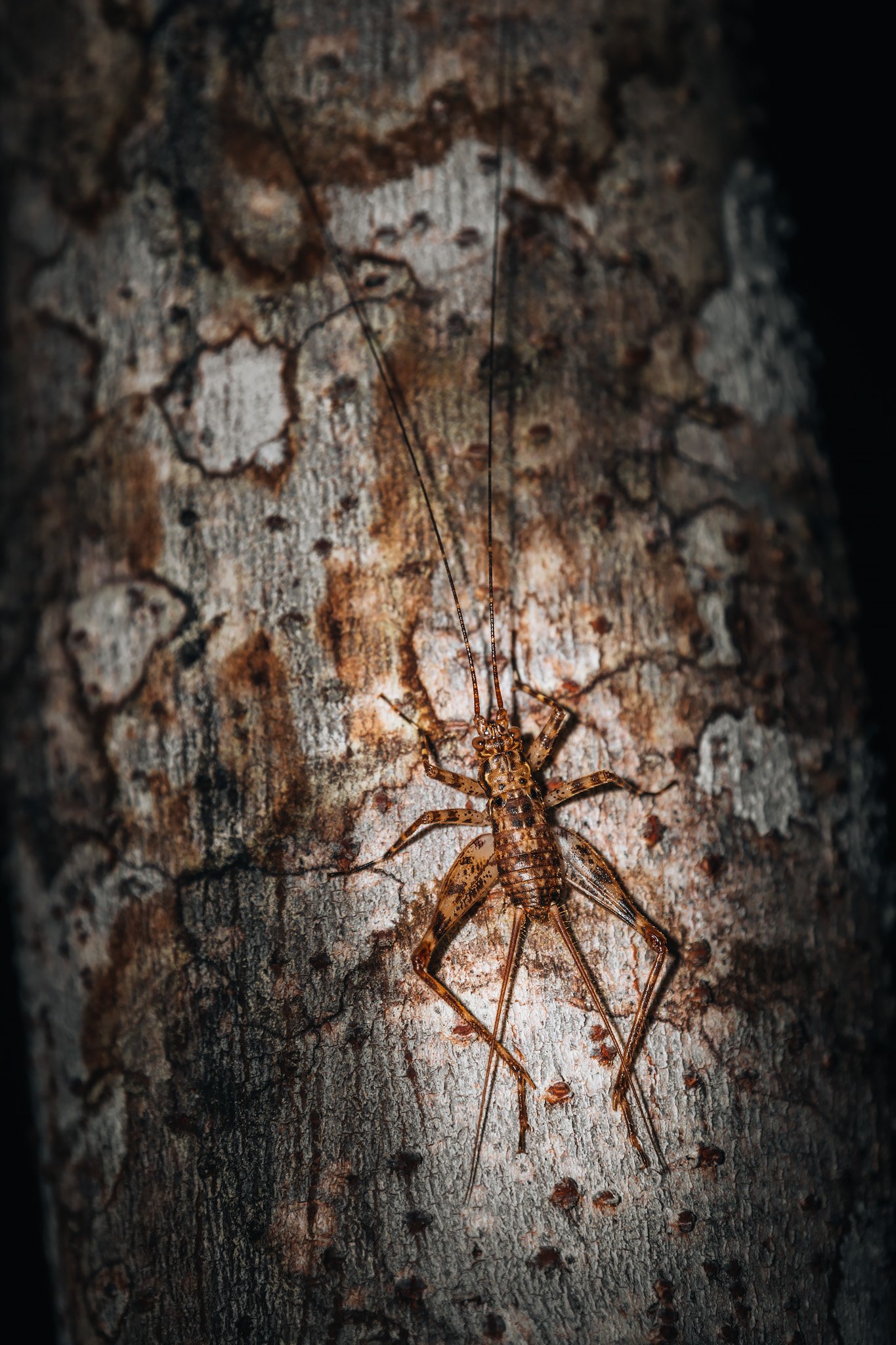
The humidity increased immediately following sunset and total darkness enveloped all areas outside of our flashlights. Frogs called continuously from every direction as insects previously hidden within moss and bark began moving through foliage.
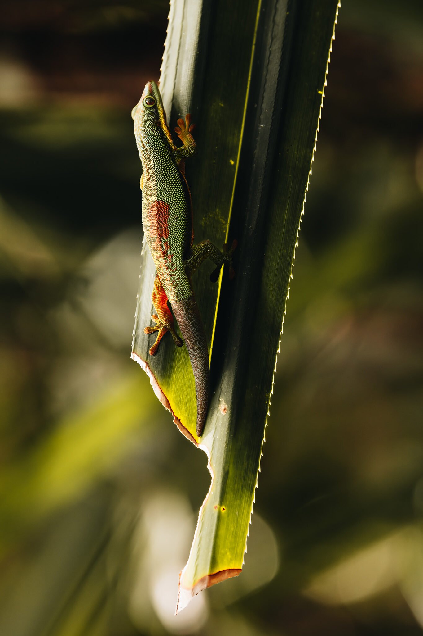
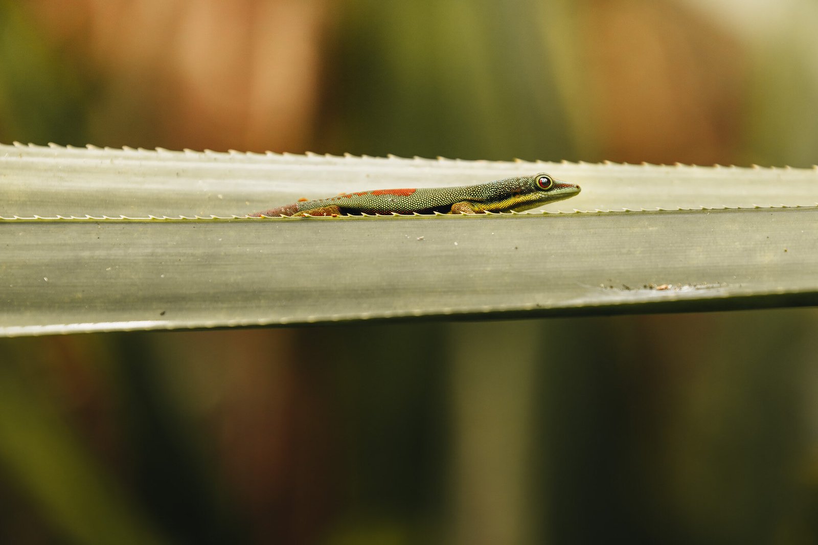
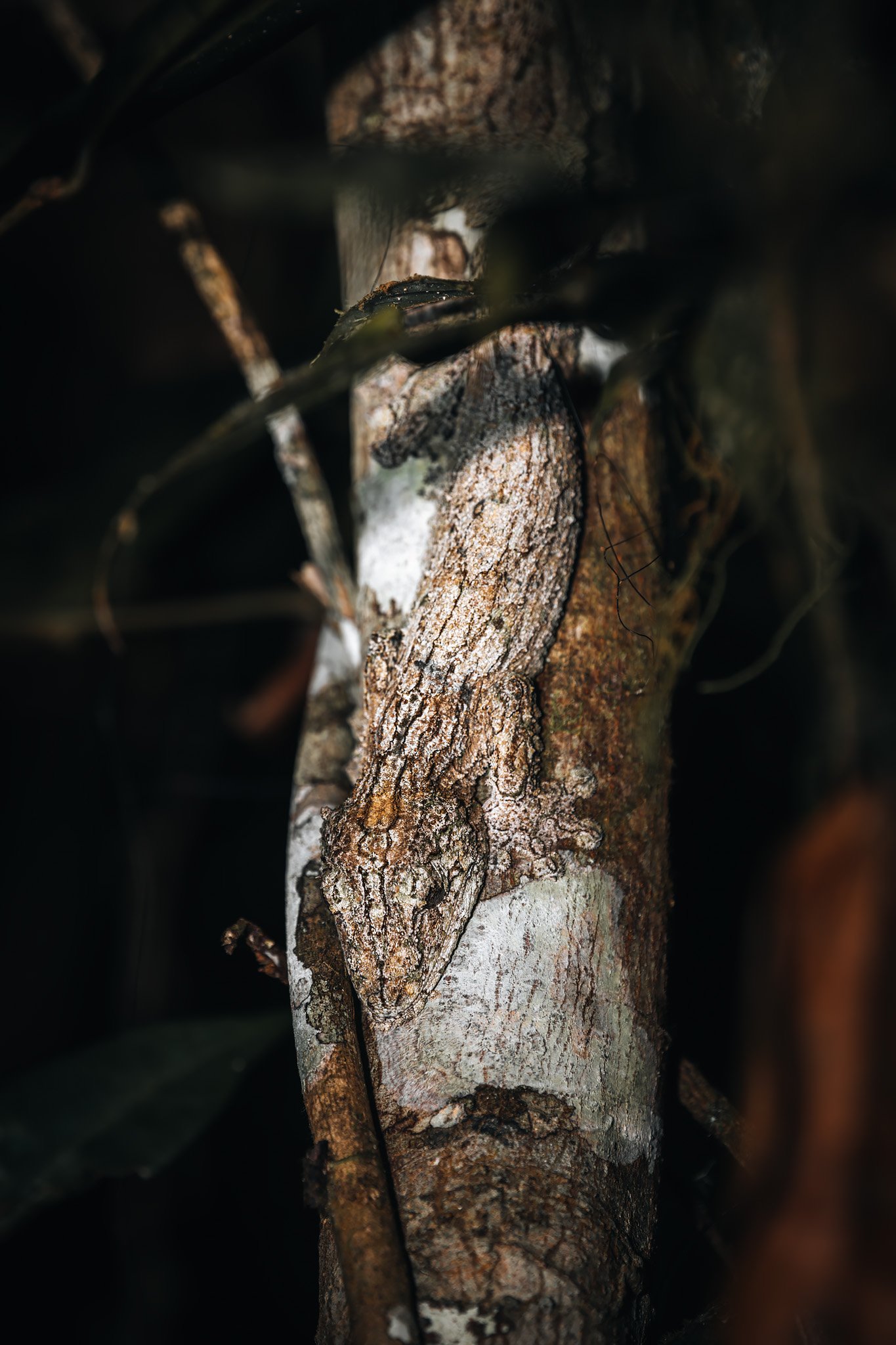
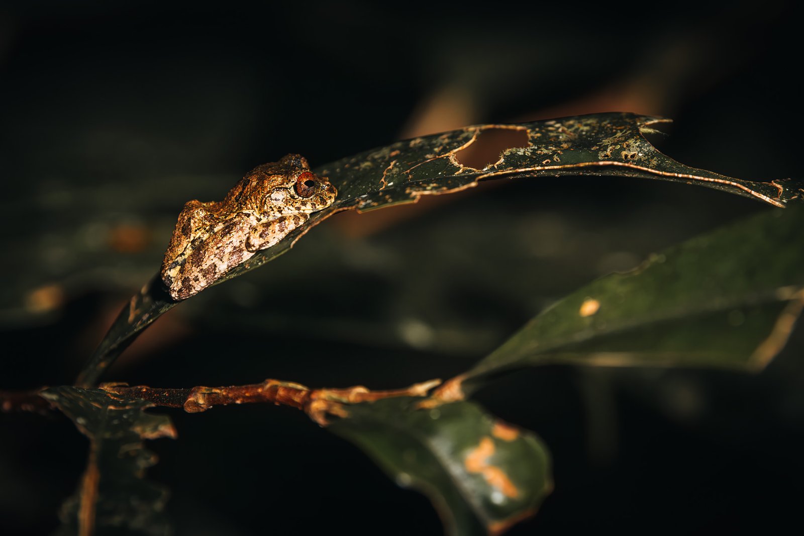
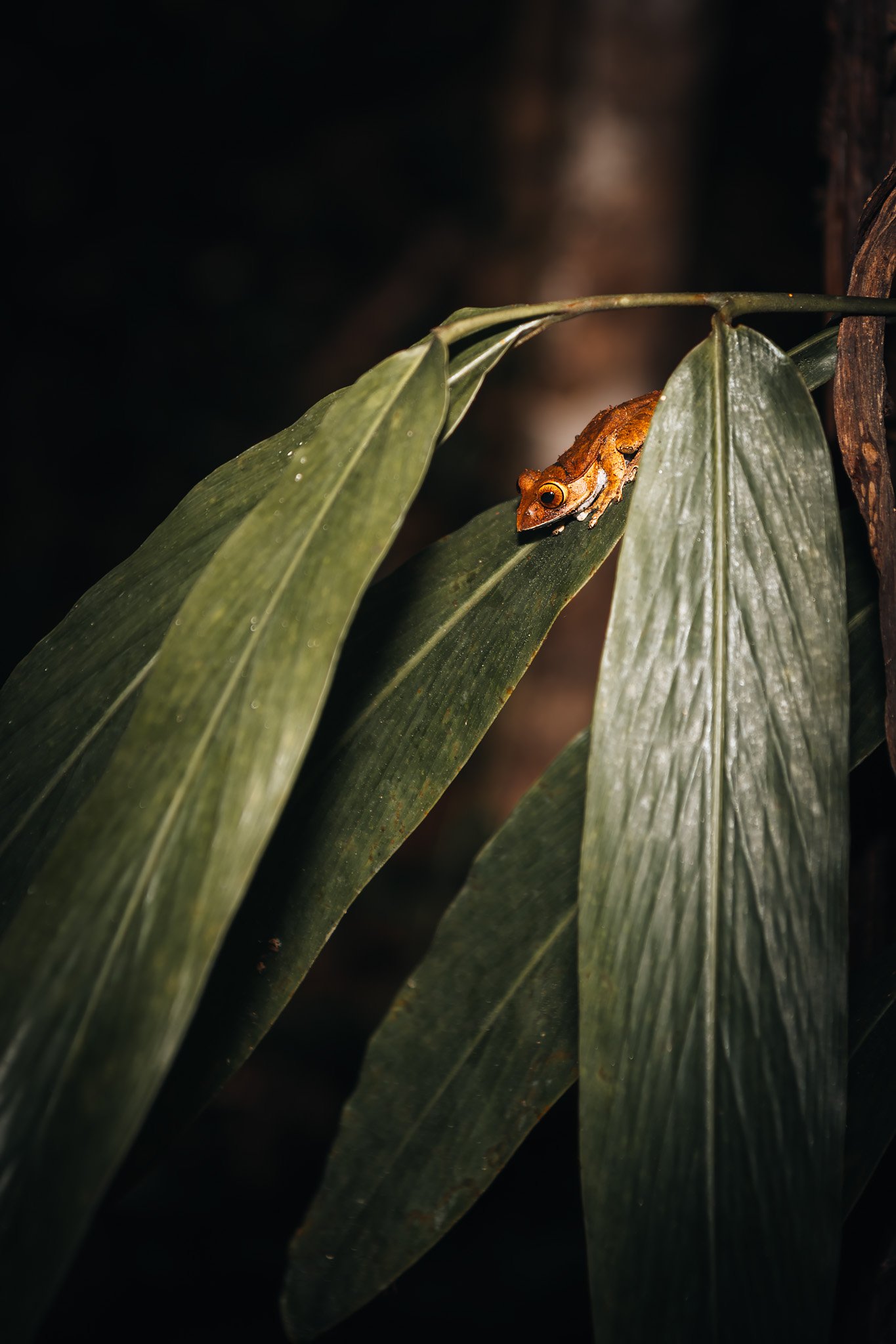
Each flashlight beam illuminated something unusual. Chameleons hanging several meters above the ground while leaf-tailed geckos disguised themselves perfectly as bark. Small frogs that blended completely with leaves until the reflection from their eyes revealed them.
The rainforest operated differently at night. One aspect that fascinated me most regarding these nighttime walks was how respectfully our guides treated wildlife. They allowed animals to remain calm without unnecessary interaction. Frequently guides knew exactly where certain species would appear since they understood feeding patterns and sleeping sites with an uncanny degree of accuracy.
Some species also appeared quite indifferent toward humans. Madagascar possesses extremely low levels of native predators compared to mainland Africa, thus much of its wildlife has developed without constant predation pressures experienced elsewhere on the continent. For photography, this meant leaving the big zoom lenses at home. A simple 200mm was usually more than enough unless you planned to photograph birds.
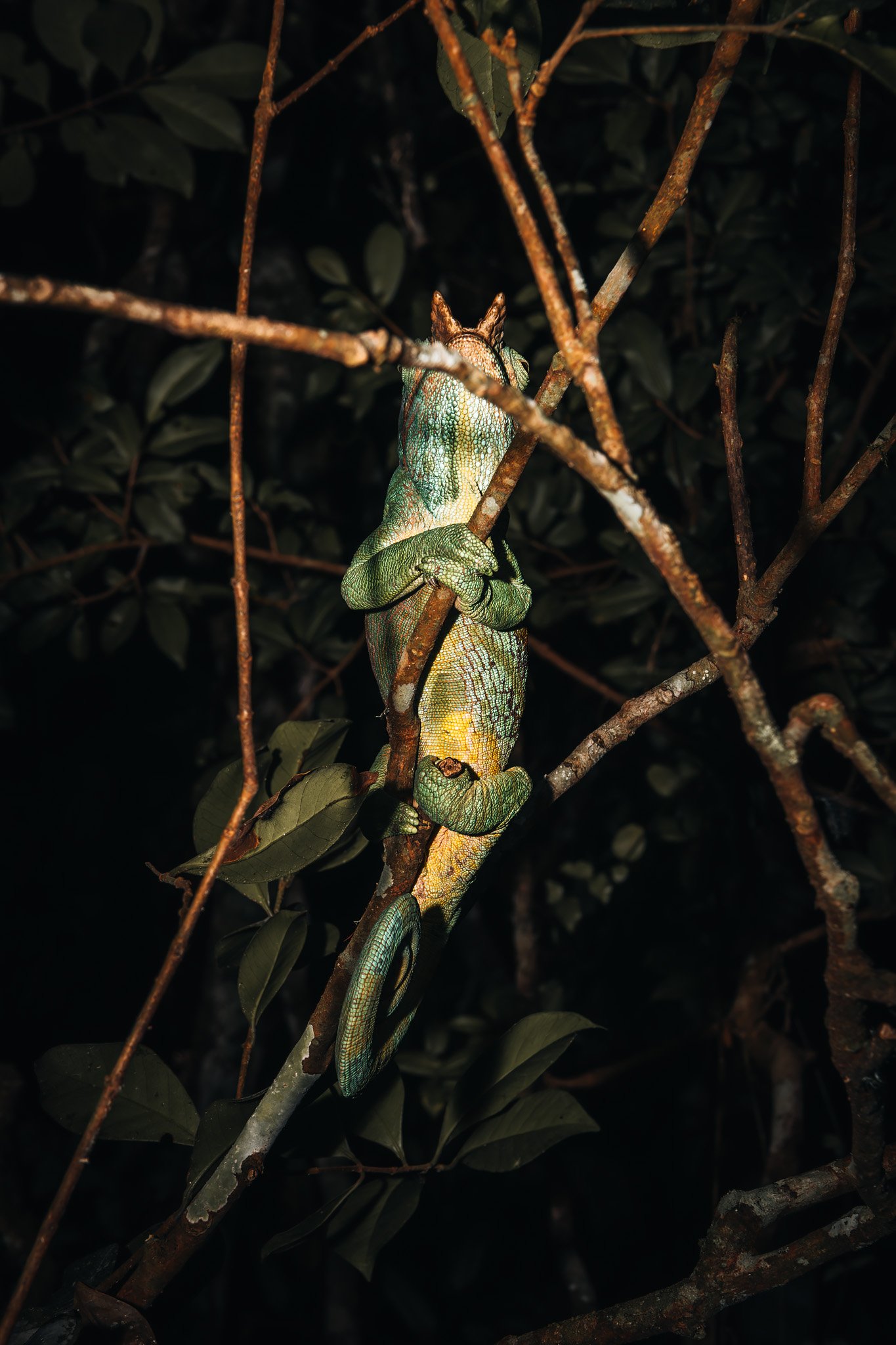
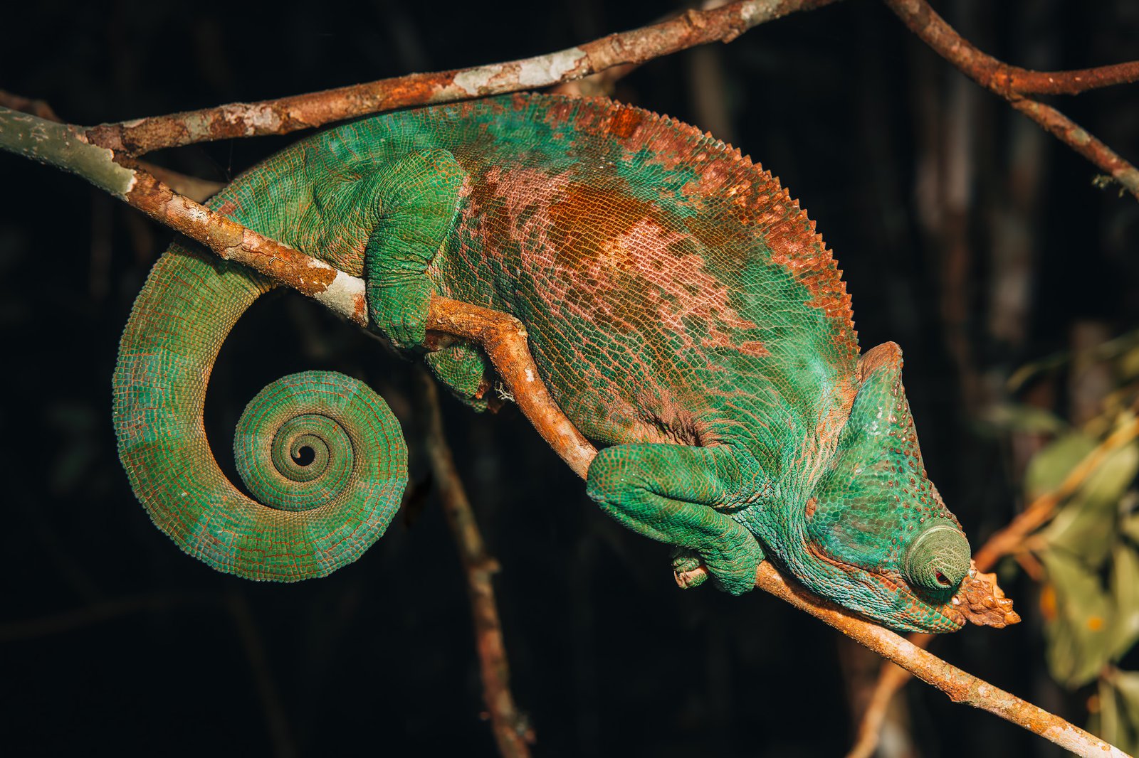
One of our most memorable experiences was encountering a Parson’s Chameleon. Locating one is difficult enough, photographing one at least five meters above ground partially concealed between branches in complete darkness is a whole different story.
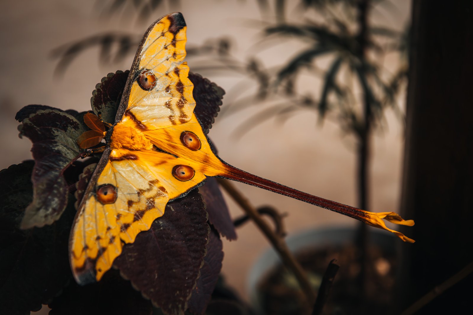
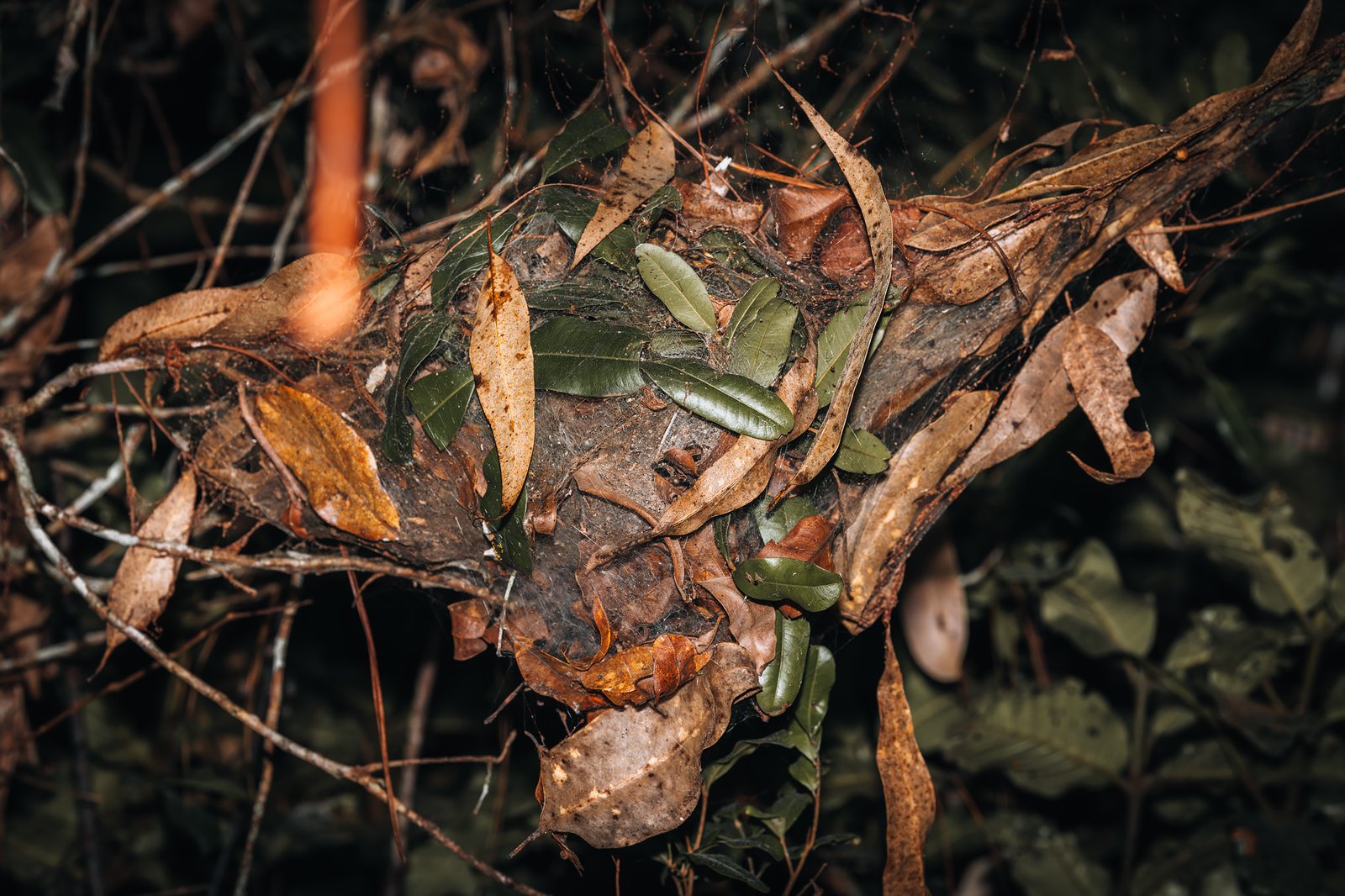
Another memorable moment was trying to spot the famous Comet Moth, one of the largest silk moths in the world, without success, only to later find one calmly sitting outside our cabin once we returned.
The Voice of the Forest
Perhaps the most memorable experience occurred early before sunrise on the second day.
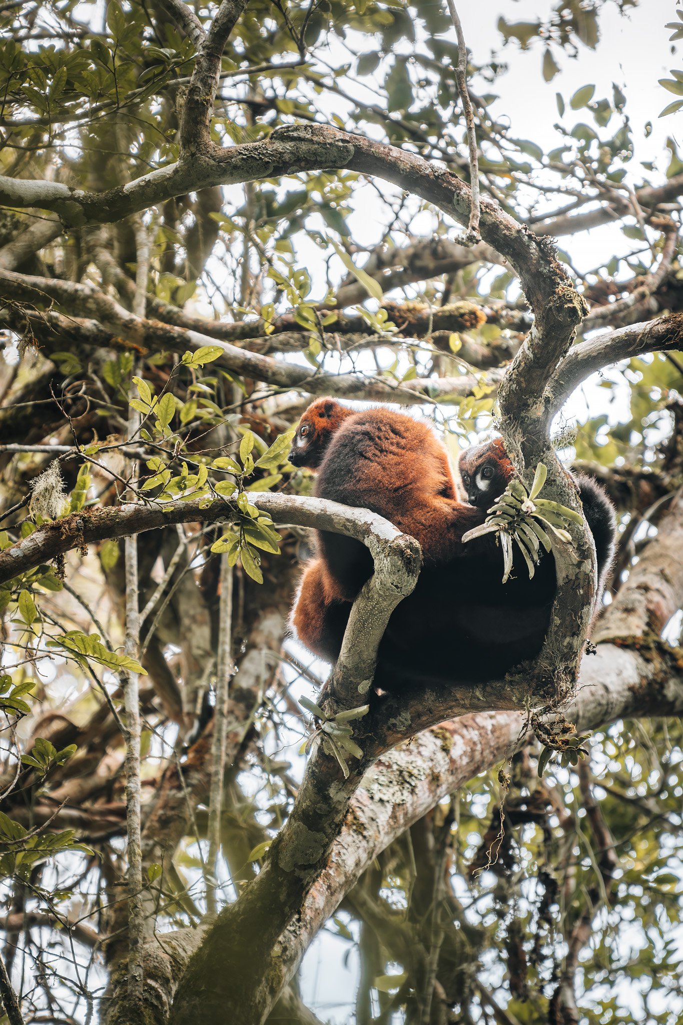
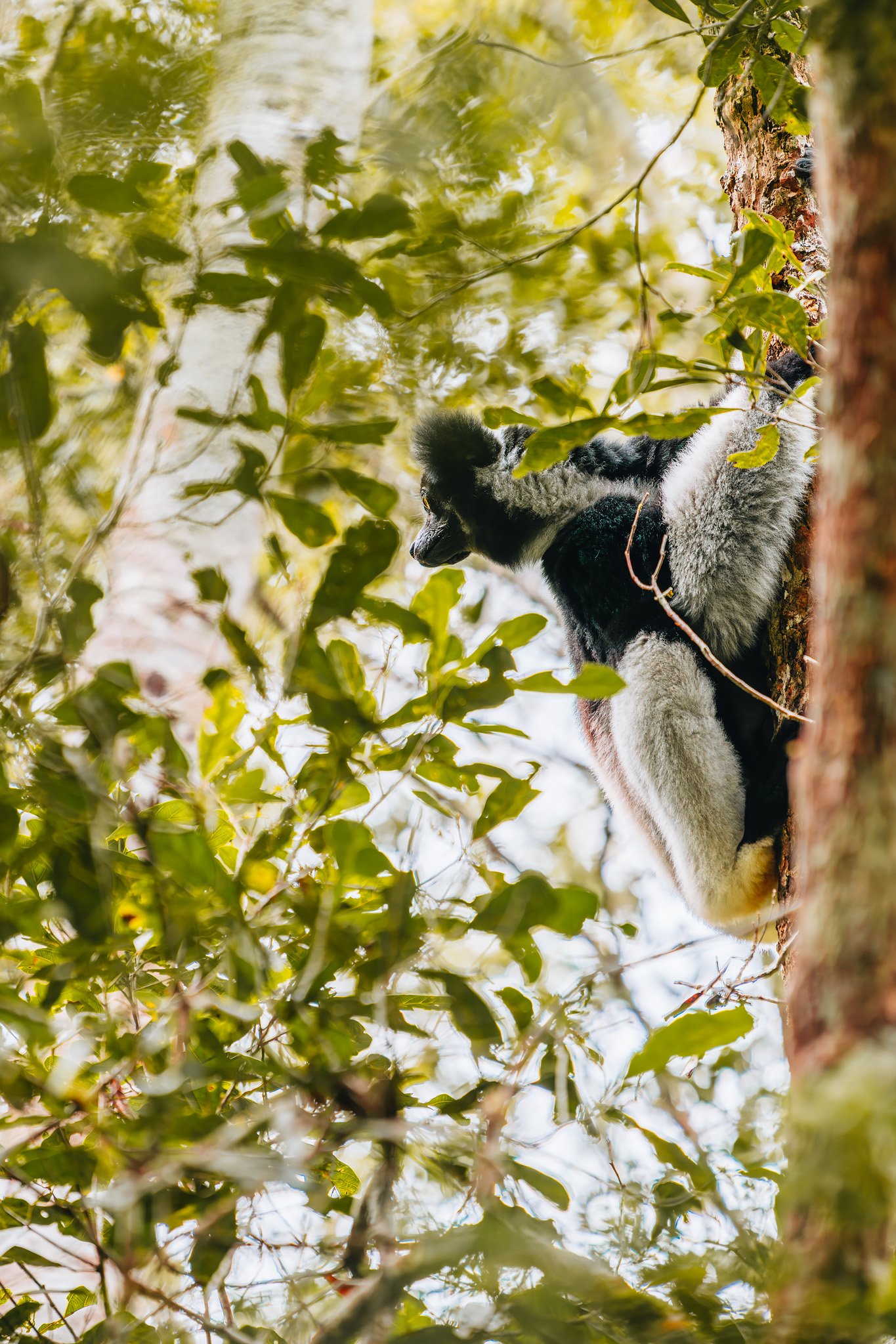
A distant rising call moving through mist above the canopy, followed by a second response deeper within the forest. The Indri.
Indri calls carry for miles through rainforests and are unlike anything else in nature; somewhere between a whale song, a siren, and something ancient emerging from the forest itself.
The Indri is not only one of Madagascar’s most iconic creatures but also one closely associated with Malagasy belief systems and fady, Malagasy taboos and ancestral myths that pervade nearly all areas of the island. Some myths portray Indris (or Babakoto) as relatives or ancestors of humans. Other legends depict Indris worshiping the sun at dawn when they occasionally stand upright facing the morning light before calling.
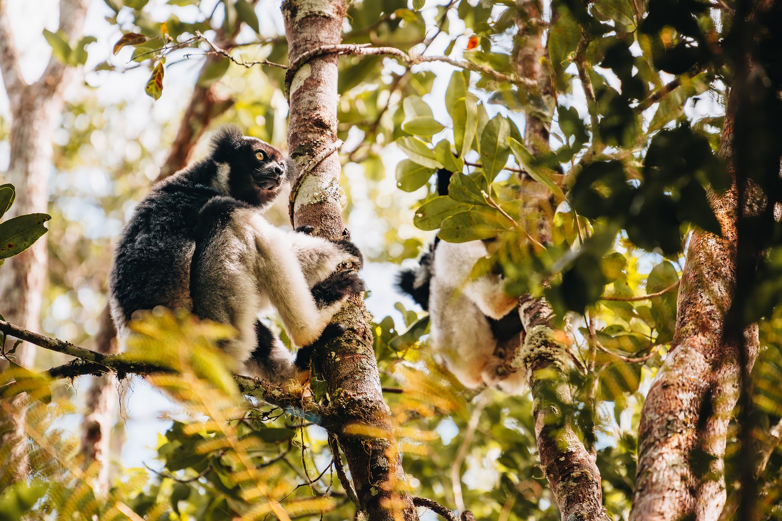
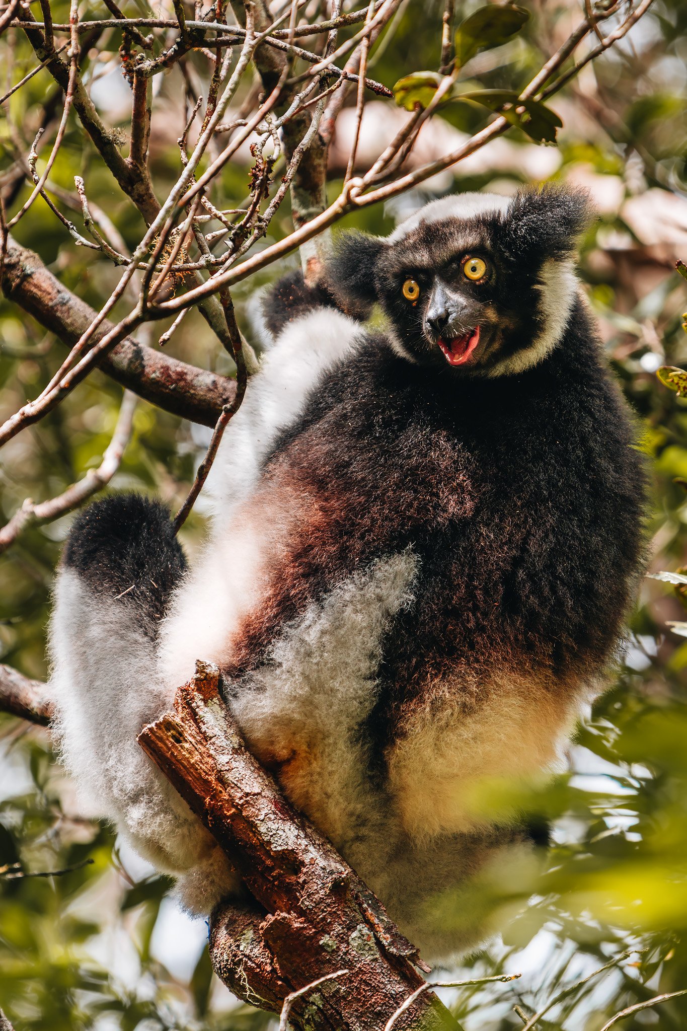
Finally we spotted them high above us eating quietly from leaves while moving through the canopy with impressive agility.
They are certainly larger than most lemurs and remarkably expressive, however it is their movement that becomes etched in memory as suddenly they propel themselves acrobatically through enormous spaces separating trees with complete control.
Observing them eat and groom each other high above the forest floor sometimes felt strangely human, and deeply ancient too.
Return To Tana
Following a couple days in Andasibe we headed back west toward Tana.
Rainforests gradually disappeared behind us while highlands re-emerged through mist, rural villages and rice terraces. However, Madagascar already felt far larger and more fragmented than when we arrived.
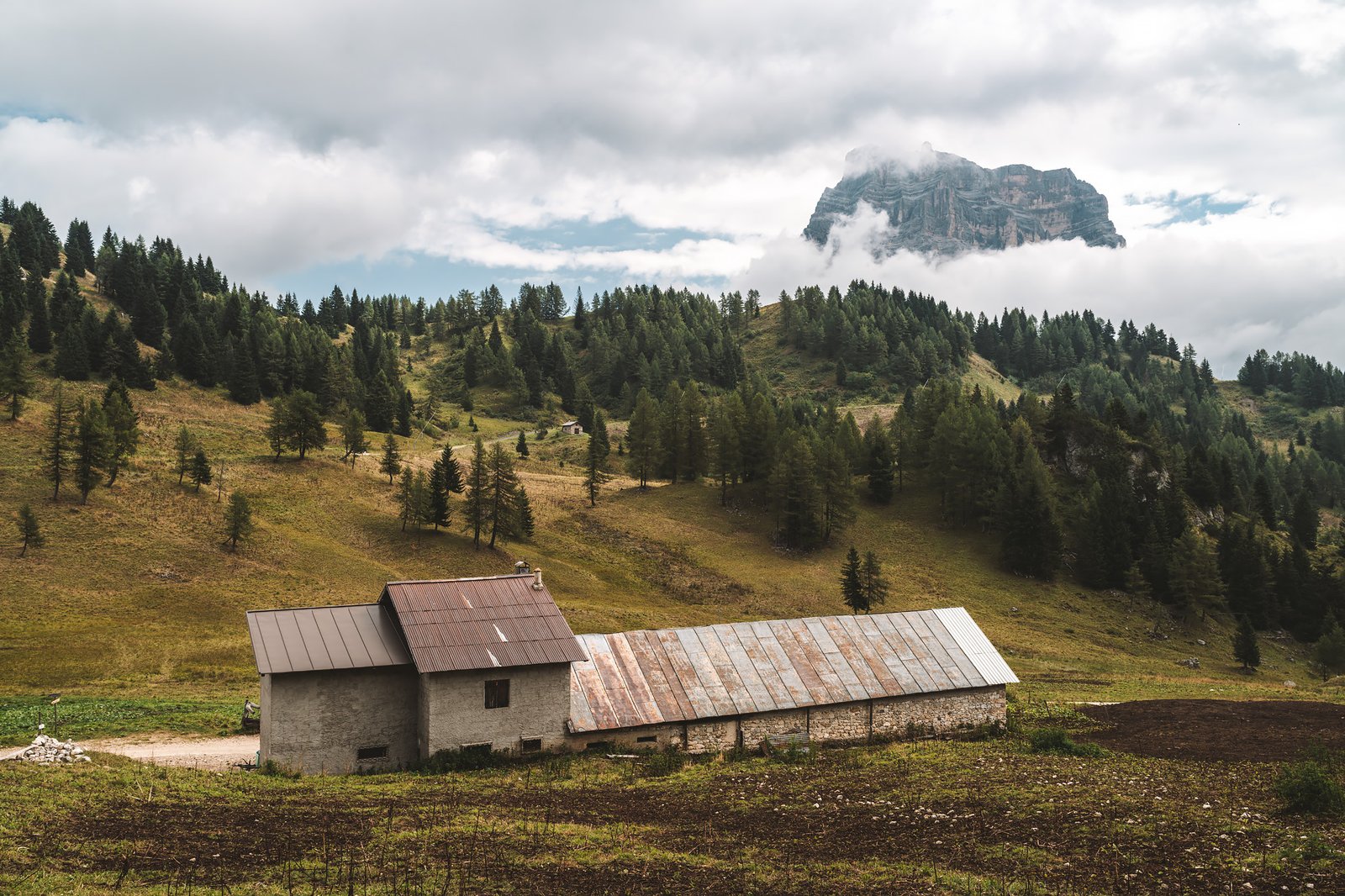
Only Andasibe was merely the beginning. Ahead lay the dry forests of Kirindy, the baobabs of the western coastline and the limestone labyrinths of Bemaraha. We would be going through water crossings, dust roads and environments unlike the humid forests encountered in eastern Madagascar.
The island was already dividing itself into separate worlds.
Alta Via 1. Part V: Tre Cime di Lavaredo - A Necessary Detour
The Alta Via 1 had ended.
Belluno marked the end of the route; lower elevation, warmer air and a return to normalcy. The rhythm of the trip had changed, and with it, the perception that the trip had reached its logical conclusion.
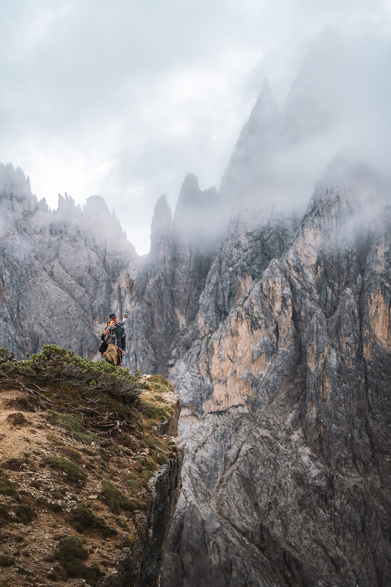
But not all had settled. Something had appeared days earlier, from the summit of Seekofel. At the time, Tre Cime was simply a reference point, far away, abstract. Something that belonged elsewhere in the trip. Officially, that area is part of a different trek, the Alta Via 4, but many visit it as a one-day trip, or even as their main experience of the Dolomites.
Regardless of fatigue or pain in my right leg, which would worsen over the next few days, the decision was simple. Just one more push.
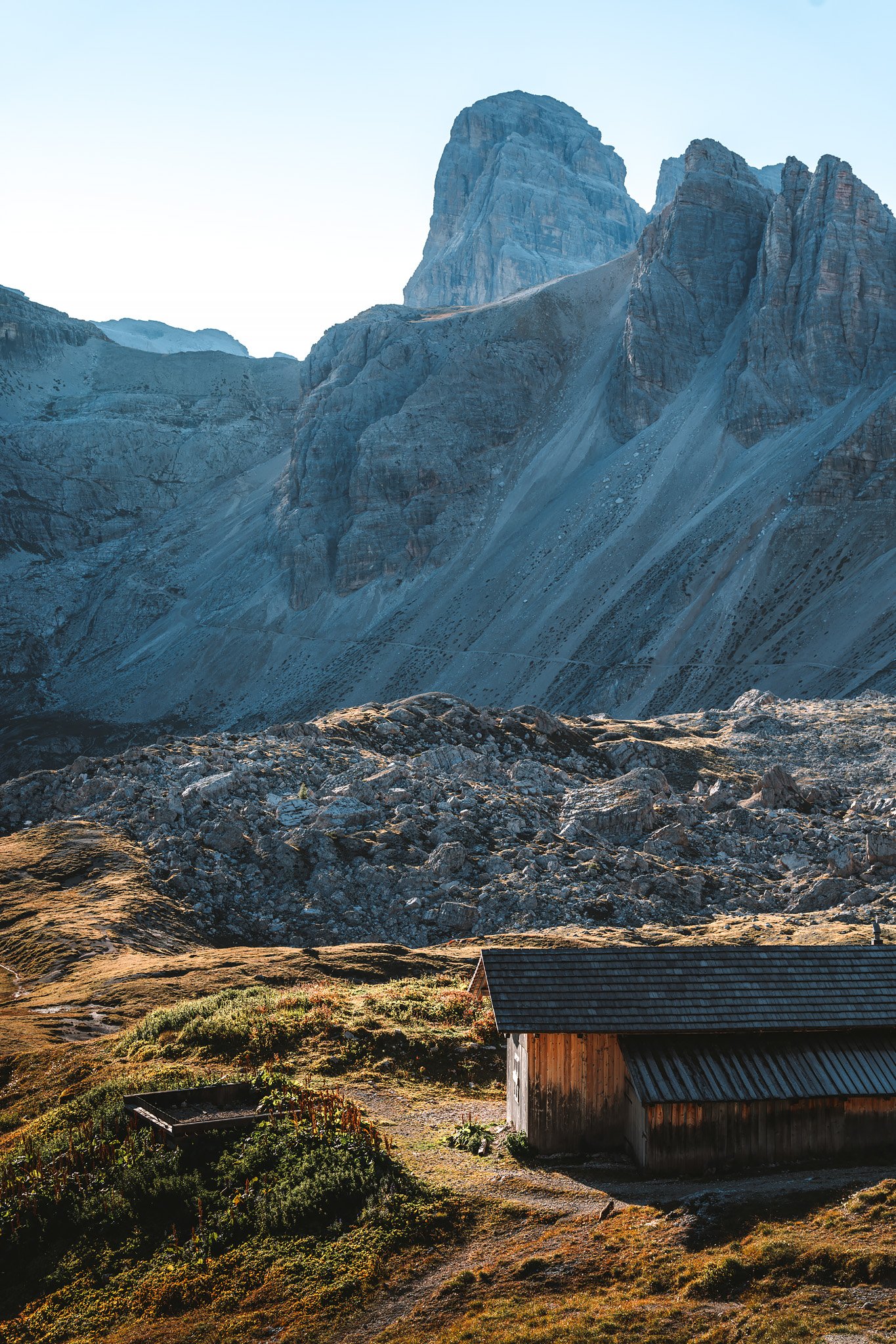
Stage 8. Auronzo – Rifugio Locatelli (via Cadini di Misurina)
Distance: 8.15 km · Elevation Gain: +389 m · Elevation Loss: −313 m · Technical Difficulty: Easy
Returning to the mountains from Belluno felt more like a return to a very familiar place. The trip back to the mountains was quieter and more direct. There was no anticipation, only movement toward something that somehow felt like the more obvious conclusion to the trip.
There was an issue at the rental car agency. License plate information and parking near Auronzo caused a slight moment of friction. This type of detail can be more important than it should be, but it was addressed quickly with the guys at the entrance gate at the bottom of the mountain and then forgotten.
And then the road began to climb toward Auronzo.
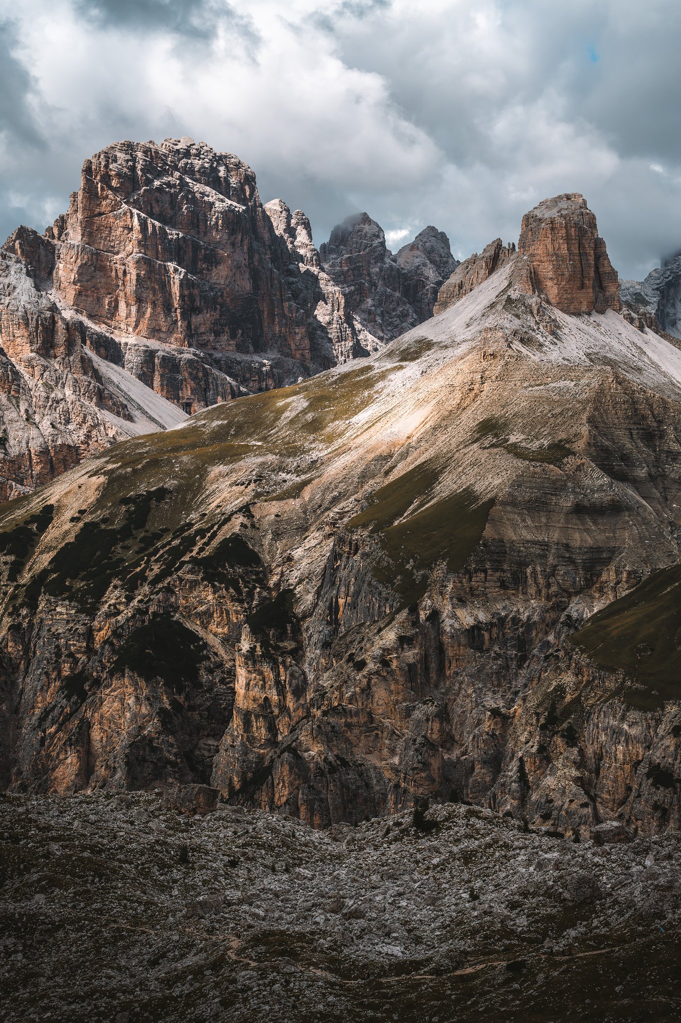
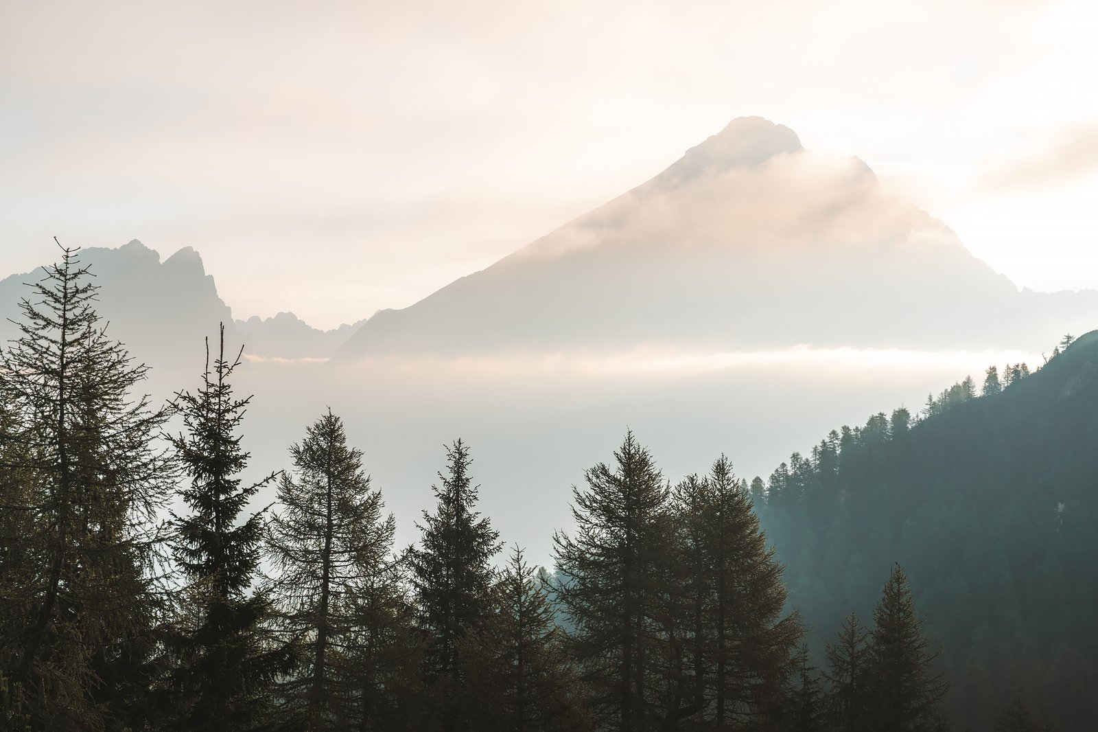
The shapes began to return. The pale rock, so distinct and nearly artificial in its tone, was back in plain sight above the tree line. Layers of spruce and larch forest gave way to more open terrain as the elevation increased.
The rhythm of the landscape was back, but the experience would be different.
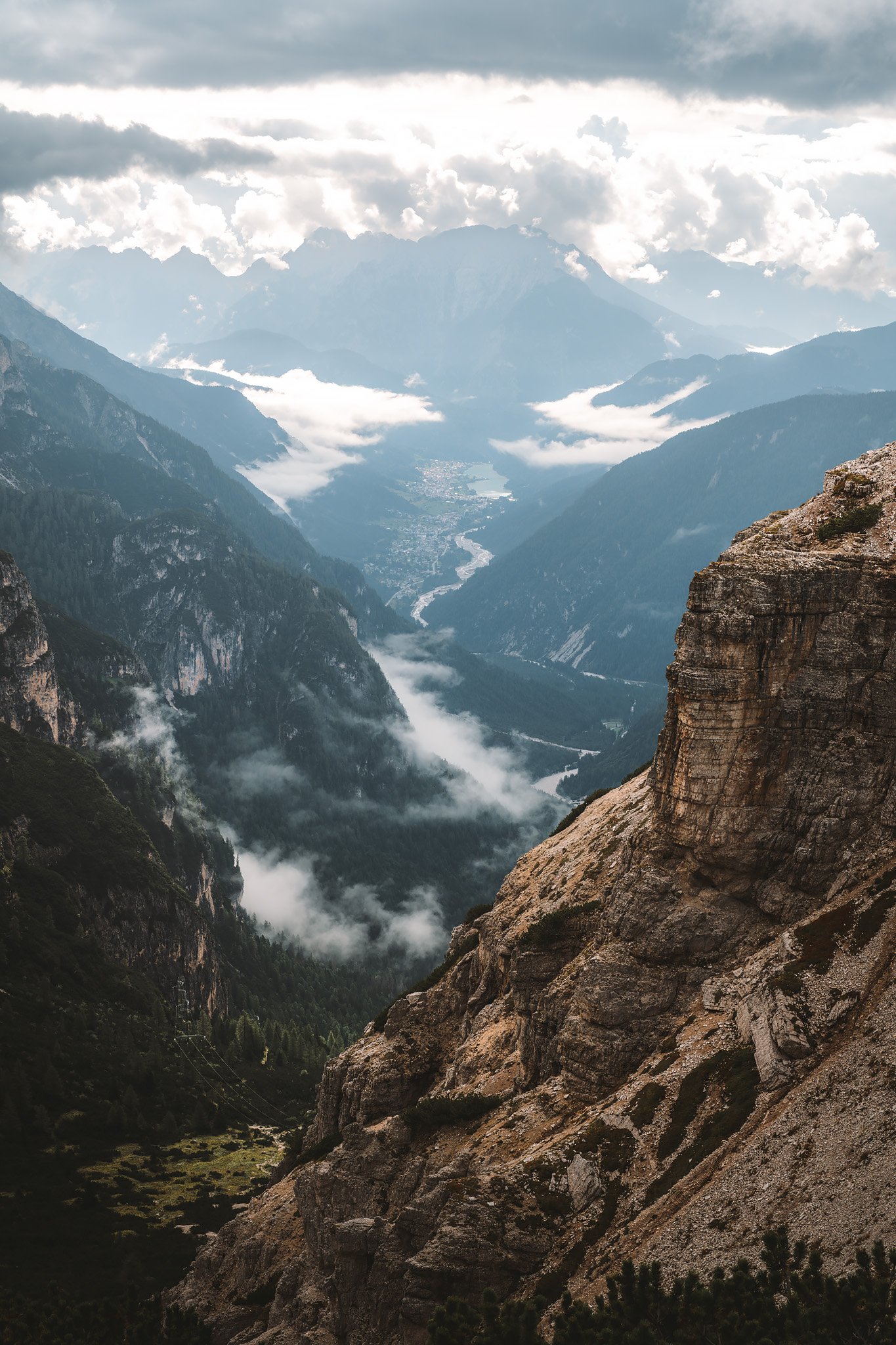
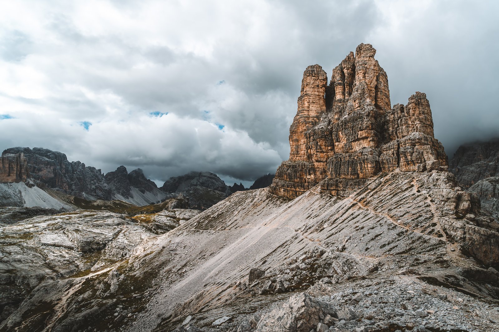
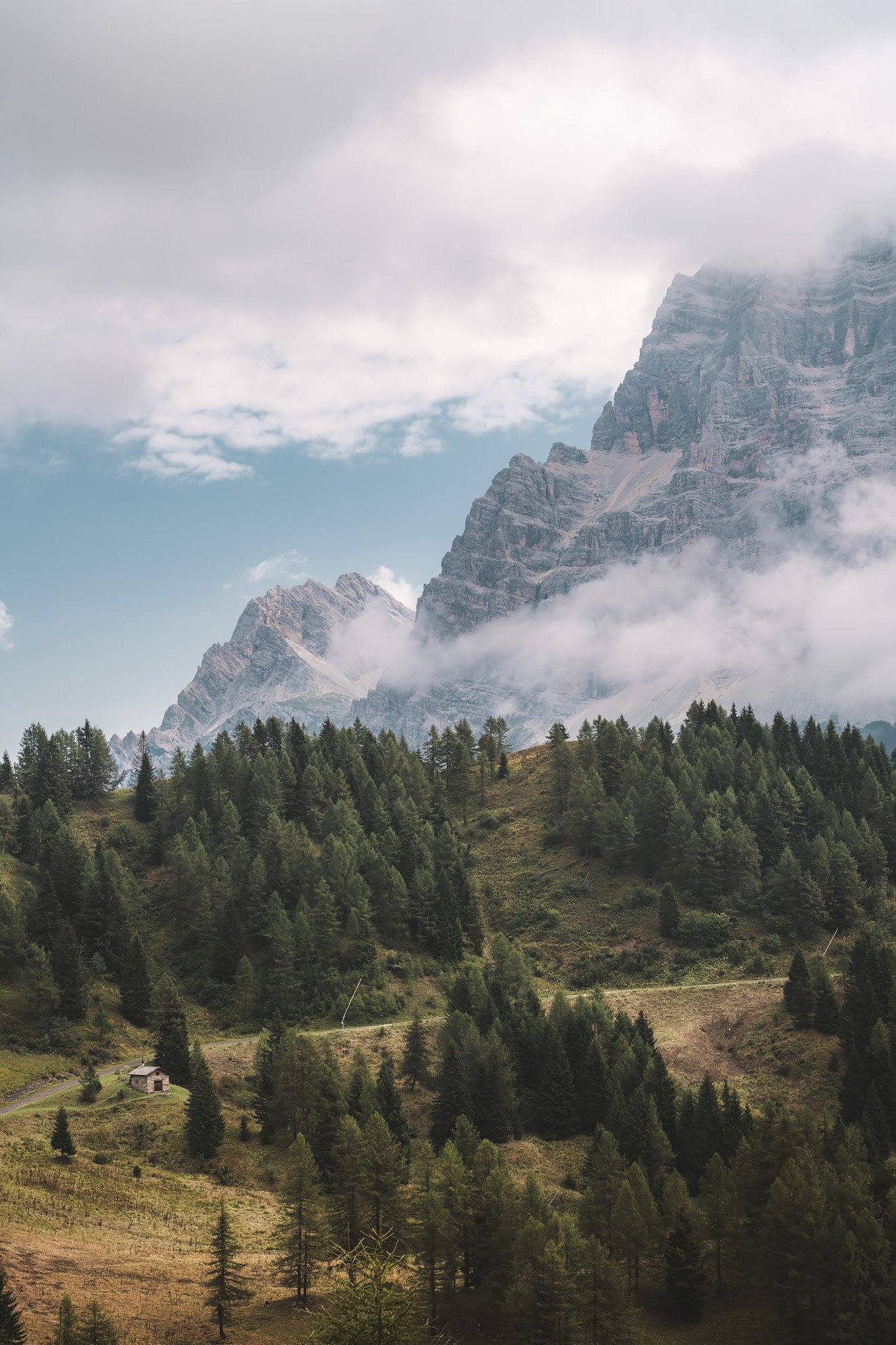
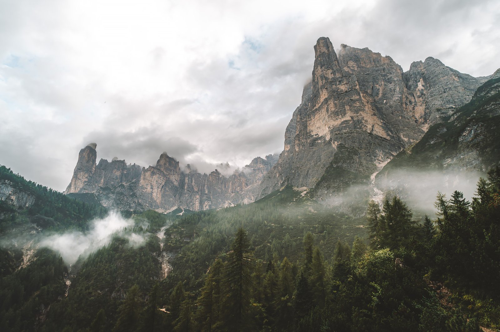
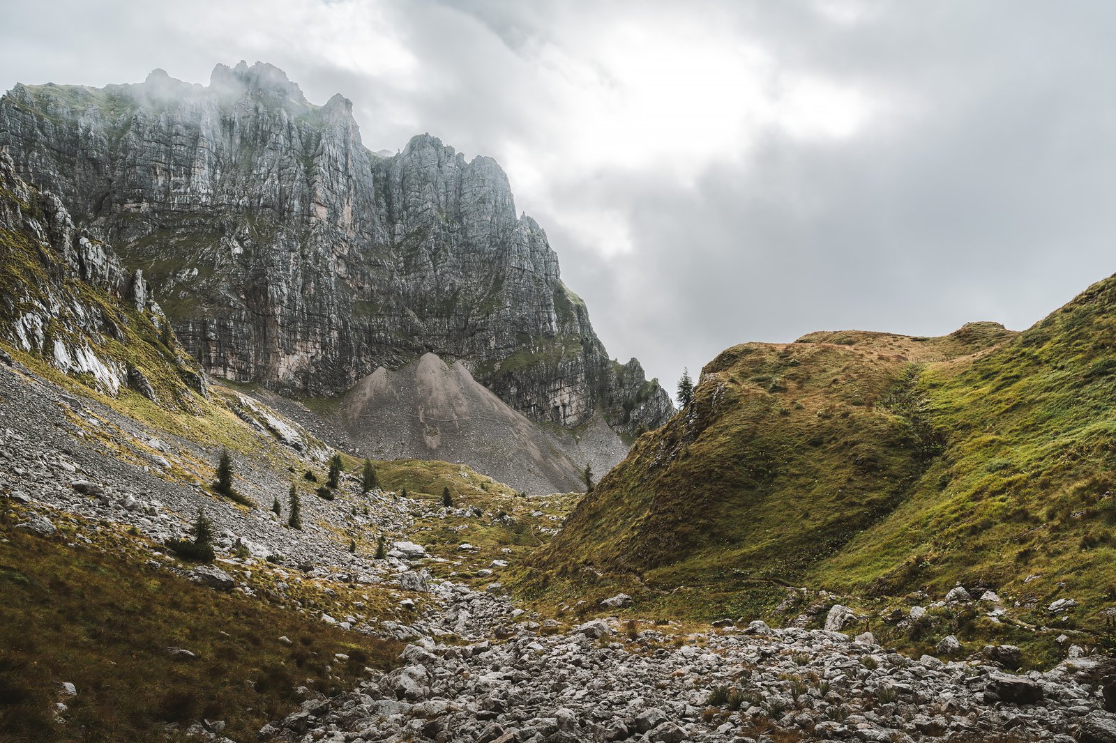
Cadini di Misurina was the first stop after leaving the car.
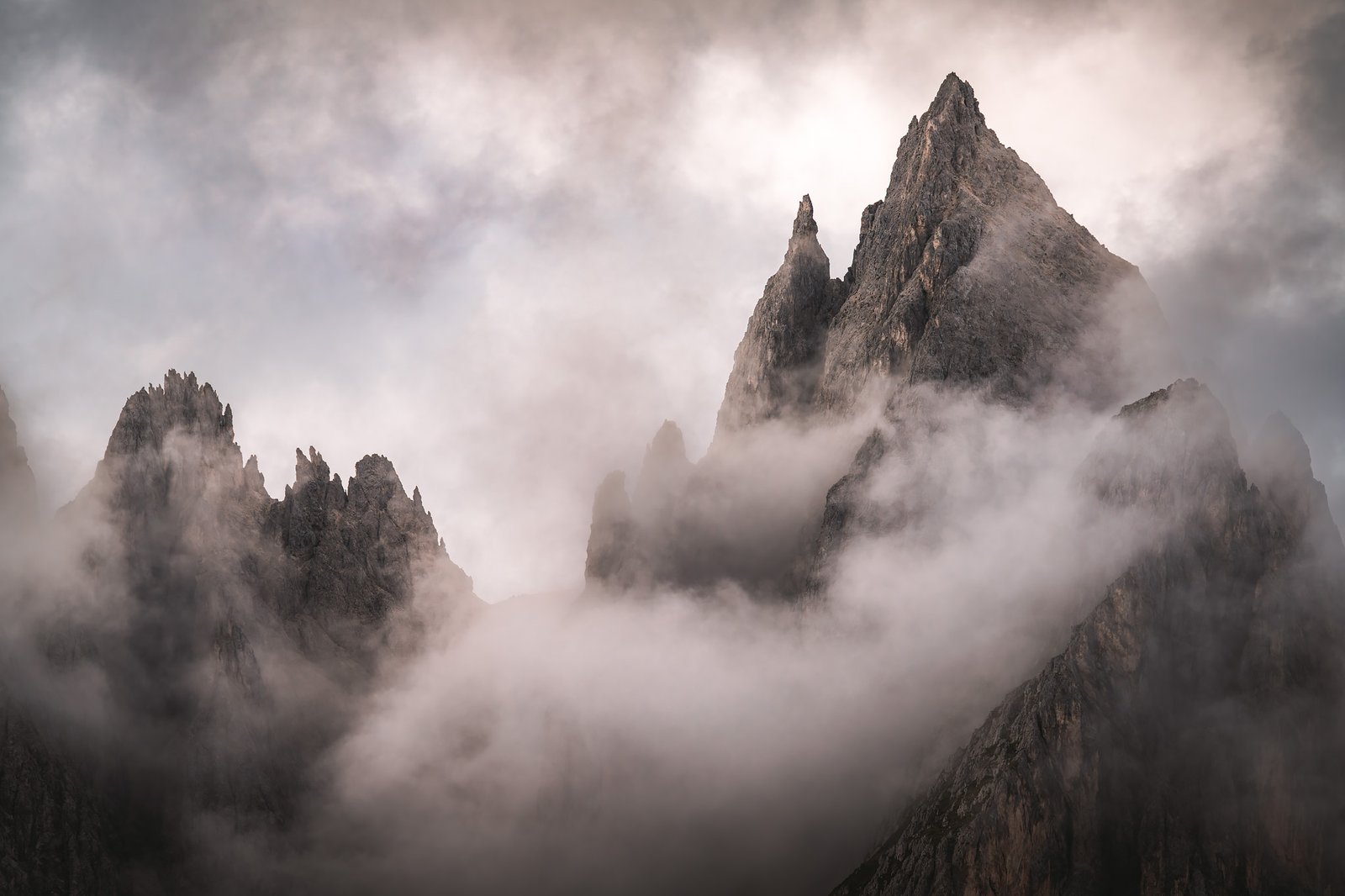
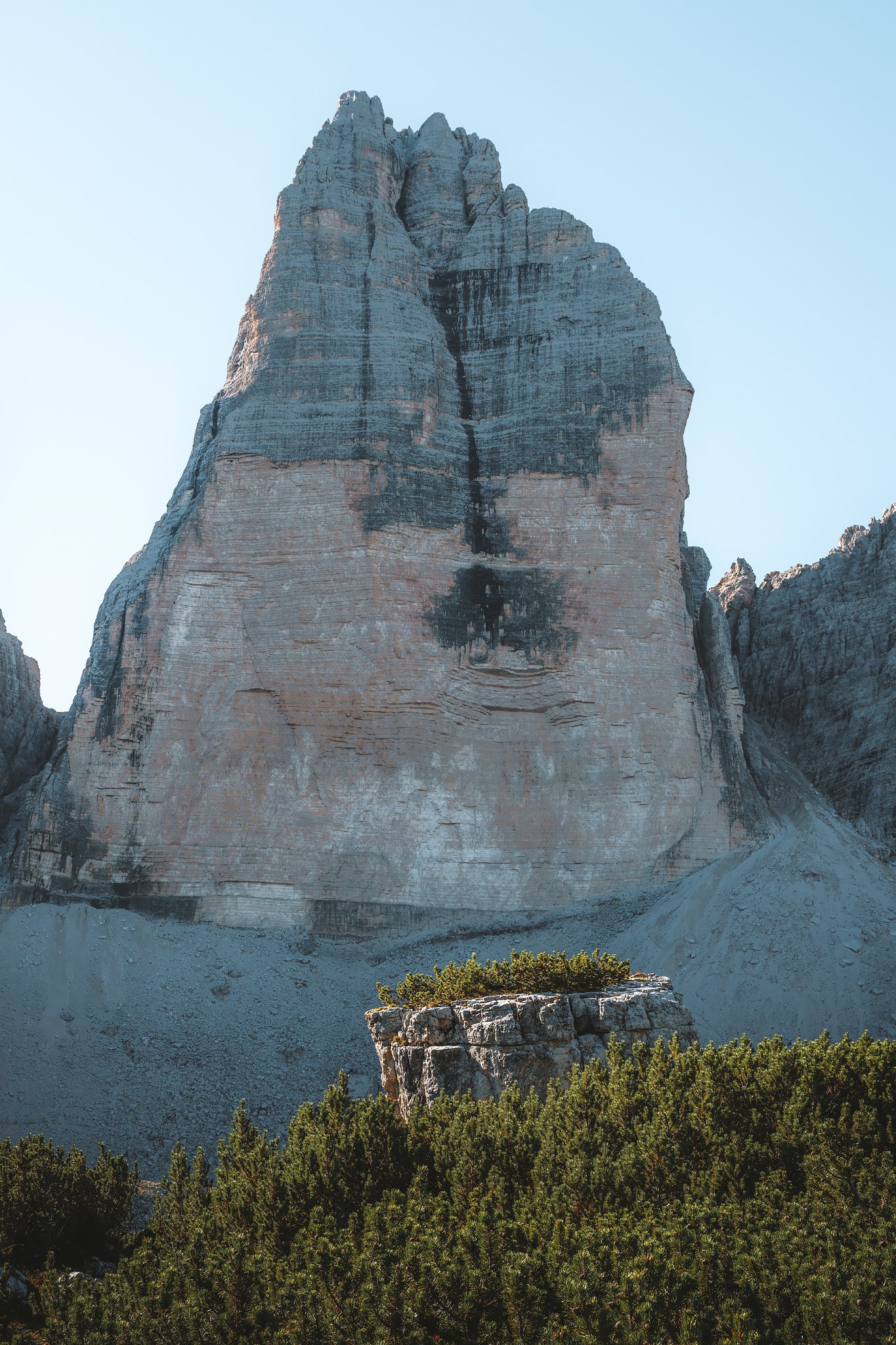
These formations differ from those that had characterized the previous days. More angular, more fractured. A collection of narrow ridges and spires created by erosion on brittle dolomitic rock, producing a sense of depth compressed into a single plane.
They lie immediately in front of the south-facing sides of Tre Cime and serve as a sort of foreground, chaotic, irregular, contrasting with the more monolithic form of the towers behind.
This contrast is part of what makes the area so compelling. It is also what has made it so visible.
A crowd had gathered for a photo. A particular vantage point, created as much by social media as by the landscape itself.
Mass tourism has hit Cadini di Misurina. Not only due to how easily accessible it is, but also due to how many times it has been shared. And yet, even there, once you see the view, the mountains remain.
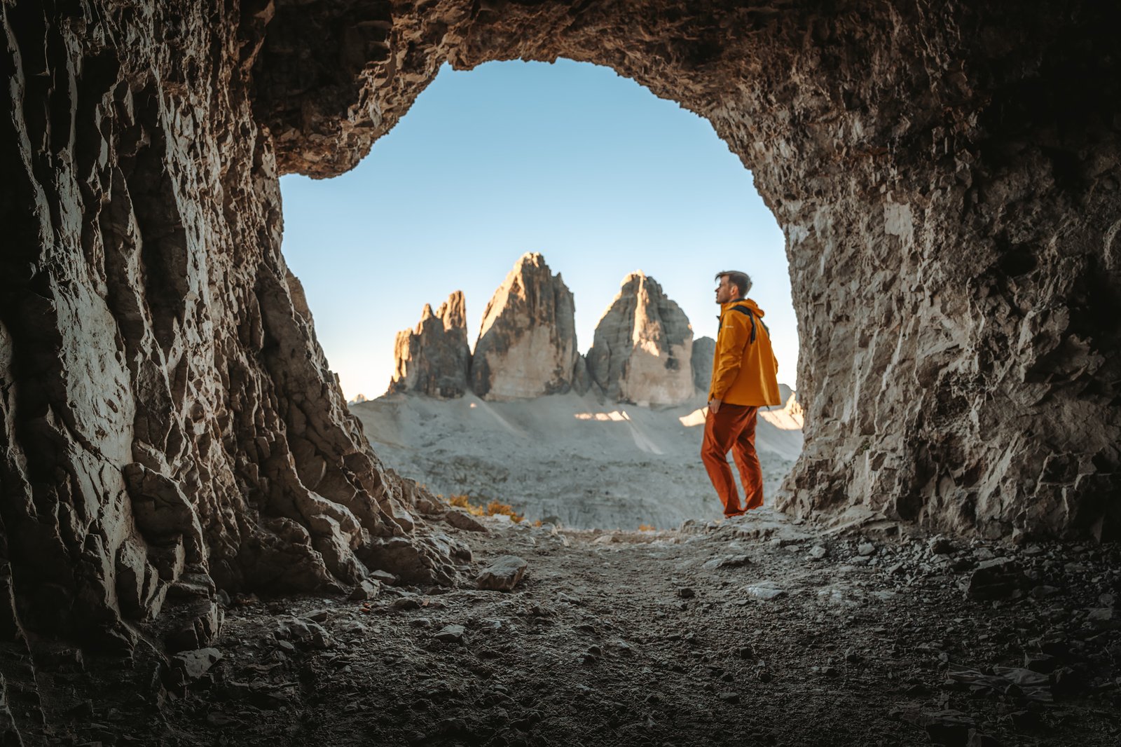
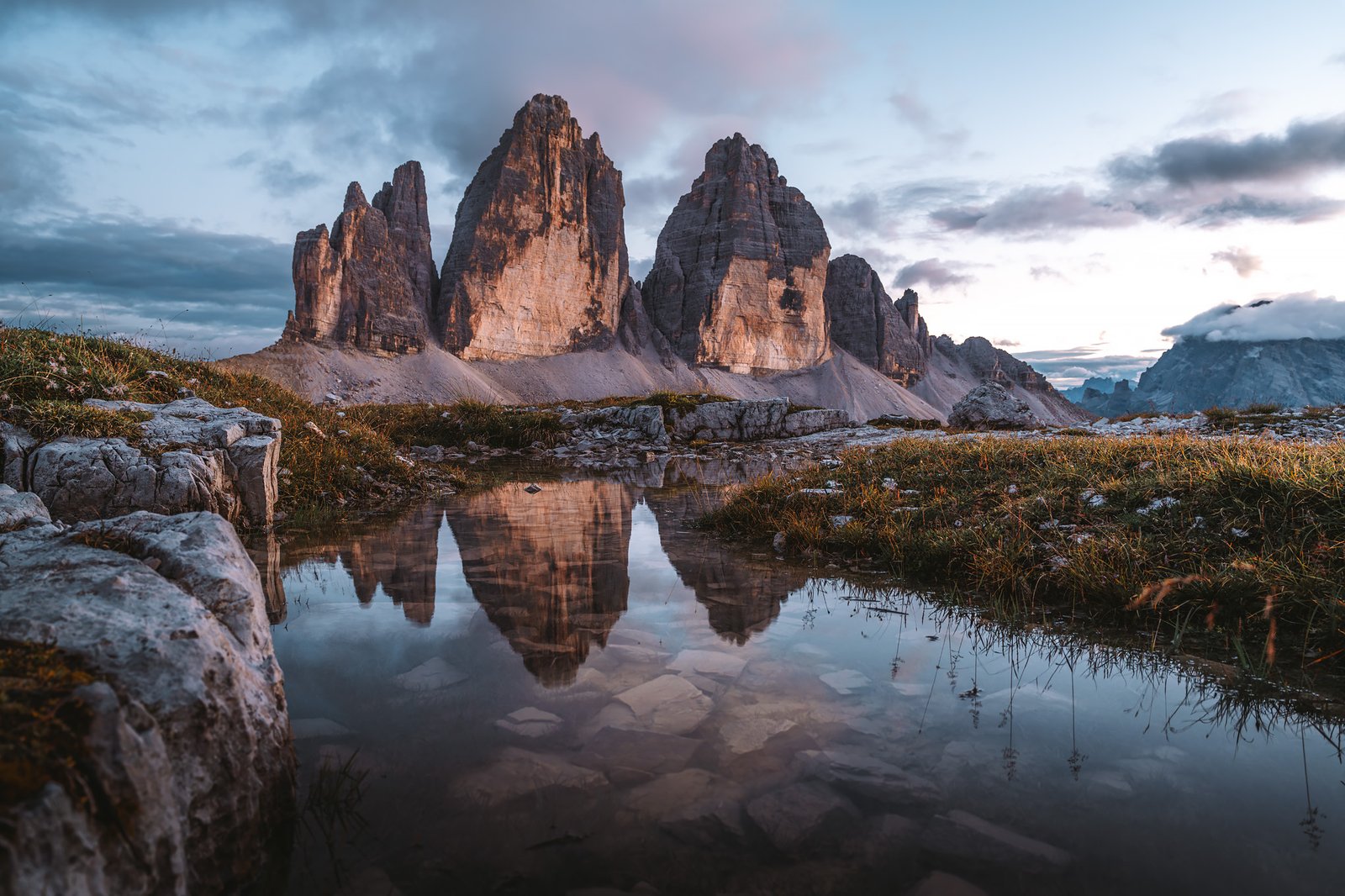
The Way to Tre Cime
The trail leading to Tre Cime is surprisingly straightforward.
Wide, well-compacted trails, built into the slope and maintained for constant traffic, dominate the terrain. The ground is stable, composed of packed gravel and worn rock, a product of both natural erosion and continuous human use.
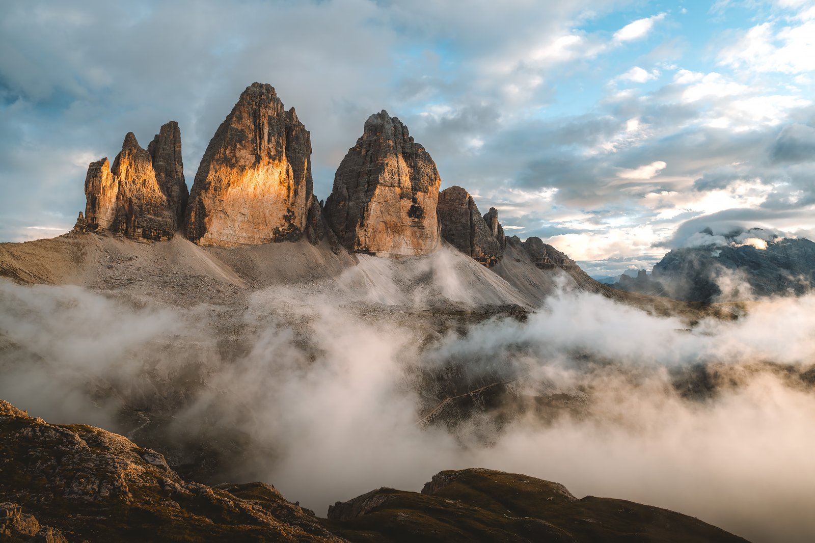
For several days, the terrain was inconsistent and technical parts of the trip were frequent. The distinction here is quite obvious. The towers begin to show themselves exponentially, until you see their most recognizable shape.
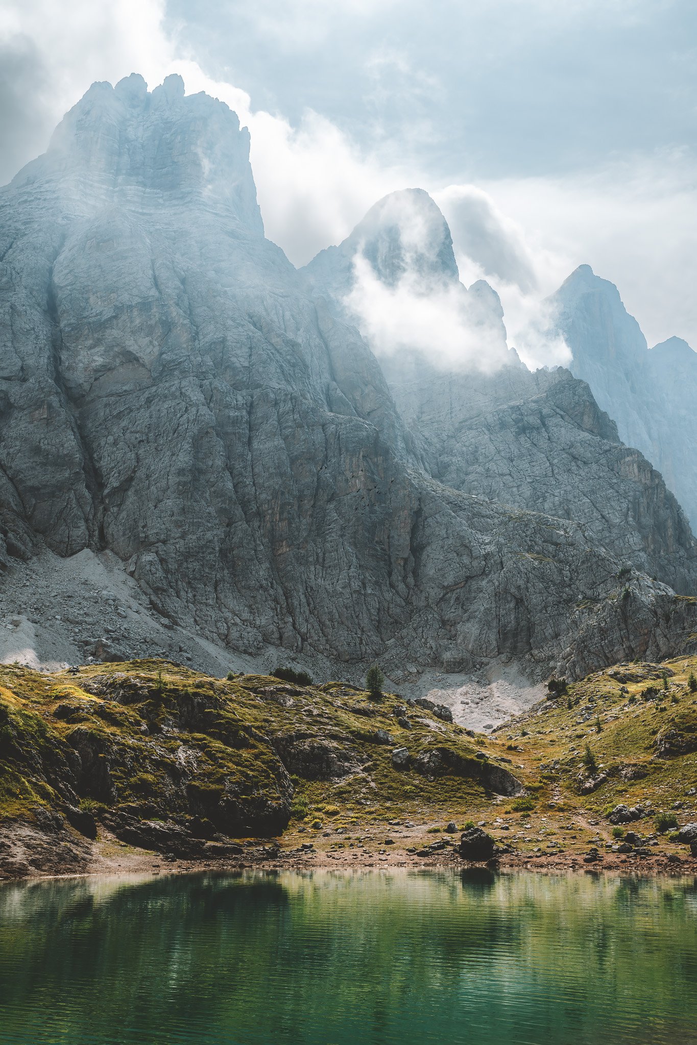
From the east, where the view opens up to the distant Passo Grande dei Rondoi, the geological structure becomes clear. Towering vertical walls of pale dolomite rise sharply from a relatively flat foundation. They are the product of millions of years of marine sedimentation followed by uplift and erosion.
Layers within the rock are sometimes visible, remnants of their origins as ancient coral reefs, now elevated into the air.
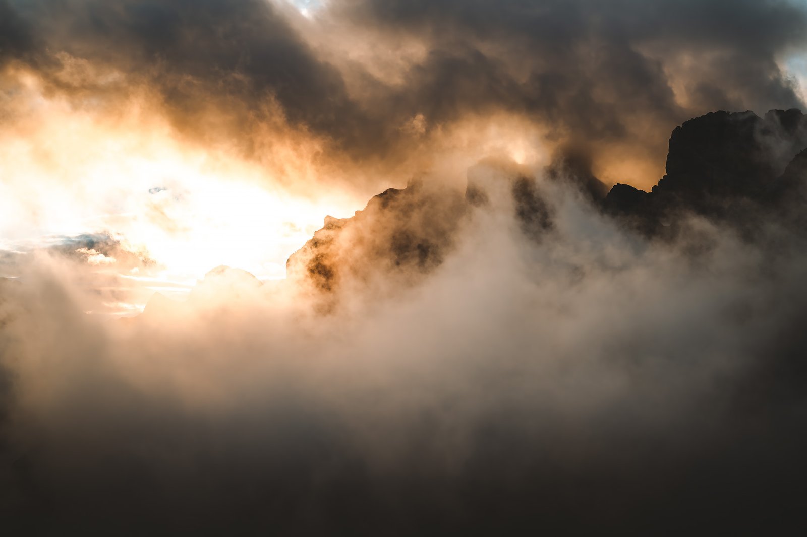
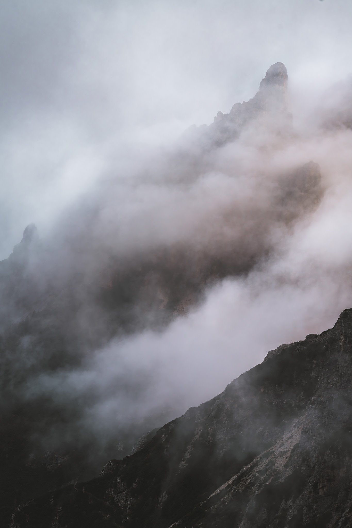
Mist circulated slowly through the terrain. Sometimes, it obscured the edges. Sometimes, it dissipated entirely, leaving the rock exposed, sharp against the sky.
Enough to understand both aspects of the location, why it draws so many, and why many do not continue past.
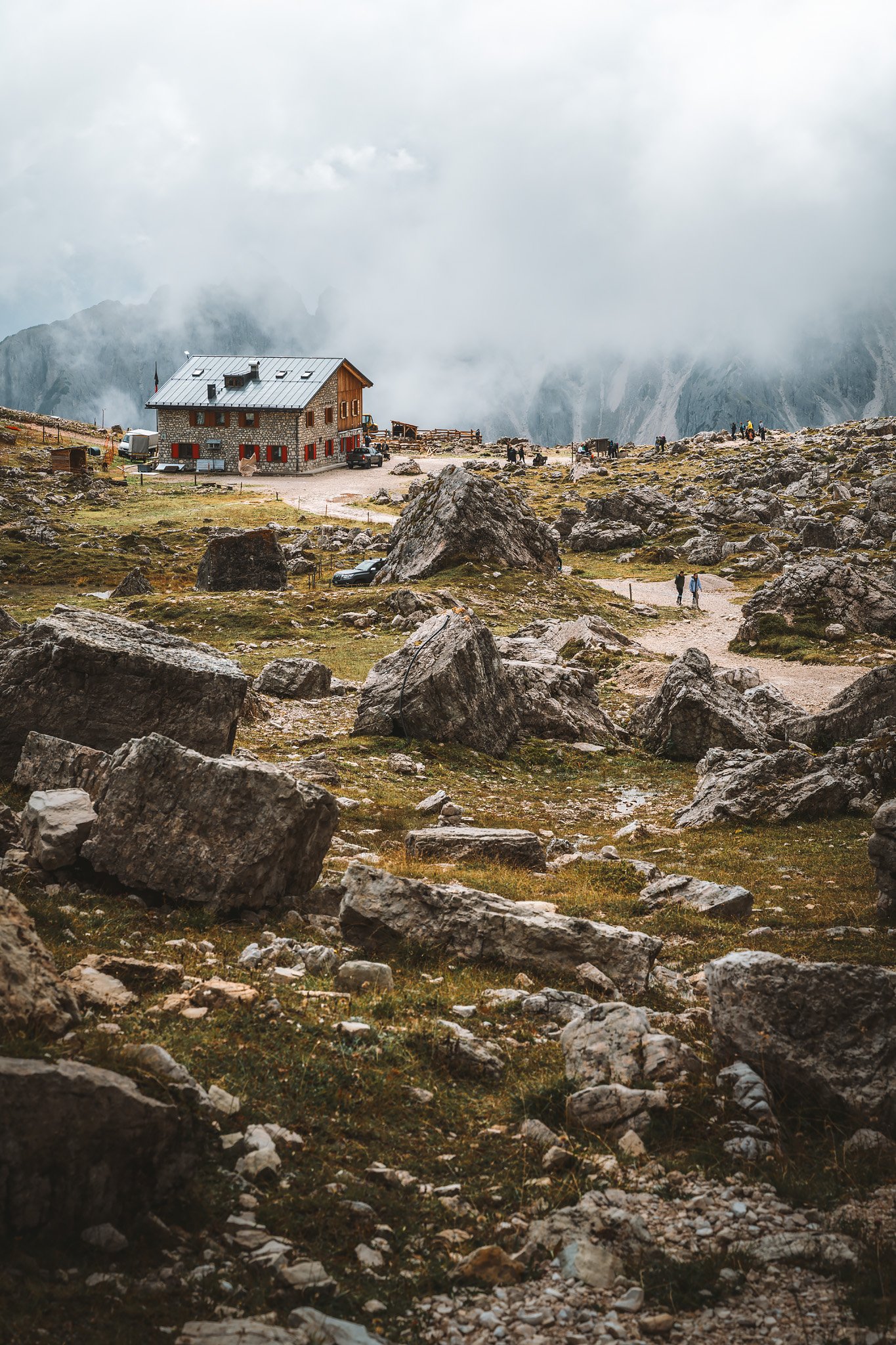
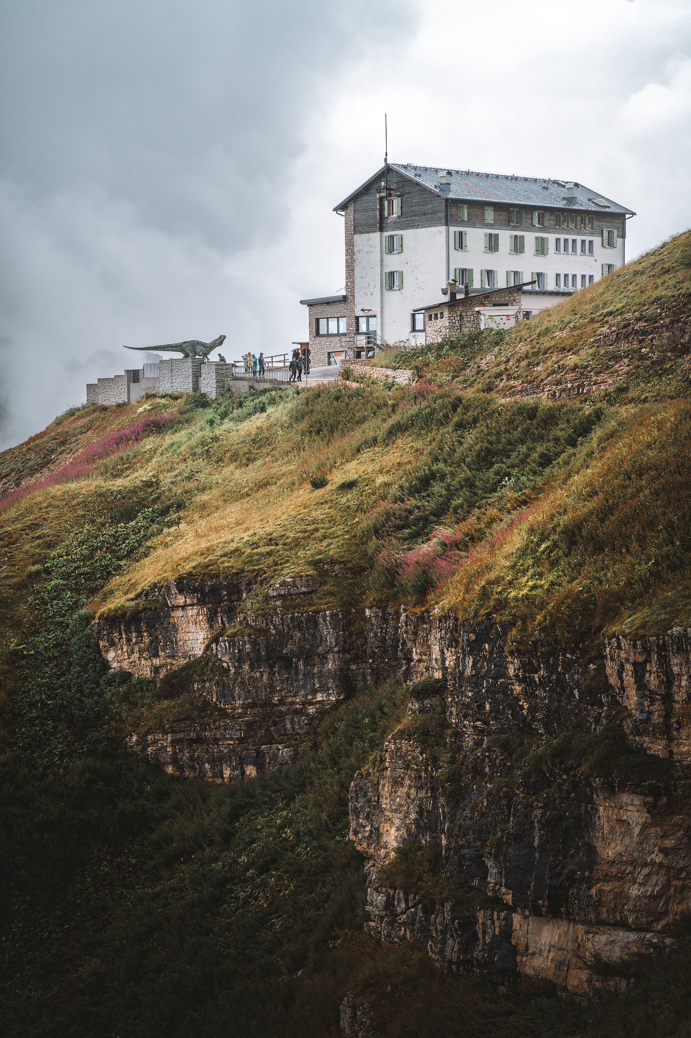
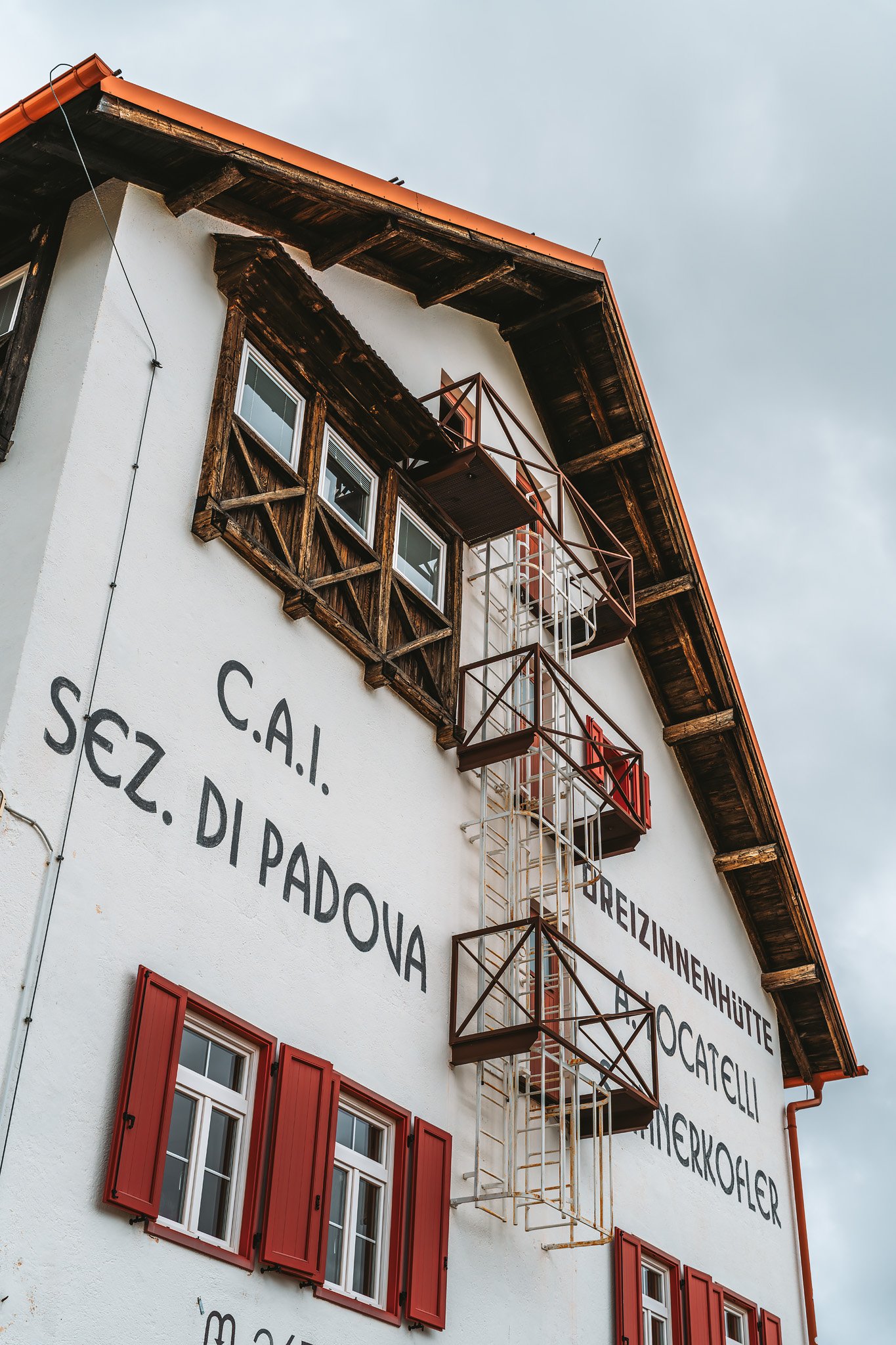
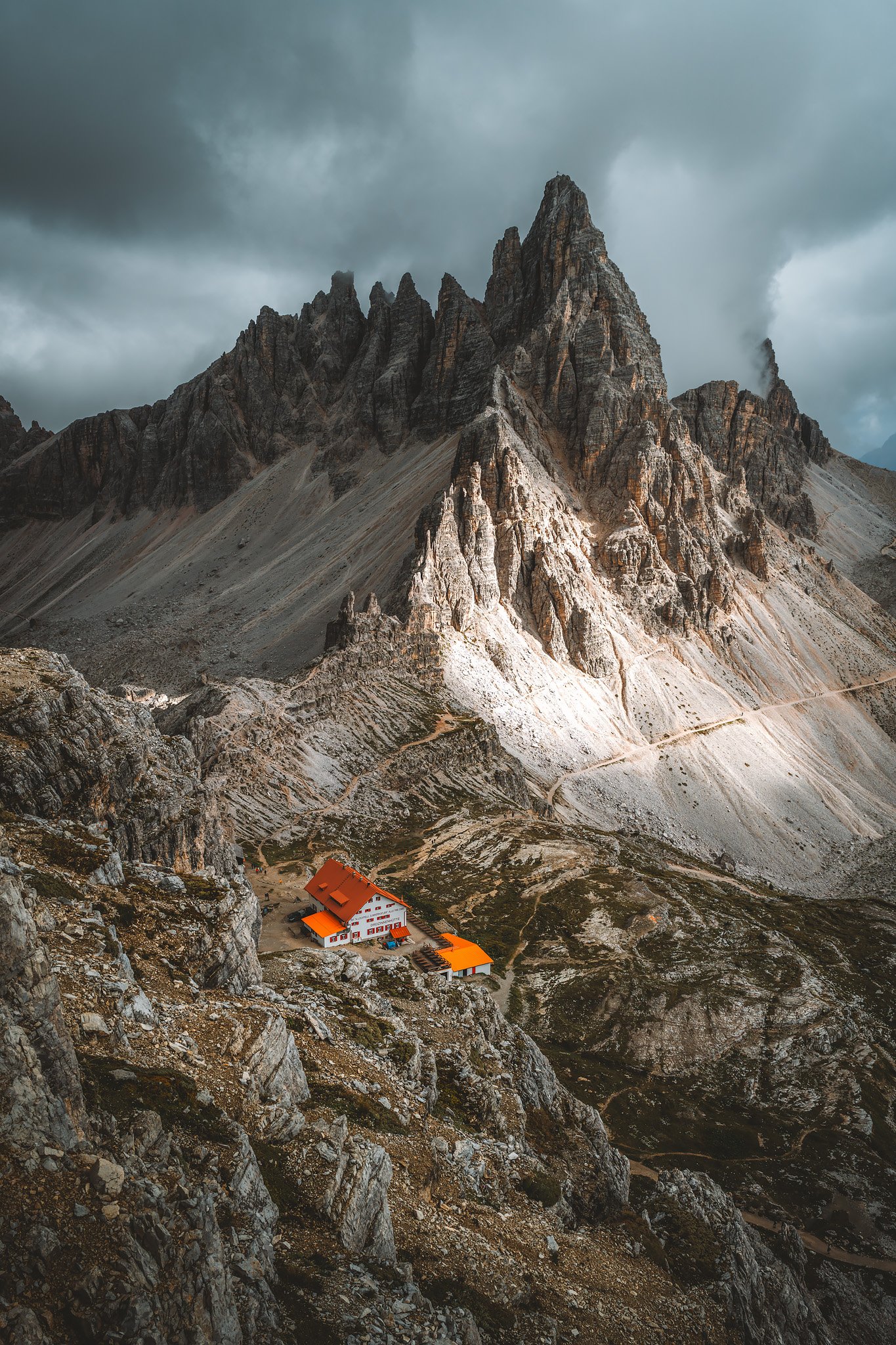
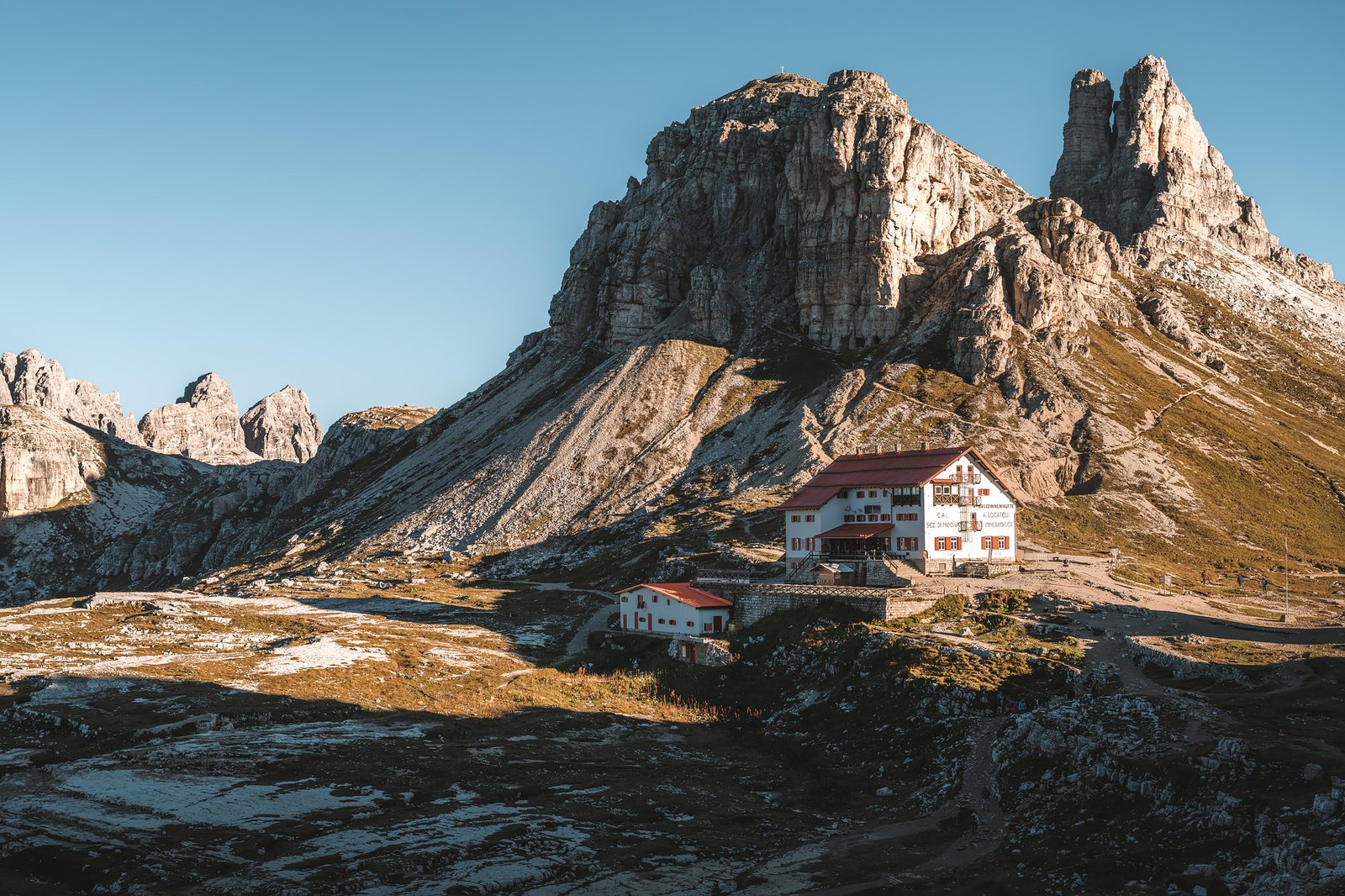
Rifugio Locatelli confirmed the contrast. Busy, active, and yet, situated perfectly.
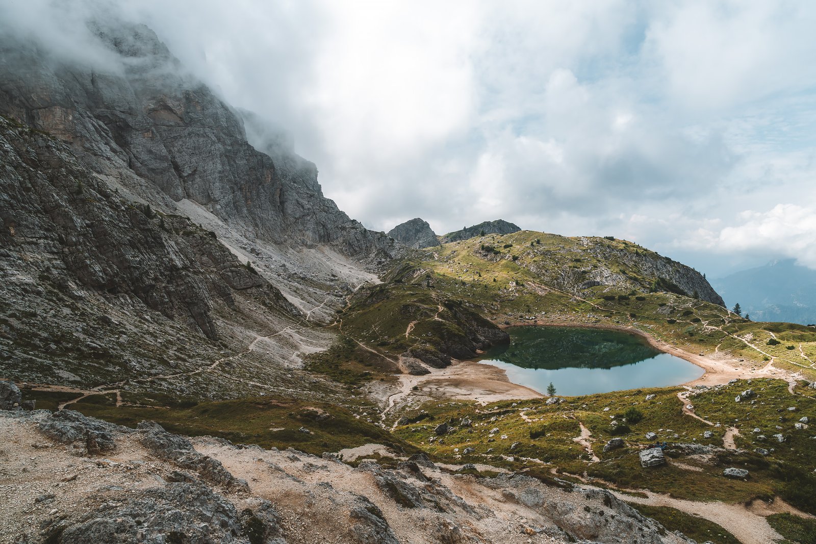
The Laghi dei Piani behind the refuge are located in shallow depressions carved into the rock. Their calm surfaces reflect the towers when the wind permits. The terrain surrounding them is bare. There is low-alpine vegetation and isolated clumps of grass between the rocks.
Sheep walk around this terrain without hesitation, accustomed to its irregularities. The caves nearby carved into the rock during WWI represent a continuation of the locations previously encountered.
I was walking with a limp by then, but it did not matter.
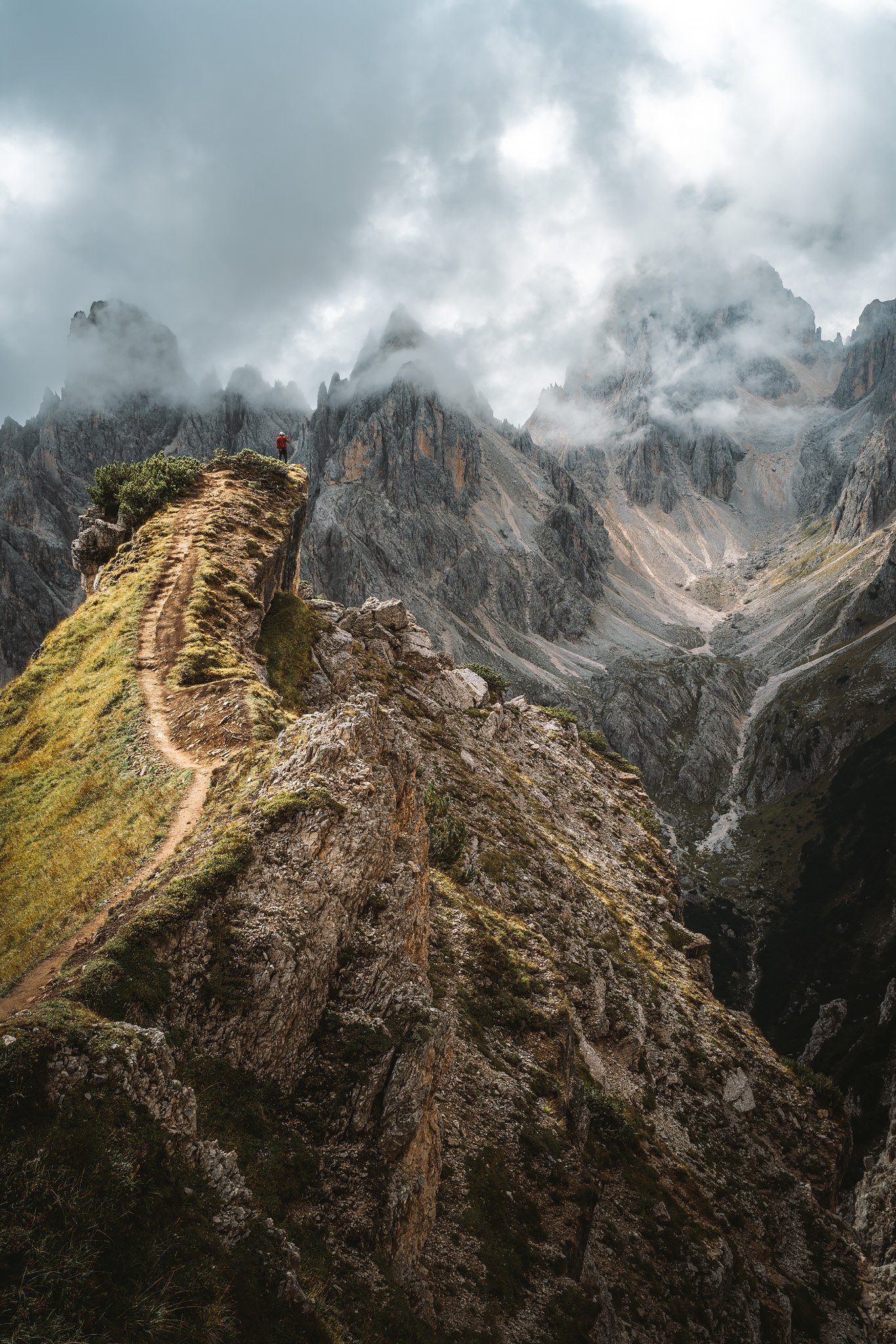
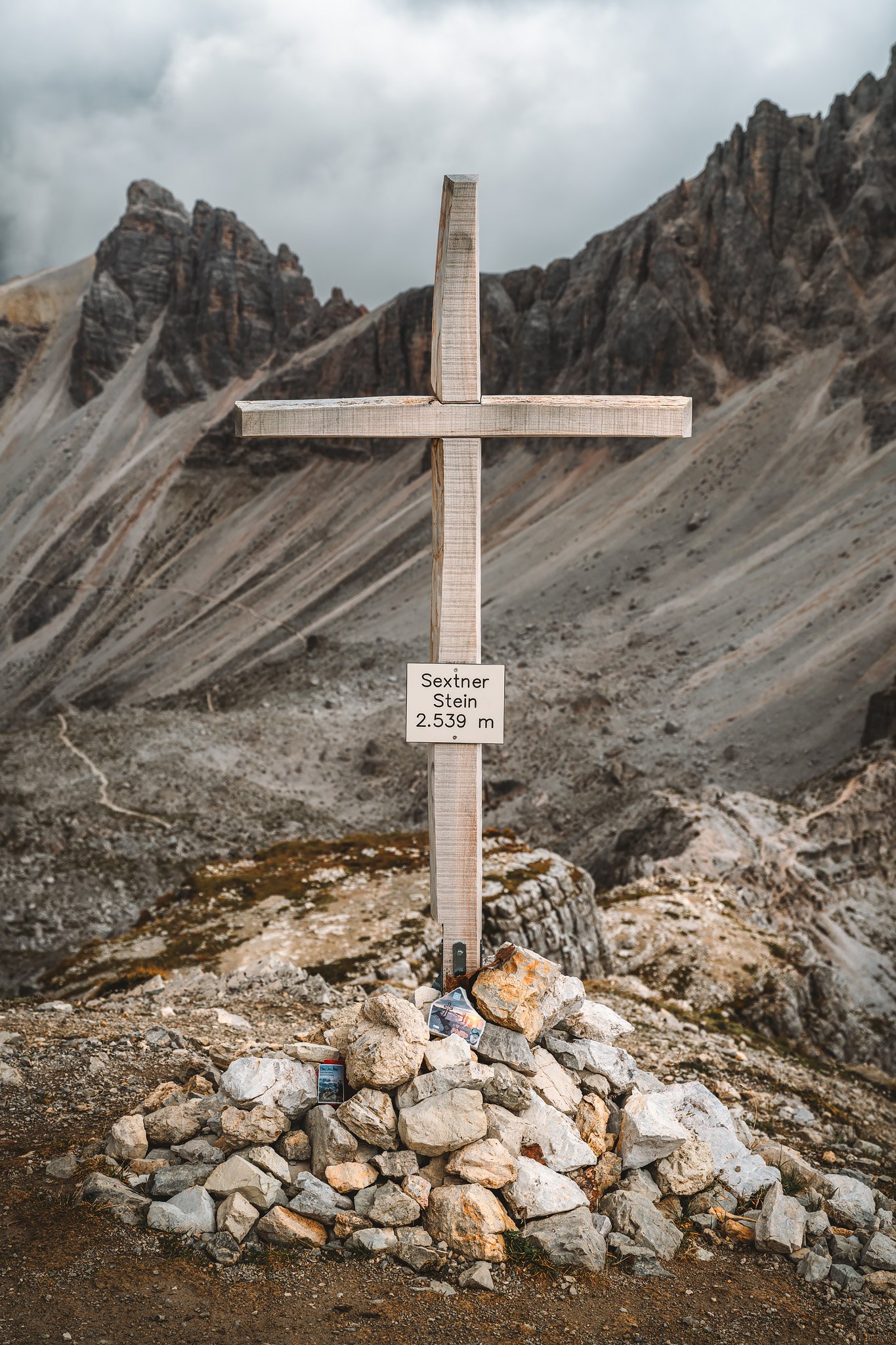
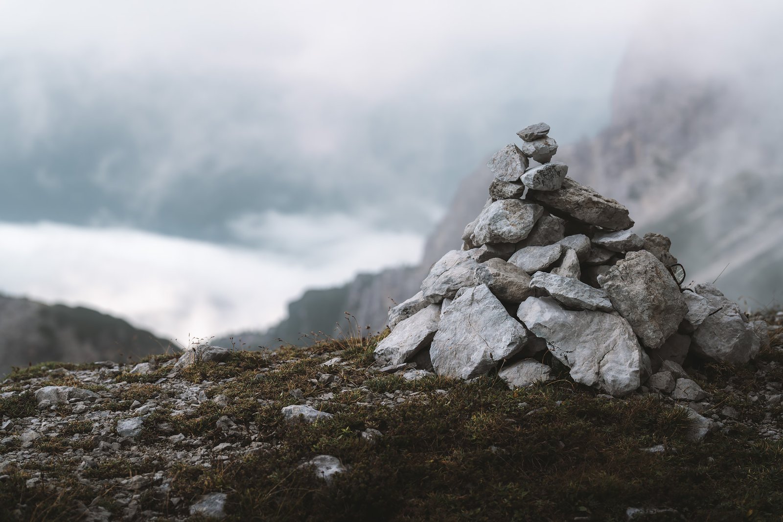
Climbing toward Sextenstein changes the perspective again. The trail to this peak that dominates the landscape around the refugio is more rugged. There is more loose rock and unstable footing. Parts of the mountain show more of its structural foundation. The pale dolomite here breaks into sharp shards, producing a visually stunning but mechanically unstable terrain.
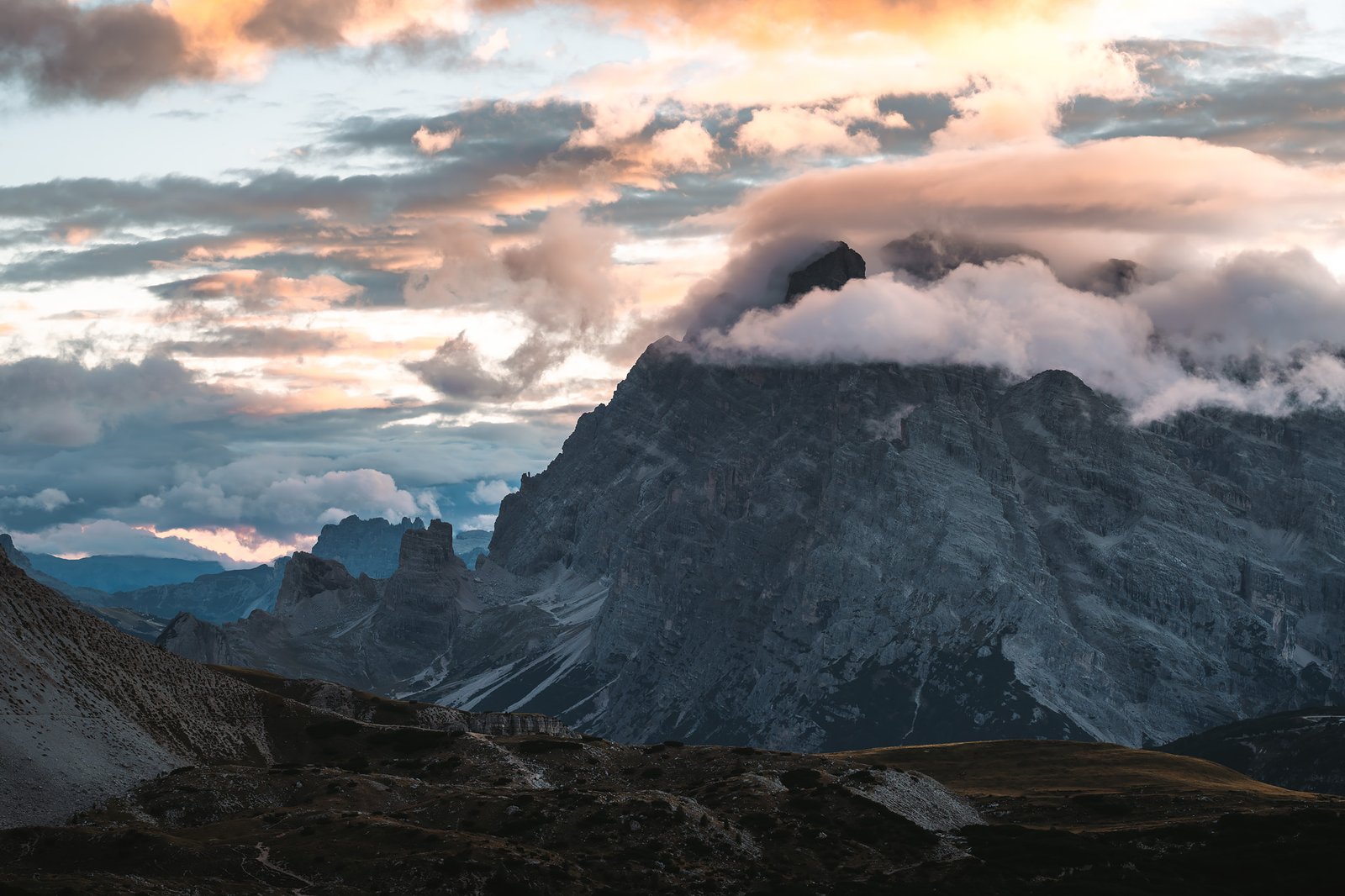
From the top, everything enlarges. The refuge is tiny and the pathways disappear. The summits stretch farther than Tre Cime and clouds move rapidly in discrete masses, circulating through the valleys, breaking against the steep faces of the rock.
The landscape never fully settled.
The Guardians of Light
Right after an interesting dinner with two other solo travelers, an Australian and an Italian lady living not far from Belluno, whose Nepalese husband worked in the refugio and had invited her for the first time, the conditions began to align. Clouds parted in patches and sunlight struck the vertical faces of the towers, and those who wished to contemplate its quiet majesty made their way toward the cliff.
The rock colors shifted, orange. Then deeper, almost red. The mineral content of the dolomite enhances this effect. Light interacts differently with angle and surface, creating strong contrasts between illuminated and shaded areas.
The mist passed through it.
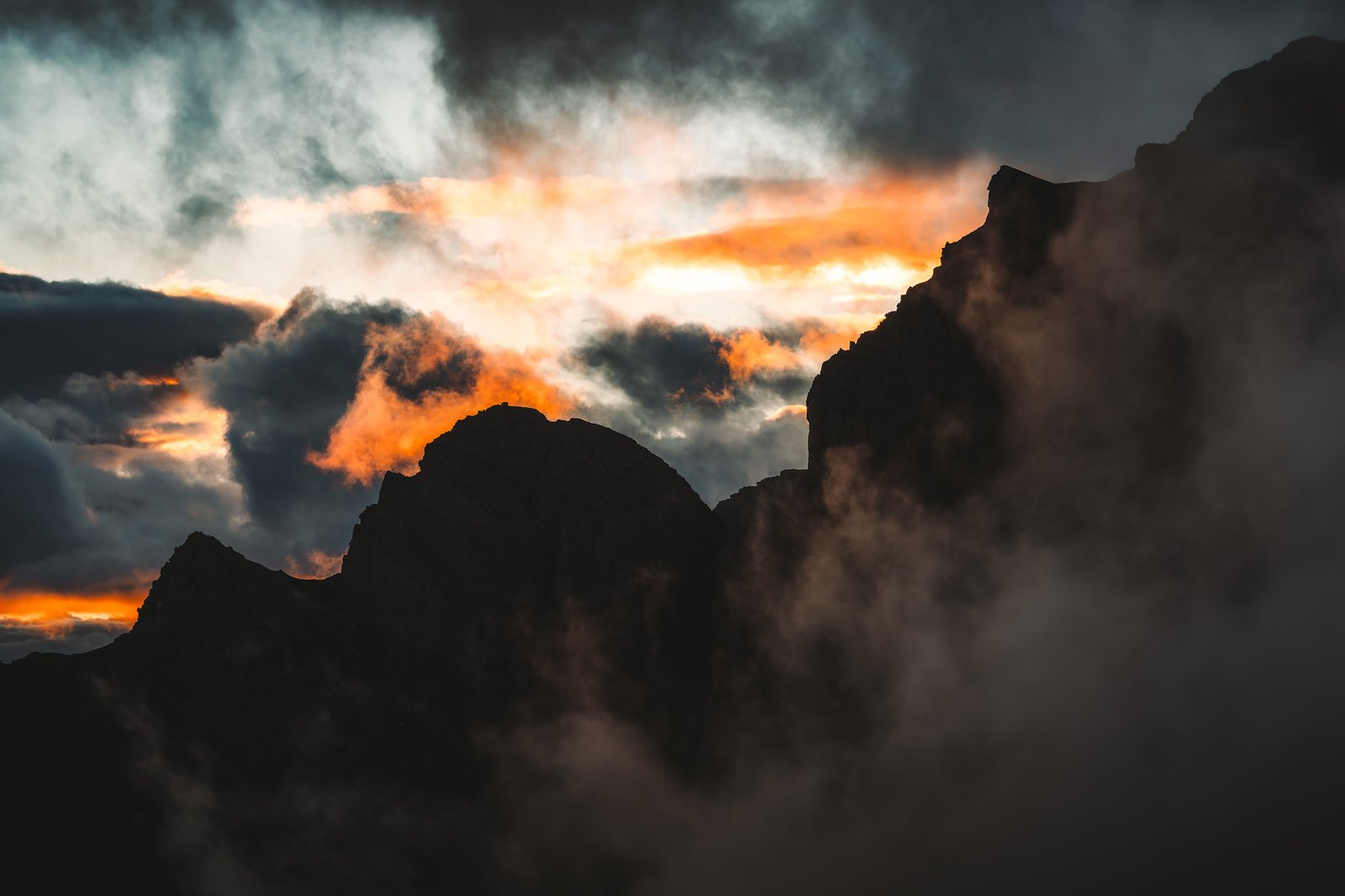
At various moments, it seemed as though the clouds were burning, absorbing light and dispersing it across the summits like suspended flame. It did not last long, but it did not need to.
Once the light dissipated, the atmosphere shifted again. Blue hour set in, and while returning to the refuge, temporary ponds, formed in shallow depressions in the rock, captured the last reflections of the towers.
Stage 9. Rifugio Locatelli – Auronzo
Distance: 5.59 km · Elevation Gain: +198 m · Elevation Loss: +274 m · Technical Difficulty: Easy
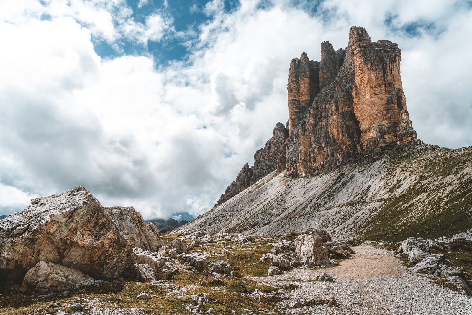
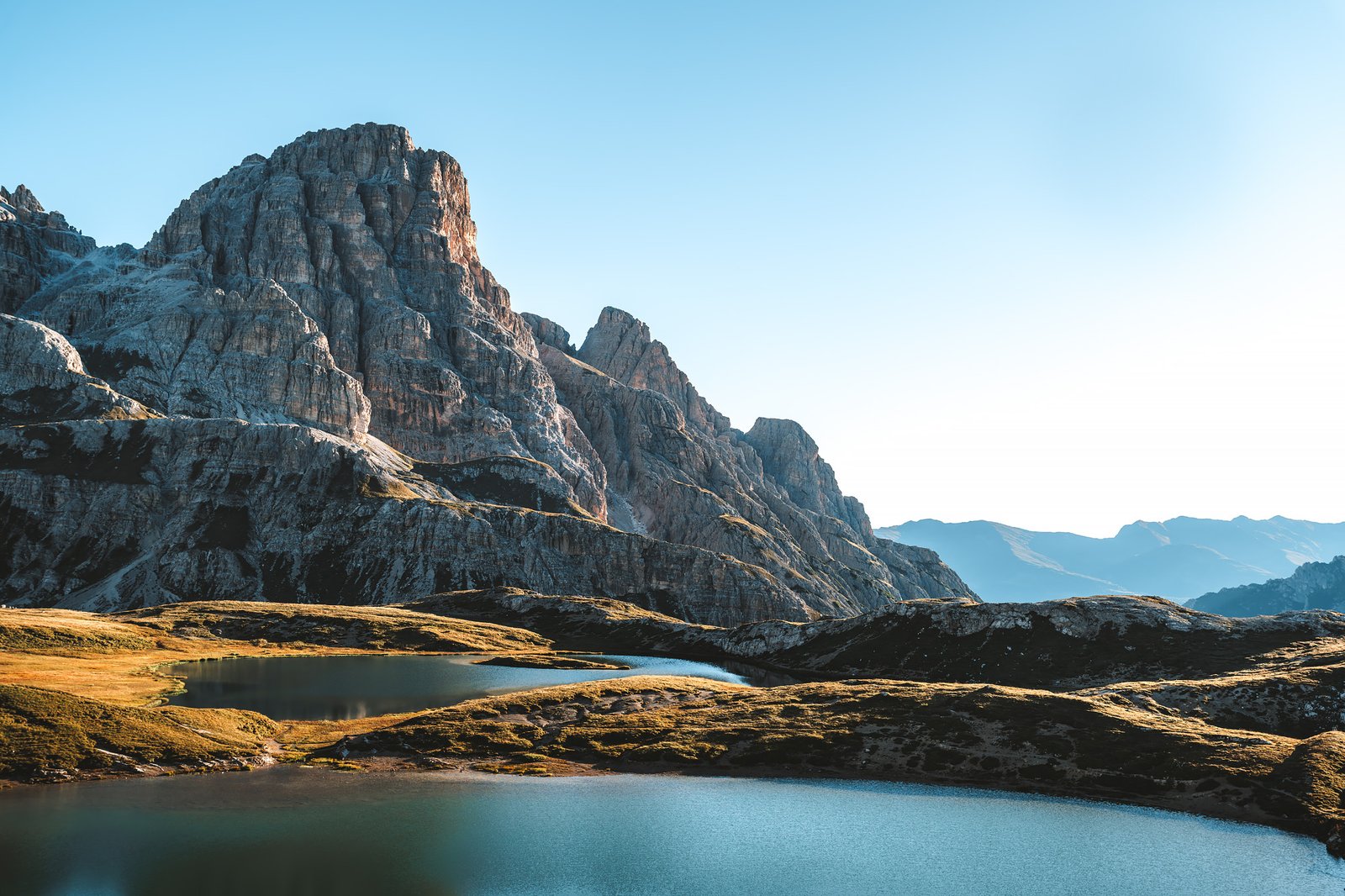
The day following was different. A cloudless blue sky with steady light.
The Laghi dei Piani reflected a completely different version of the same landscape. The reflections were more defined. The geometric clarity of the towers is more visible, clean edges, vertical lines, clear separation between each tower.
There was almost no movement, only geometry.
Walking around the massif from the other side showed another level. The terrain relaxed gradually with more grass and less exposed rock. Gradual transition from high-alpine terrain to lower-elevation meadows. While descending toward Auronzo, people became more abundant.
Accessibility defines this place as much as the mountains themselves.
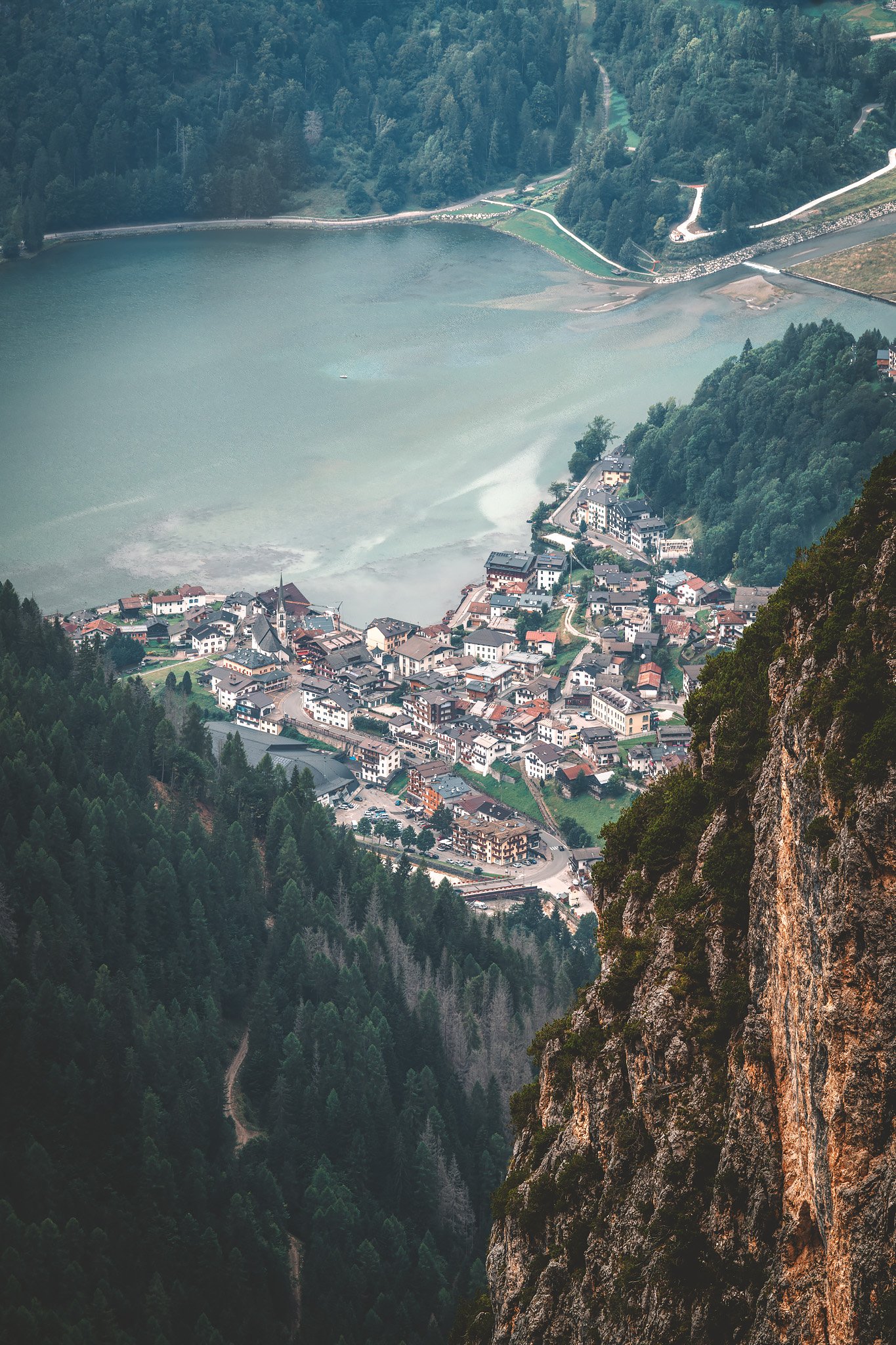
A brief stop in Misurina Lake framed by trees and smaller peaks. Less dramatic, but connected to the larger system. It started to feel like the experience was about to end.
The Return
The train from Belluno to Venice was the final transition.
When I arrived at Santa Lucia station, the change was total. Heat and large crowds moving in every direction. Sound bouncing off surfaces rather than disappearing into open space.
The Alta Via 1 should not be confined to a begin and an end location. Tre Cime represents a type of closure to the route that is difficult to replicate elsewhere. Seeing it at the end, and not at the beginning, changes its meaning completely.
By then, the Dolomites are no longer something to discover, but an experience that even after leaving, remains.

Alta Via 1. Part IV: From Pelmo to Belluno - Into the Bellunesi
Stage 5. Rifugio Venezia – Rifugio Mario Vazzoler
Distance: 24.80 km · Elevation Gain: +1389 m · Elevation Loss: −1608 m · Technical Difficulty: Moderate
The Alta Via 1 changes from here. The route is defined by altitude, exposure, open spaces and a big dose of humidity. Past Pelmo the terrain softens. The peaks are still there, but they start to retreat behind forested valleys, and longer descents. The scale is still there, but the feeling of the landscape is more subdued.
And, very soon, another aspect of the AV1 will become obvious, there are significantly fewer hikers.
The morning at Rifugio Venezia starts slowly, it is before the sunrise and when is really peaceful and quiet. The sky is heavy and the air is still. The first steps are easier than anticipated, descending toward Palafavera, a ski resort that takes on a different character in summer. Here the trail reconnects with a different kind of world, roads and infrastructure. There is a cappuccino, some supplies, and the kind of small decisions that, for a while, make you feel connected to the world again.
Then, the ascent recommences. The path toward Coldai winds its way through open slopes and scattered cabins. Sheep graze near the trail, unconcerned with the activity happening nearby. The terrain is softer here and less rugged.
However, the sense of calmness is what stands out the most. After the exposure of the preceding days, this area of the Alta Via 1 feels quieter. Longer sections of trail pass without seeing anyone. The trail starts to feel more like an individual experience, and less like a shared route.
At Rifugio Coldai, the mood shifts once again. People congregate and watch a cloudy and uncertain sky, while a share my french fries with a kid that happened to be hiking with his family but was really there for the food mostly.
There is a collective awareness that the light may change. And then it does.
Just enough of the clouds clear, and Lago Coldai appears, fully formed, as if the fog had been holding it back until that instant. The water in the lake mirrors the surrounding peaks with a clarity that feels almost unreal after the grey morning.
Many stop here. Some even wade into the water and swim across it, despite the cold. The effect is strong enough to be impossible to resist.
The First Rains
The route proceeds through meadows and valleys. This is where the Alta Via 1 becomes more human. Interactions occur more frequently, a few exchanged words, trail comparisons, adjustments to plans. An Australian couple share a stretch of the trail; then a group of Swedish friends or a Korean lady that had been living not far away from me back in the day, a casual conversation begins, and just as easily ends.
These encounters do not change the journey, but they help define it. They add perspective and context. They make the trail feel less solitary, without disrupting the silence.
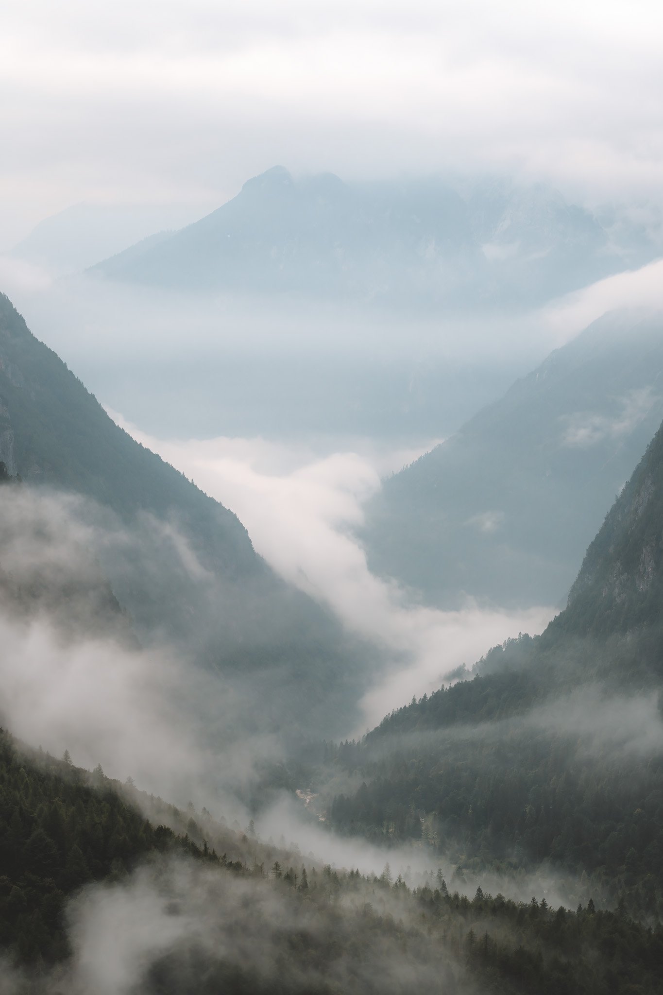
For the first time on the Alta Via 1, the weather changes. Initially, the rain is quite gentle. A light drizzle that barely disrupts the rhythm, but that doesn’t last. Fog develops and valleys disappear. Visibility is much reduced and the trail becomes softer underfoot. Then wetter.
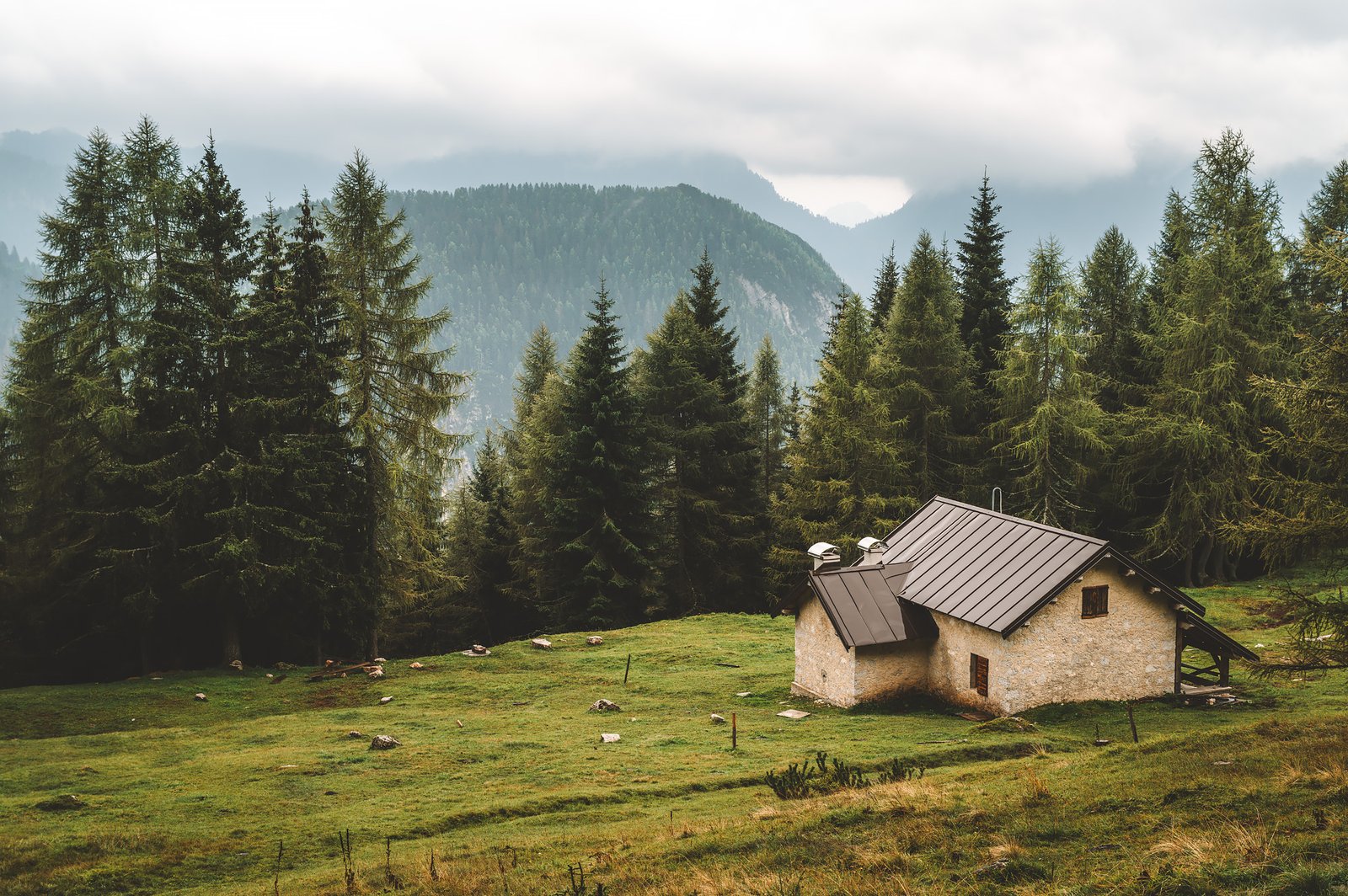
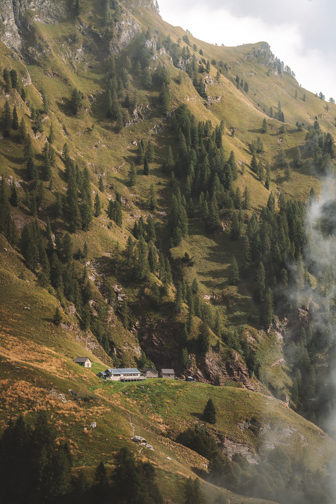
When Rifugio Mario Vazzoler comes into view, the rain becomes steady. The refuge is located in a clearing within the forest, three buildings, basic, functional. Surrounded by open space and grazing animals.
By the time I arrive, the light is already fading. Not because of the hour, but because of the forest. The refuge is set deep within it, and even during the day, it feels darker than it should Inside, everything slows down again.
Wet gear dries where it can. Conversations resume around tables. The outside world continues, but from a distance.
On that night, the experience is less about the landscape and more about the people within it. Shared tables and unexpected conversations with a Canadian couple who were visiting Europe for the first time. Stories exchanged between people who have nothing in common except the trail that brought them there.
At times, the Alta Via 1 feels like a sequence of landscapes, but on that night, it felt like something more.

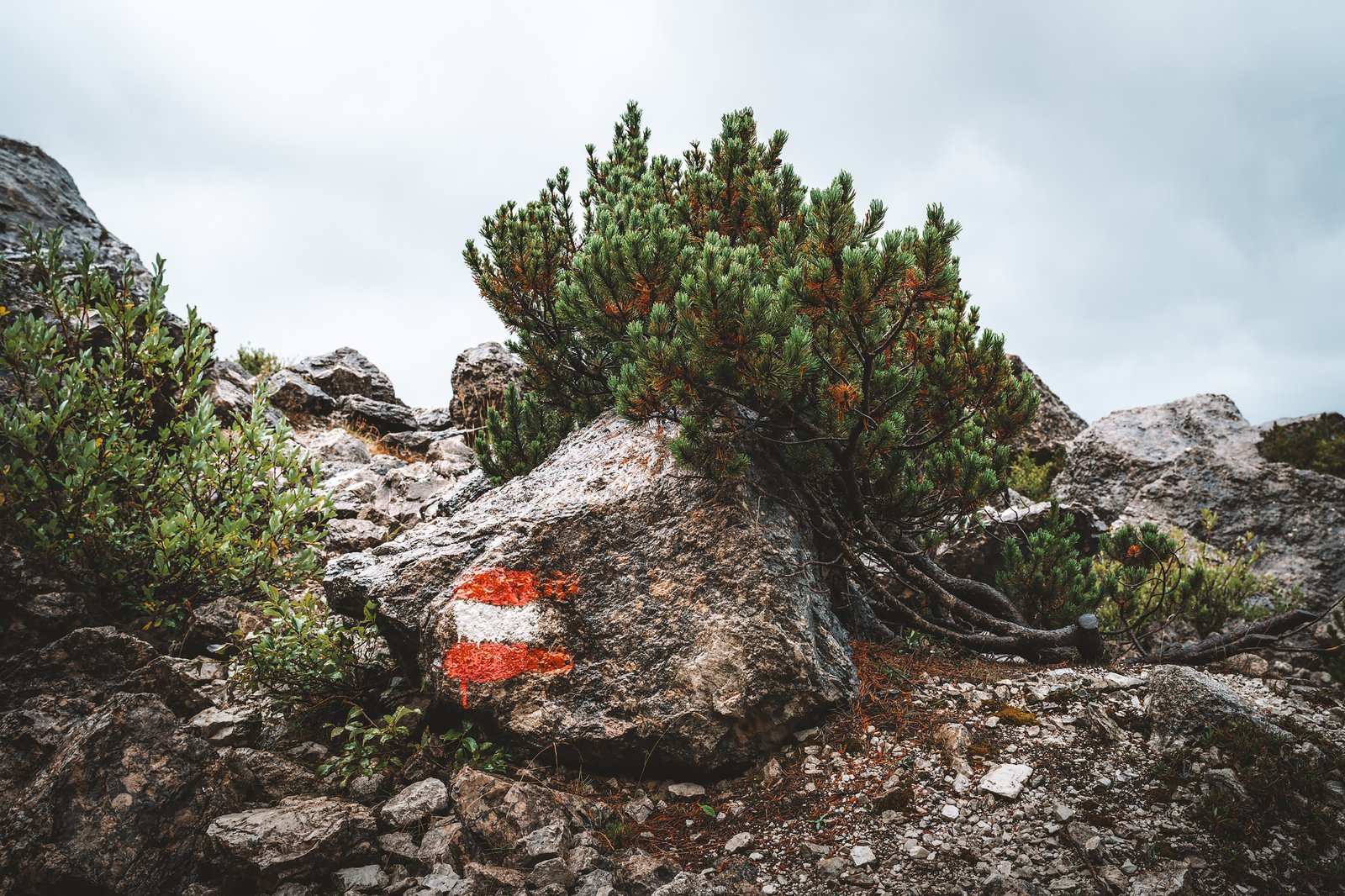
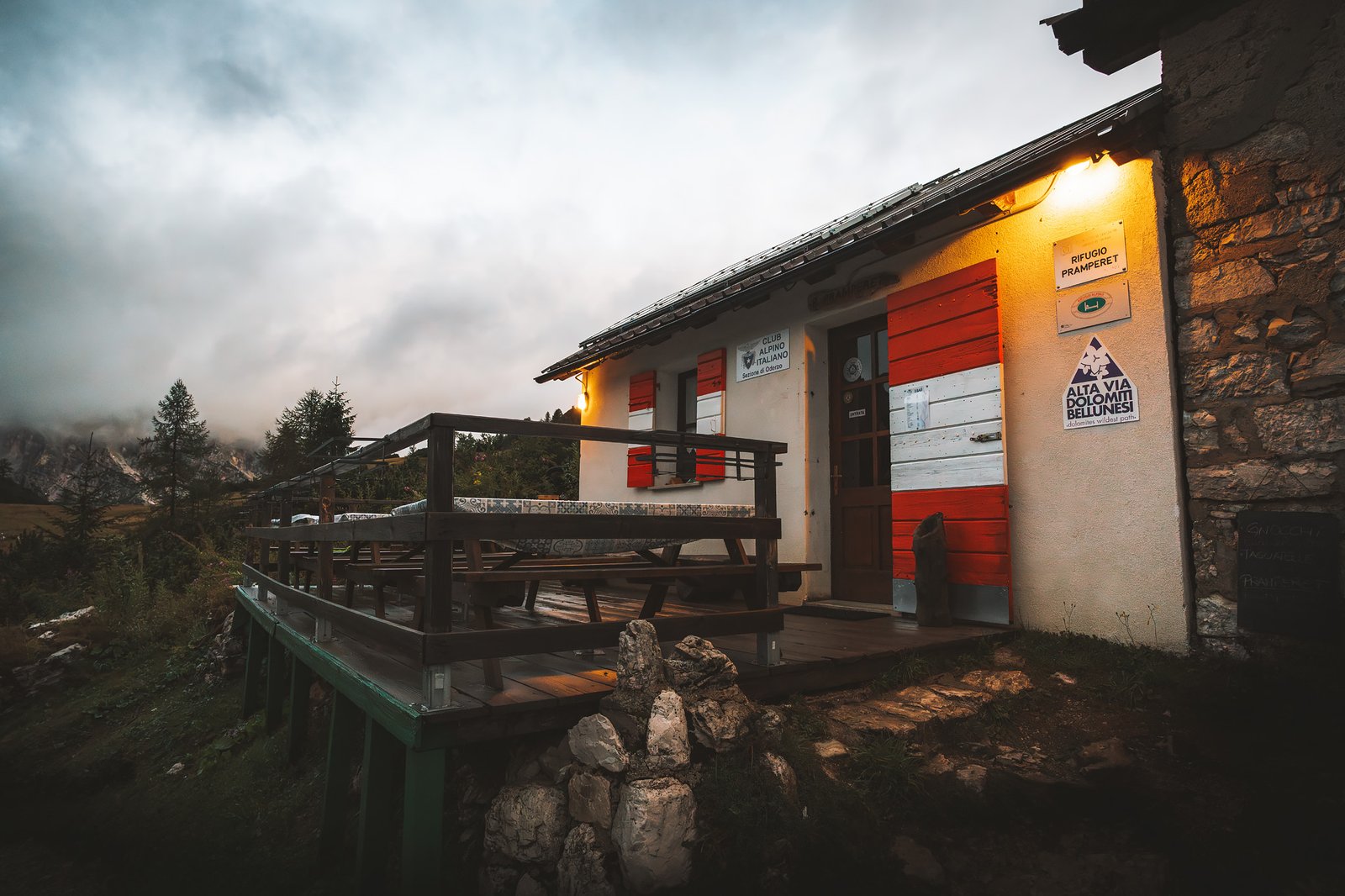
Stage 6. Rifugio Mario Vazzoler – Rifugio Sommariva al Pramperet
Distance: 23.92 km · Elevation Gain: +1373 m · Elevation Loss: −1223 m · Technical Difficulty: Moderate
The next morning begins early and with the sound of hikers surprised that their gear is still wet despite being hanged outside from the day before (under heavy rain at night…) Forecasts indicate mixed weather. The plan is simple, wake up early, skip breakfast, move quickly.
Initially, the conditions were in favor. Fog defines the landscape, obscuring visibility and compressing depth. Photography becomes secondary and movement becomes the priority.
Then the rain returns. Light at first, then constant, and eventually, intense. In a matter of minutes, everything is soaked. Pants cling heavily and boots are full. Water runs down your arms, into your hands, into every item of clothing. The trail becomes invisible beneath flowing water. Muddy areas transform into small streams and rocks become pathways for water.
There were moments when I walked in water up to my ankles and each step felt heavier than the one before.
Eventually, it transitions from unpleasant to mechanical, simply putting one foot in front of the other instead of contemplating the landscape.

Shelter from the Storm
Casera Moschesin appears almost unexpectedly, an old, abandoned building, once a small hut for shepherds. Very simple and functional. A temporary shelter from the storm in the middle of nowhere.
I was completely alone, only the sound of the rain hitting the roof. It seemed unlikely that anyone was close.
Everything I was wearing was soaked. There was no way around it. So I removed everything I was wearing and got completely naked. It wasn’t comfort, but necessity.
I put back my wet clothes and check my gear, the camera gear is not affected. The decision is simple, continue or wait. The rain answers. It doesn’t stop. I keep walking.
Eventually, the rocky path, waterlogged and uneven, opens into a meadow. The rain pauses for a moment, and I catch sight of Rifugio Sommariva al Pramperet.
Inside there is no cell phone reception. None at all. No occasional connection. No messages. Nothing.
And the rain does not stop. It continues through the evening, steady and uninterrupted. Few hikers make it this far. Most stop earlier, or choose to walk only the first half of the Alta Via 1. Beyond this point, the route becomes quieter, less predictable, less traveled.
Conversation replaces distraction. A simple dinner with a Scottish young man who was camping with a friend of his, sick that night from a bad snack. Szymon was also there, a Polish completing the trek in just six days while preparing for a Marathon in Valencia. The last night before the final push feels magical under the heavy rain.

Stage 7. Rifugio Sommariva al Pramperet – La Pissa
Distance: 20.00 km · Elevation Gain: +827 m · Elevation Loss: −2198 m · Technical Difficulty: Moderat
The final day begins early. The rain has diminished, but everything remains wet. The air is heavy and the ground is saturated. The ascent begins immediately, very steep, quiet, and enclosed within forest.
The Bellunesi landscape appears gradually.
This is not the Dolomites of vertical faces and dramatic silhouettes. This is something older, wilder and less structured. The geology shifts here, pale dolomite gives way to darker, more weathered rock, covered in dense vegetation.
The forest reflects that change, beech and larch cover the slopes, forming a thicker, more continuous canopy. The terrain feels deeper and more enclosed, almost primal.
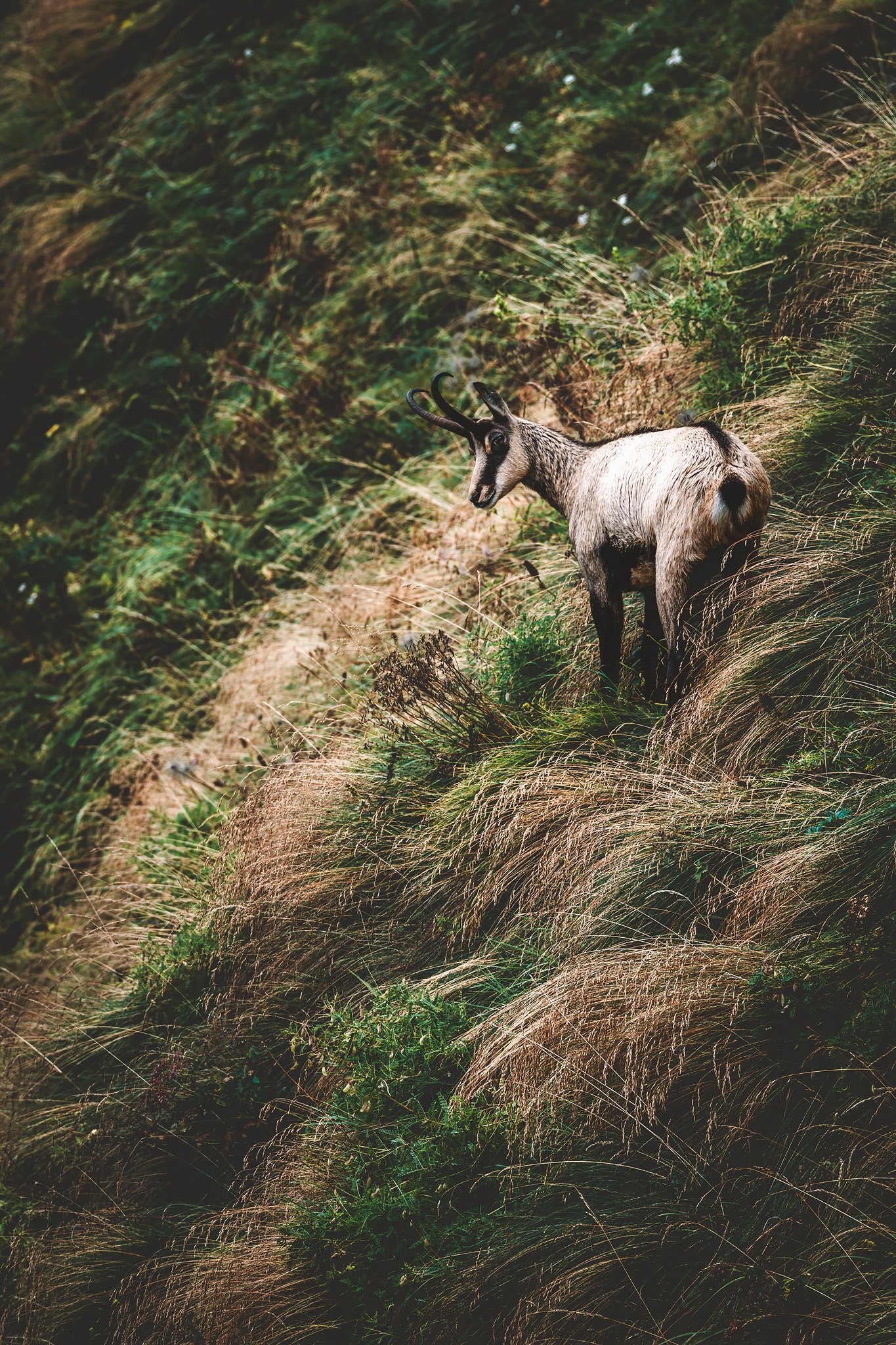
And then a chamois appears. Then several make their way where the one I saw first was.
Before seeing them, I had been hearing something, sharp, high-pitched calls echoing across the rock. At first, it sounded like a bird, something like an eagle. But it wasn’t, it was them. I manage to take a picture of one of them, he stops in front of me, and repeats the call. What a moment to remember!
They move across the slopes with complete ease, triggering small cascades of falling stones as they run. The sound carries far and unmistakable.
This part of the Dolomites feels different. Not less impressive, simply less controlled and wilder.


The Bellunesi Forest and the Final Descent
As the descent continues, the forest becomes denser. Roots cross the trail in irregular patterns. The ground shifts constantly, mud and exposed roots. The terrain demands attention again, but in a different way. Less exposure and more instability.
Light filters unevenly through the trees, but occasionally, it breaks through.
Near Rifugio Pian de Fontana, the sun finally reaches the slopes. After days of changing conditions, the light feels direct and the landscape sharpens again.
After a short capuccino break, Szymon, who was still asleep when I left, entered the rifugio. He would then catch me again after a few kilometres, just to disappear into the wilderness of teh Bellunesi.
The last section toward La Pissa is long and continuous.
The forest remains and surrounds the last rifugio before the end of the trek, Bianchet. The path becomes steeper and more technical. In places, footing is irregular. Roots and rocks force constant adjustment and the descent takes its toll cumulatively.
My right leg began to give in somewhere along the way. A slight limp at first, barely noticeable. Then more evident with each step. Over two thousand meters of descent in a single day begin to take their toll.
The final section is steep, slippery and uneven. It is the kind of terrain that demands attention, even when the body is already exhausted. And then, suddenly, it ends. The road appears.
I was just in time for the last bus of the morning to Belluno. Szymon was there, waiting, smiling, happy to see that I made it. The trail dissolved into infrastructure, movement became direction again, and we shared the understanding that something had just finished.
Belluno
The bus ride to Belluno from La Pissa takes about 45 minutes. The town feels different. Larger than Dobbiaco, but quieter in a different way. Less influenced by tourists and more by everyday life.
Closer to the southern edge of the Dolomites, it feels like Italy again. The rhythm changes. Cafés, shops and conversations unrelated to the mountains. A place to rest, to eat, to wash, to dry everything that had been soaked for days.
And to think. To think about whether the journey is complete, or whether something still remains.
The last few days of this trip have been quieter, less dramatic. Not as much “iconic” action, but they finish the journey.
They show another aspect of Alta Via 1 that does not rely on peak experiences; it relies on the flow of the trail, on the weather, on your tenacity. And some time in that long walk down, you get so caught up in the details of walking and looking at everything, that the act of walking becomes something you’ve done, rather than something you’re doing.
Or almost.