The Alta Via 1 had ended.
Belluno marked the end of the route; lower elevation, warmer air and a return to normalcy. The rhythm of the trip had changed, and with it, the perception that the trip had reached its logical conclusion.
But not all had settled. Something had appeared days earlier, from the summit of Seekofel. At the time, Tre Cime was simply a reference point, far away, abstract. Something that belonged elsewhere in the trip. Officially, that area is part of a different trek, the Alta Via 4, but many visit it as a one-day trip, or even as their main experience of the Dolomites.
Regardless of fatigue or pain in my right leg, which would worsen over the next few days, the decision was simple. Just one more push.
Stage 8. Auronzo – Rifugio Locatelli (via Cadini di Misurina)
Distance: 8.15 km · Elevation Gain: +389 m · Elevation Loss: −313 m · Technical Difficulty: Easy
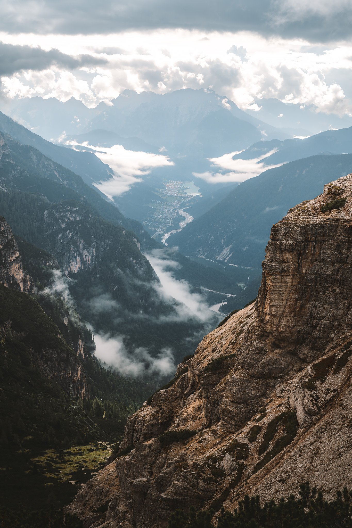
Returning to the mountains from Belluno felt more like a return to a very familiar place. The trip back to the mountains was quieter and more direct. There was no anticipation, only movement toward something that somehow felt like the more obvious conclusion to the trip.
There was an issue at the rental car agency. License plate information and parking near Auronzo caused a slight moment of friction. This type of detail can be more important than it should be, but it was addressed quickly with the guys at the entrance gate at the bottom of the mountain and then forgotten.
And then the road began to climb toward Auronzo.
The shapes began to return. The pale rock, so distinct and nearly artificial in its tone, was back in plain sight above the tree line. Layers of spruce and larch forest gave way to more open terrain as the elevation increased.
The rhythm of the landscape was back, but the experience would be different.
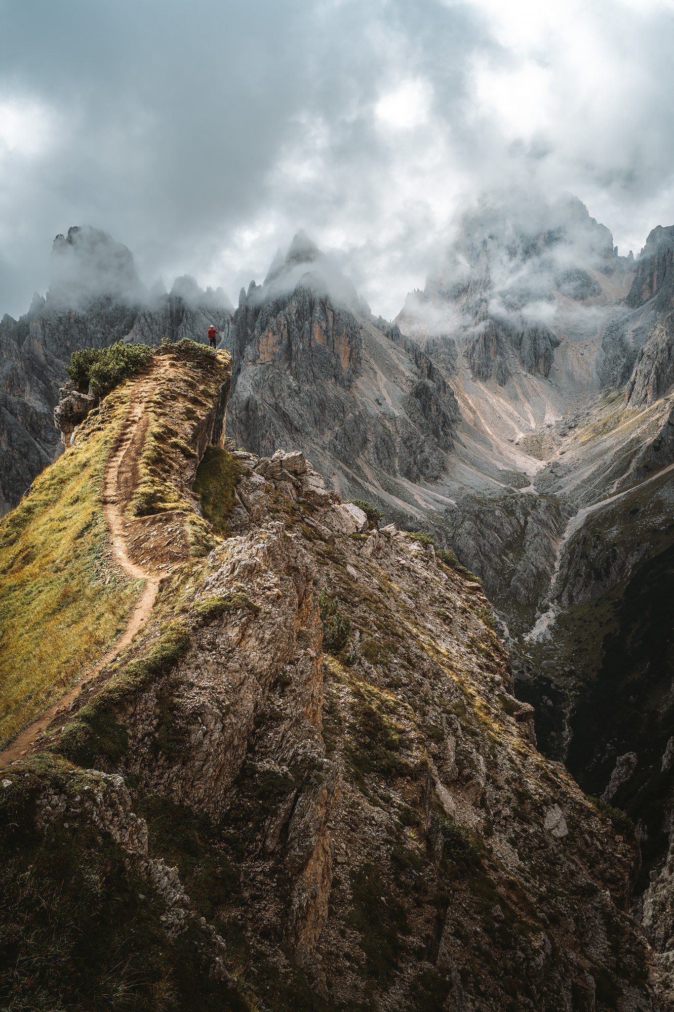
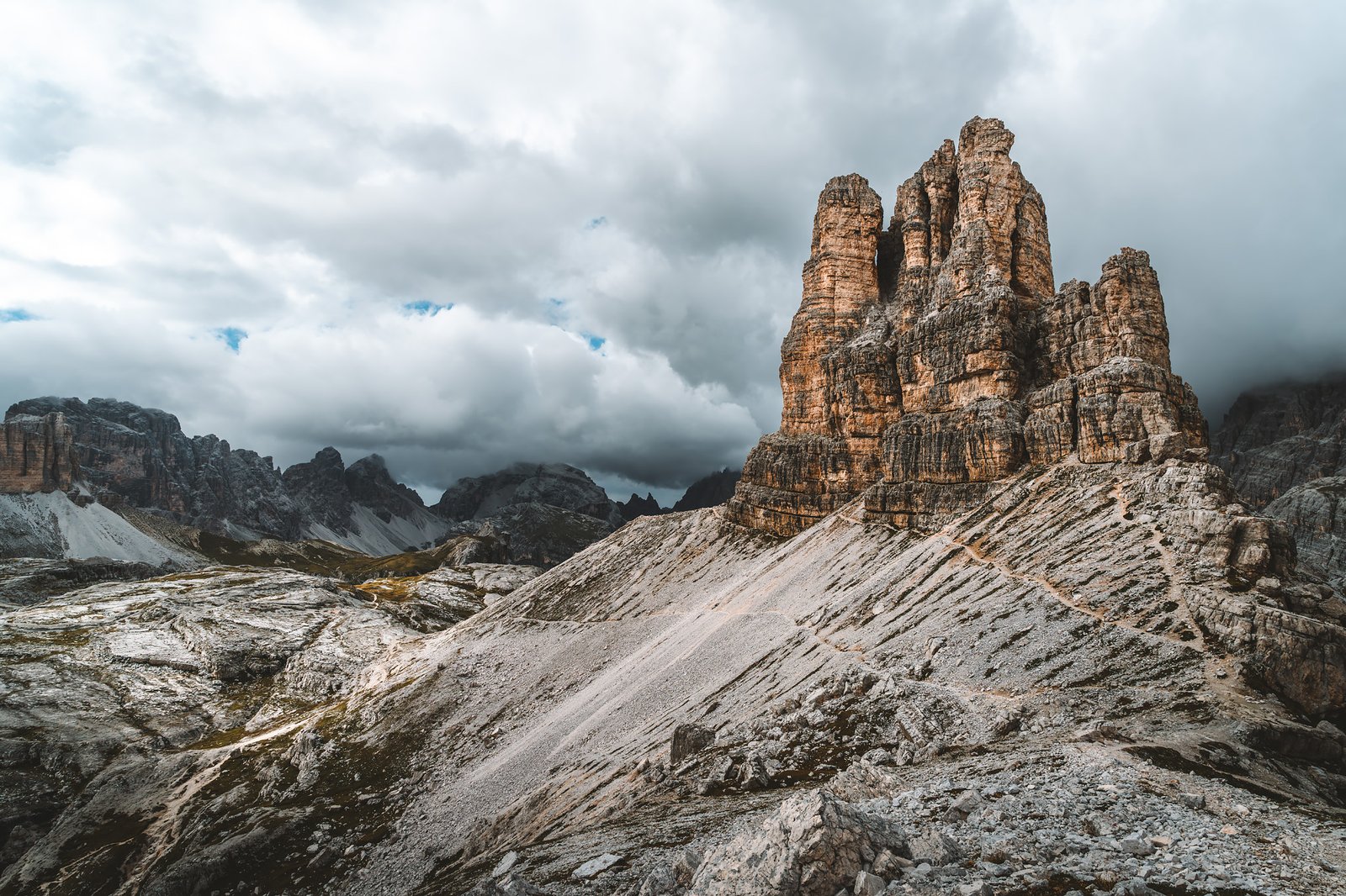
Cadini di Misurina was the first stop after leaving the car.
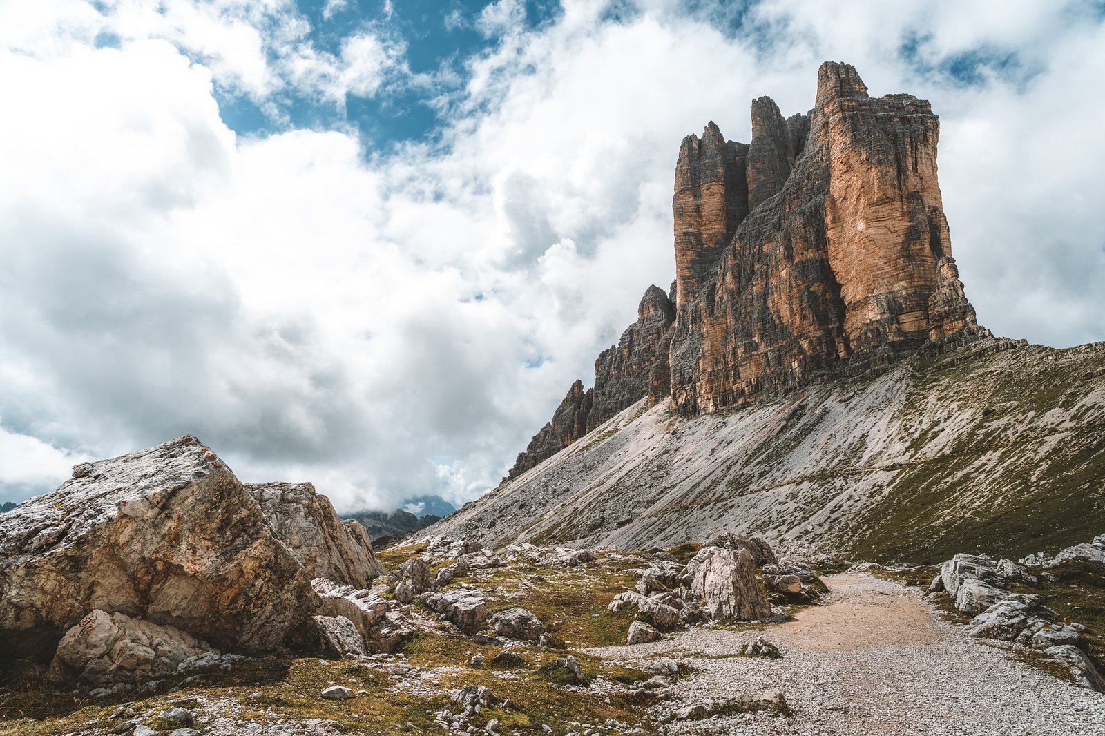
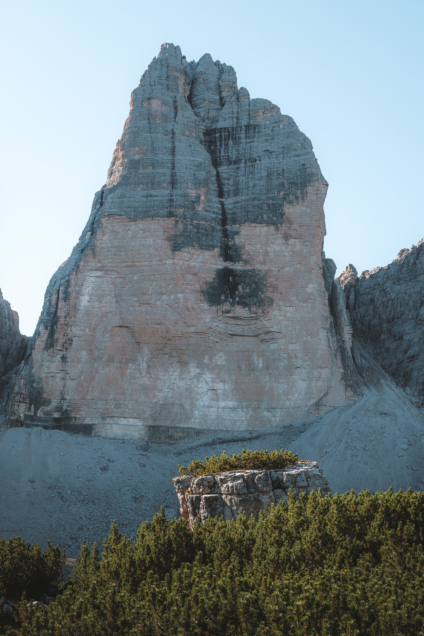
These formations differ from those that had characterized the previous days. More angular, more fractured. A collection of narrow ridges and spires created by erosion on brittle dolomitic rock, producing a sense of depth compressed into a single plane.
They lie immediately in front of the south-facing sides of Tre Cime and serve as a sort of foreground, chaotic, irregular, contrasting with the more monolithic form of the towers behind.
This contrast is part of what makes the area so compelling. It is also what has made it so visible.
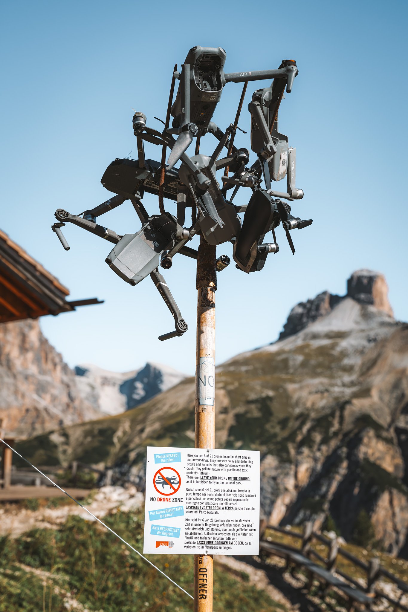
A crowd had gathered for a photo. A particular vantage point, created as much by social media as by the landscape itself.
Mass tourism has hit Cadini di Misurina. Not only due to how easily accessible it is, but also due to how many times it has been shared. And yet, even there, once you see the view, the mountains remain.
The Way to Tre Cime
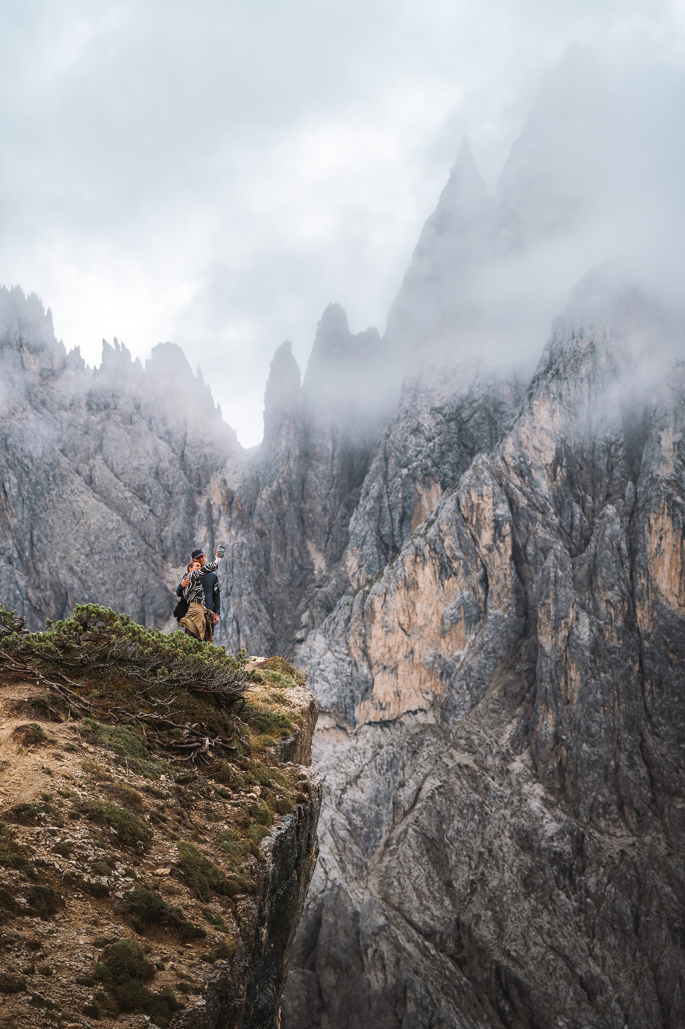
The trail leading to Tre Cime is surprisingly straightforward.
Wide, well-compacted trails, built into the slope and maintained for constant traffic, dominate the terrain. The ground is stable, composed of packed gravel and worn rock, a product of both natural erosion and continuous human use.
For several days, the terrain was inconsistent and technical parts of the trip were frequent. The distinction here is quite obvious. The towers begin to show themselves exponentially, until you see their most recognizable shape.
From the east, where the view opens up to the distant Passo Grande dei Rondoi, the geological structure becomes clear. Towering vertical walls of pale dolomite rise sharply from a relatively flat foundation. They are the product of millions of years of marine sedimentation followed by uplift and erosion.
Layers within the rock are sometimes visible, remnants of their origins as ancient coral reefs, now elevated into the air.
Mist circulated slowly through the terrain. Sometimes, it obscured the edges. Sometimes, it dissipated entirely, leaving the rock exposed, sharp against the sky.
Enough to understand both aspects of the location, why it draws so many, and why many do not continue past.
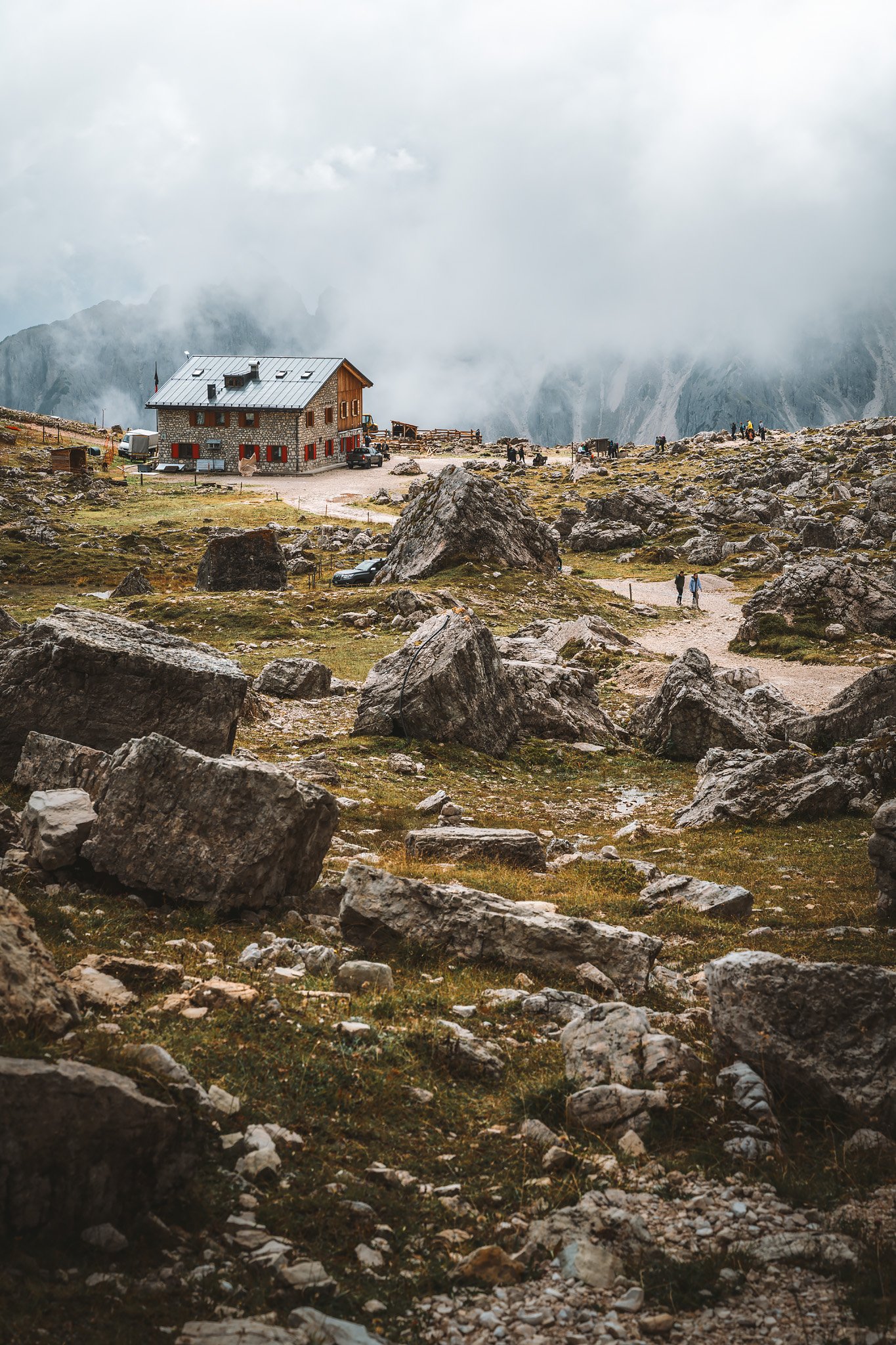
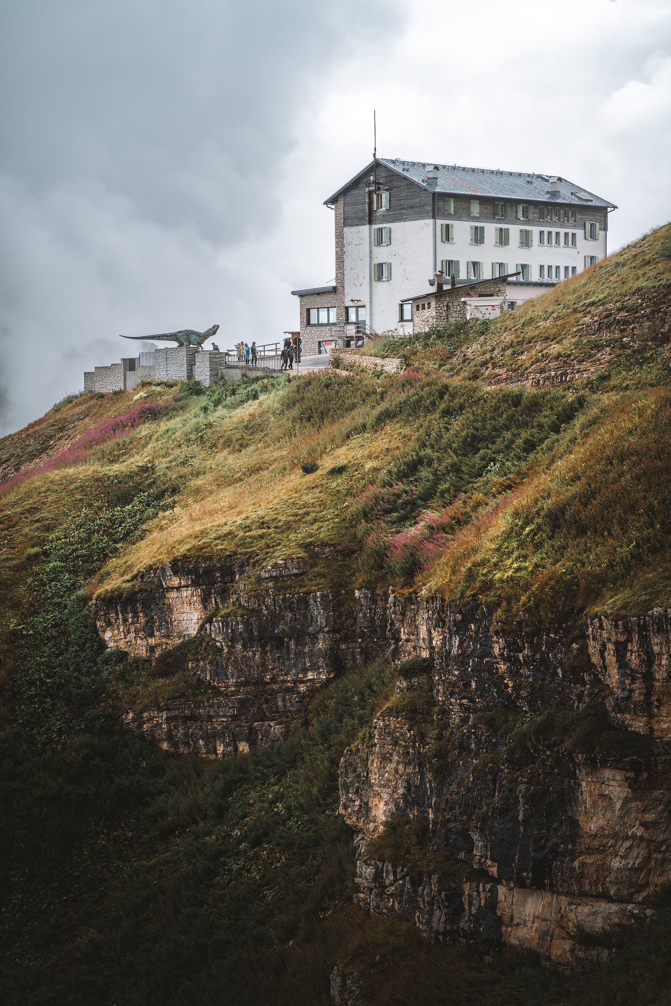
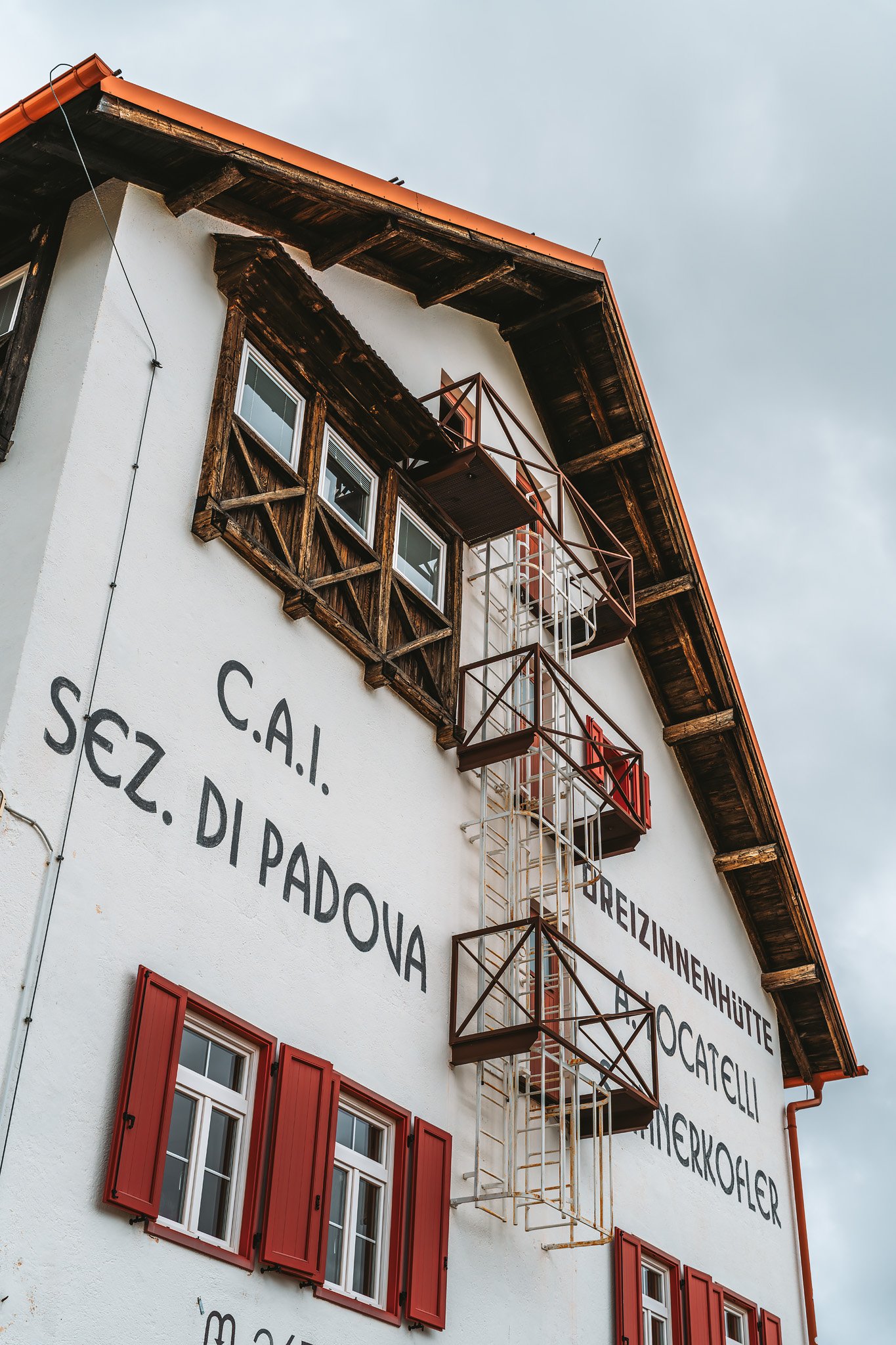
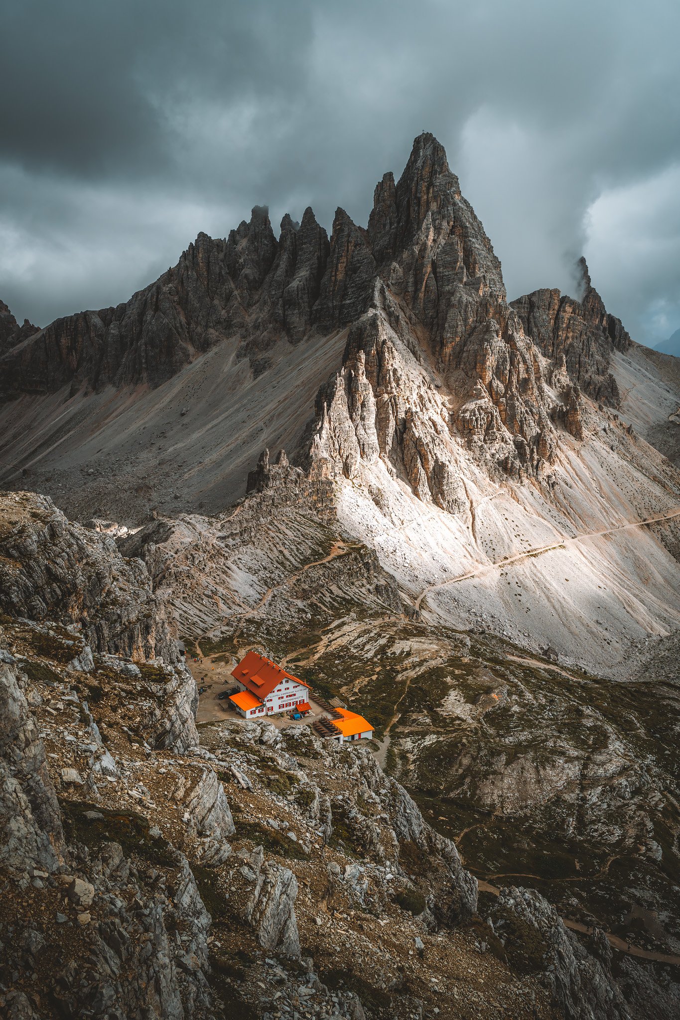
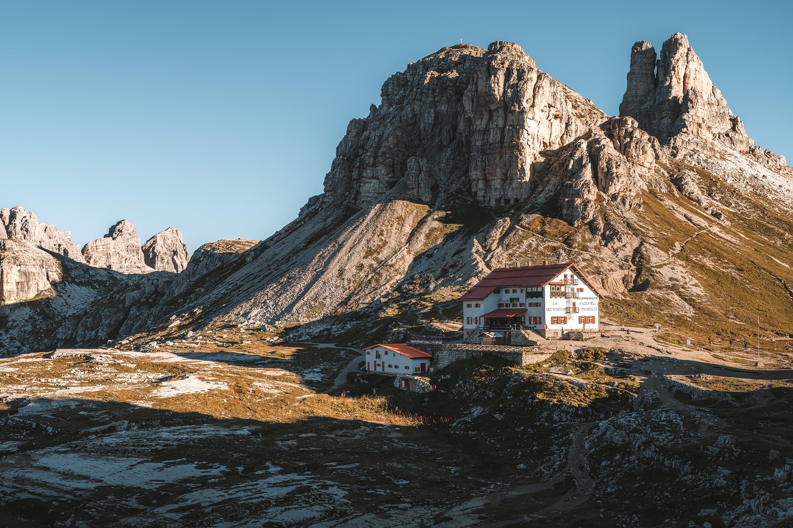
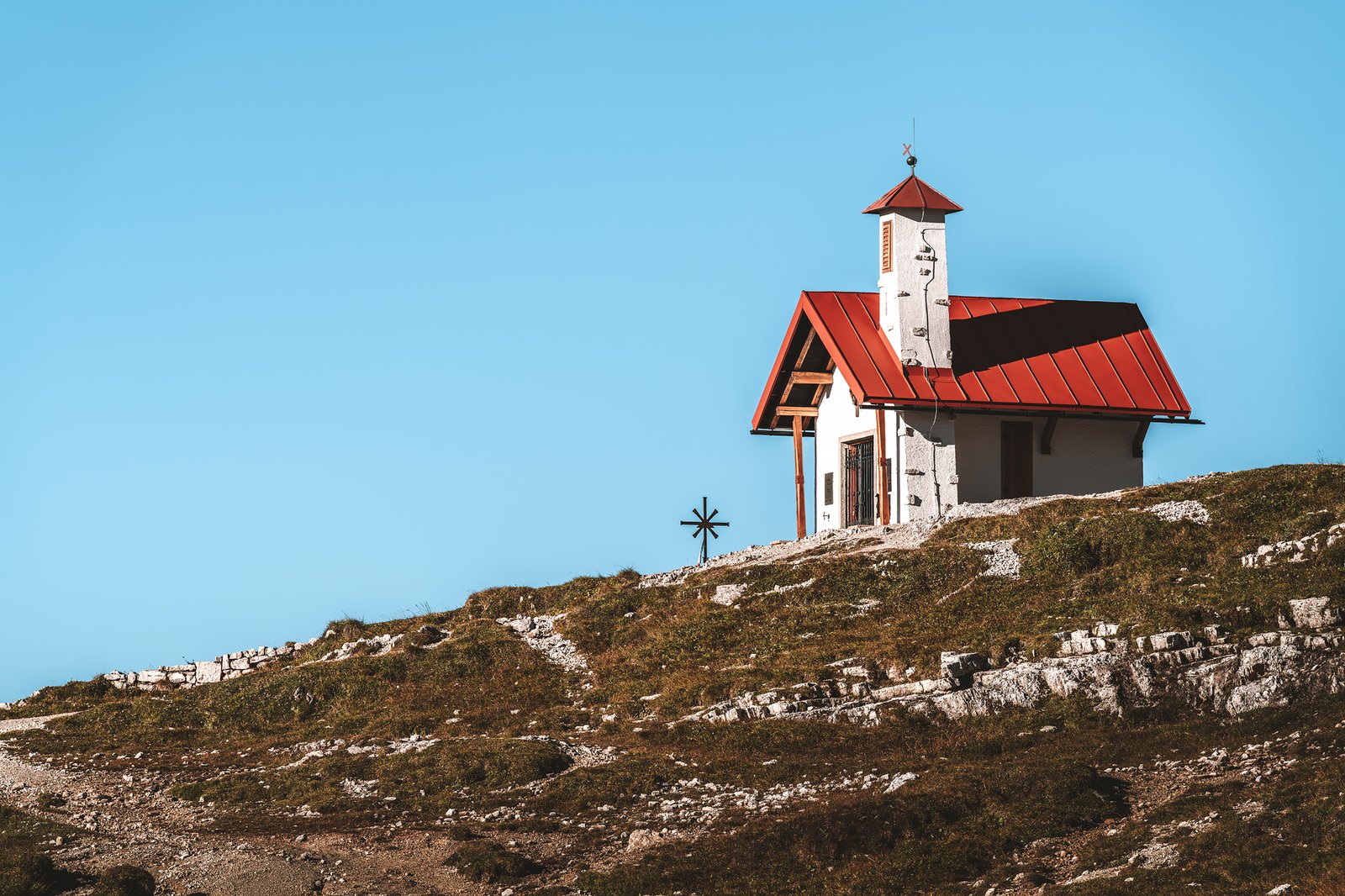
Rifugio Locatelli confirmed the contrast. Busy, active, and yet, situated perfectly.
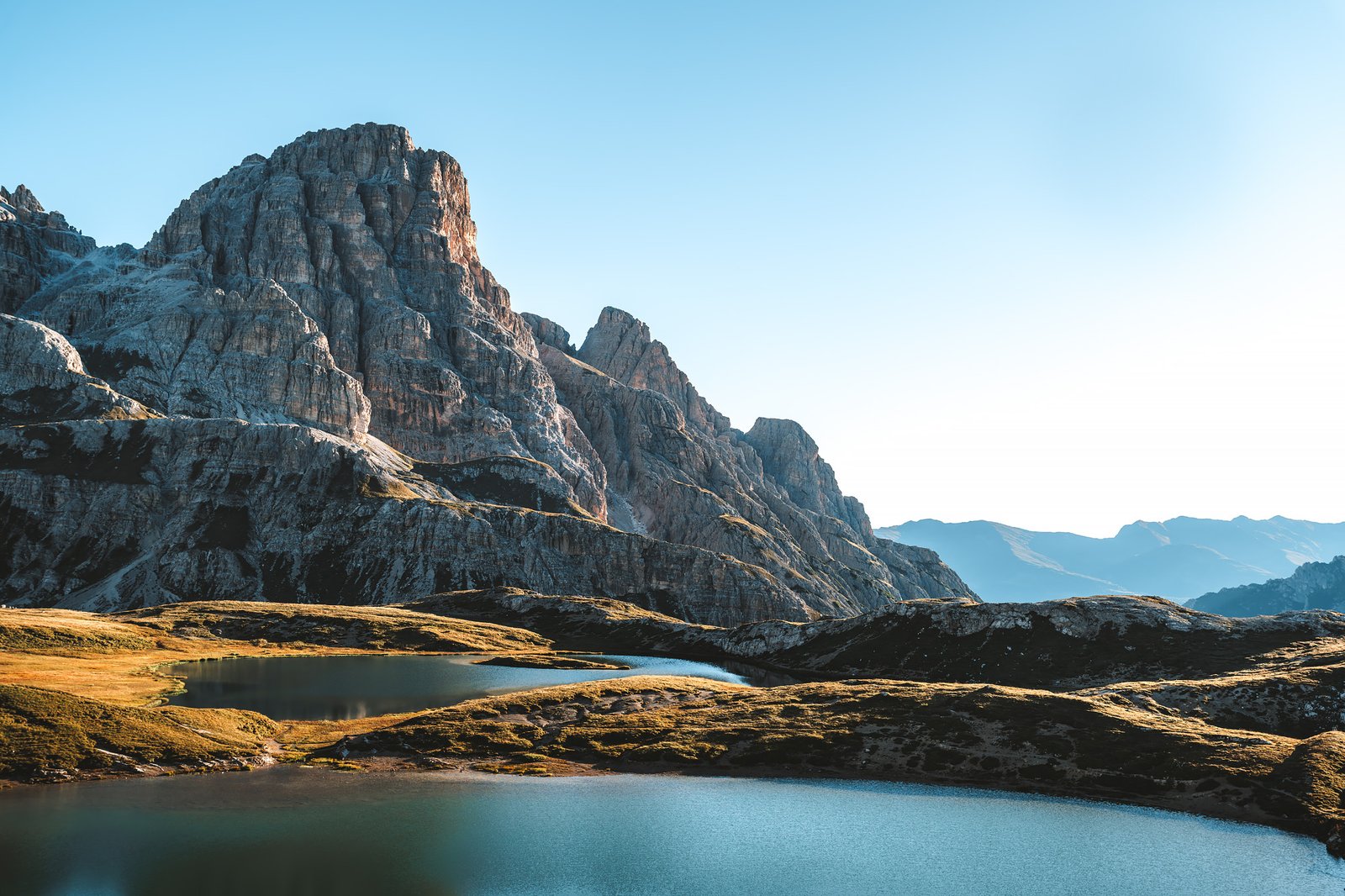
The Laghi dei Piani behind the refuge are located in shallow depressions carved into the rock. Their calm surfaces reflect the towers when the wind permits. The terrain surrounding them is bare. There is low-alpine vegetation and isolated clumps of grass between the rocks.
Sheep walk around this terrain without hesitation, accustomed to its irregularities. The caves nearby carved into the rock during WWI represent a continuation of the locations previously encountered.
I was walking with a limp by then, but it did not matter.
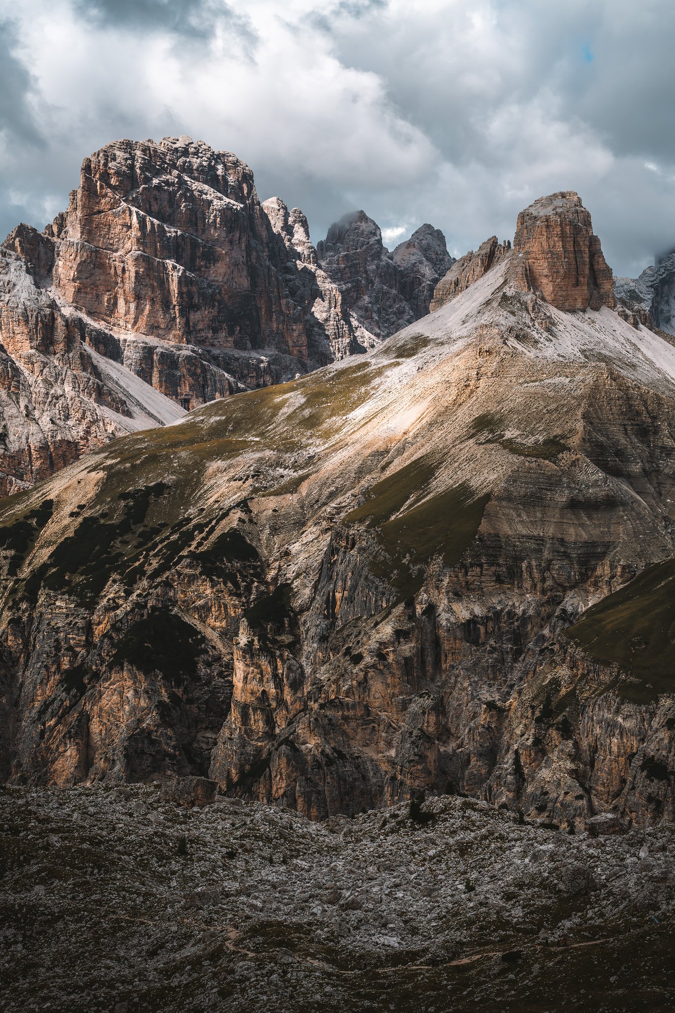
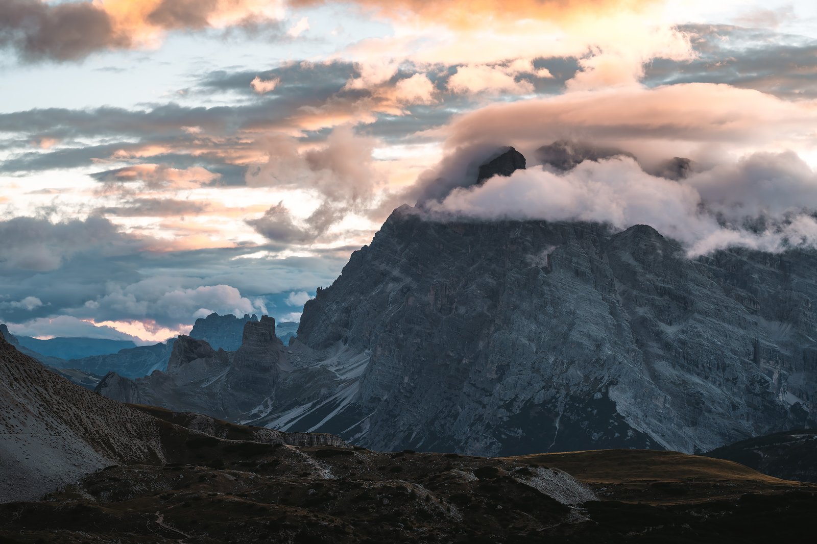
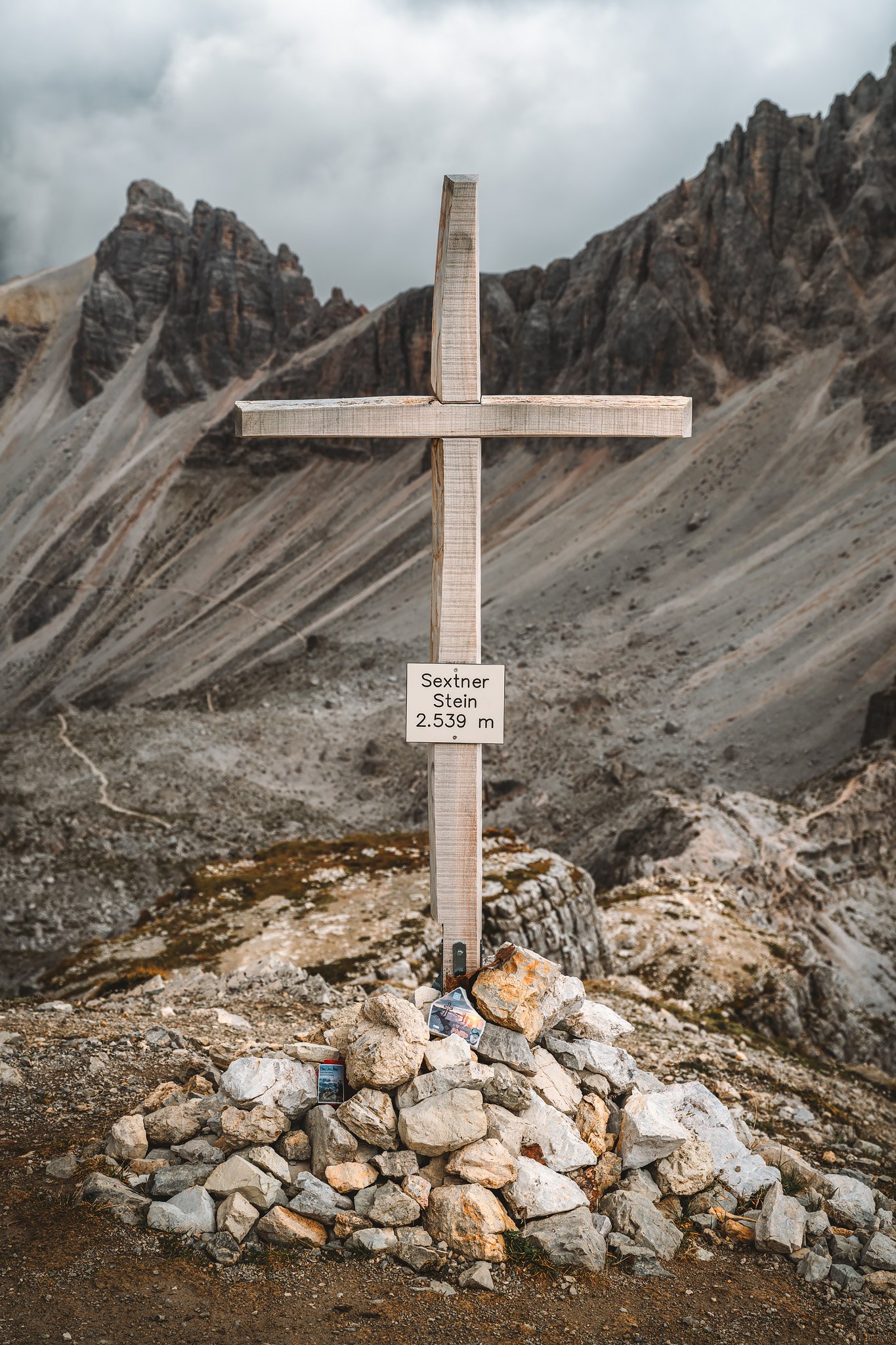
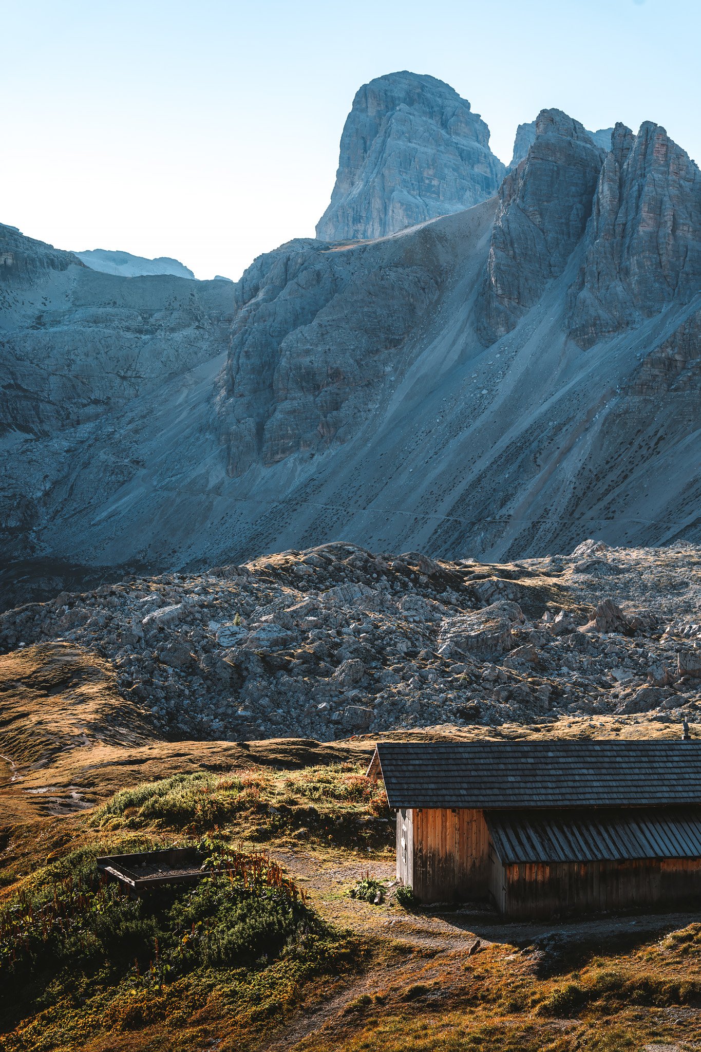
Climbing toward Sextenstein changes the perspective again. The trail to this peak that dominates the landscape around the refugio is more rugged. There is more loose rock and unstable footing. Parts of the mountain show more of its structural foundation. The pale dolomite here breaks into sharp shards, producing a visually stunning but mechanically unstable terrain.
From the top, everything enlarges. The refuge is tiny and the pathways disappear. The summits stretch farther than Tre Cime and clouds move rapidly in discrete masses, circulating through the valleys, breaking against the steep faces of the rock.
The landscape never fully settled.
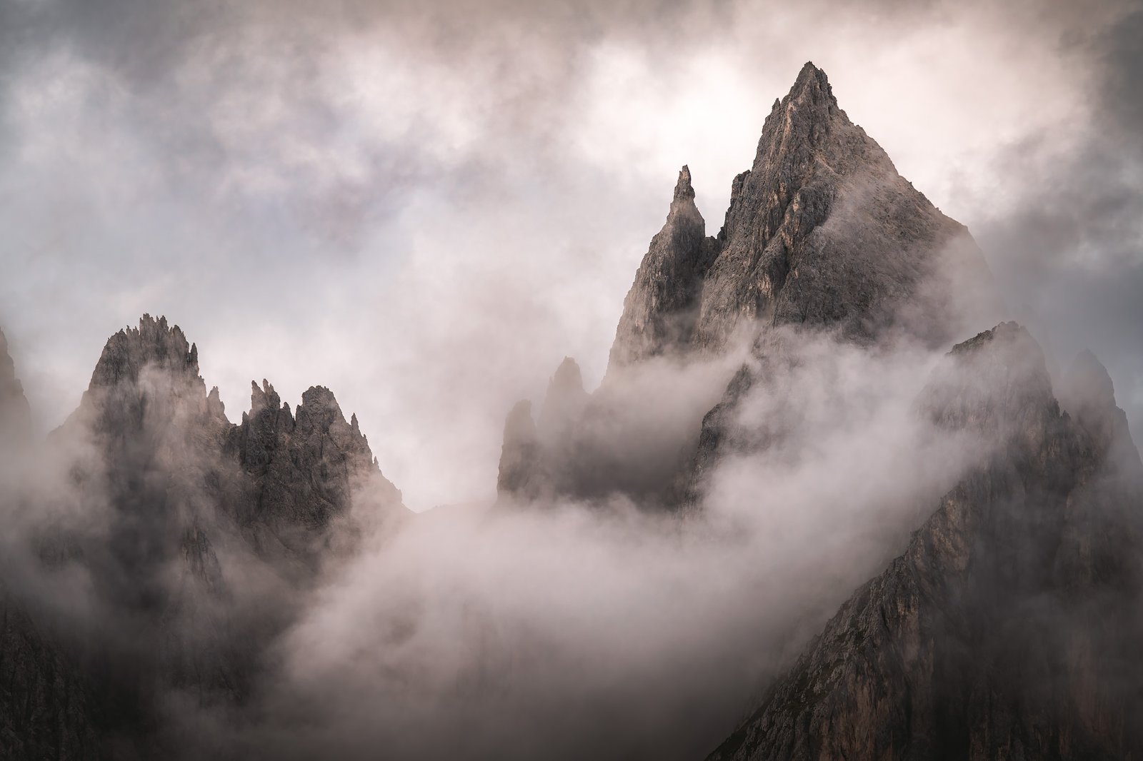
The Guardians of Light
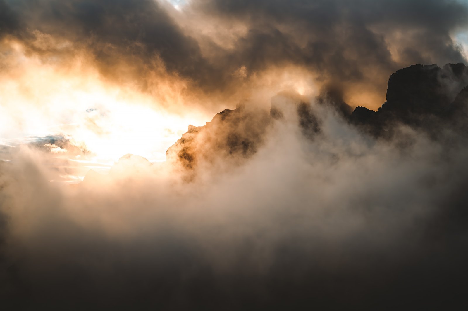
Right after an interesting dinner with two other solo travelers, an Australian and an Italian lady living not far from Belluno, whose Nepalese husband worked in the refugio and had invited her for the first time, the conditions began to align. Clouds parted in patches and sunlight struck the vertical faces of the towers, and those who wished to contemplate its quiet majesty made their way toward the cliff.
The rock colors shifted, orange. Then deeper, almost red. The mineral content of the dolomite enhances this effect. Light interacts differently with angle and surface, creating strong contrasts between illuminated and shaded areas.
The mist passed through it.
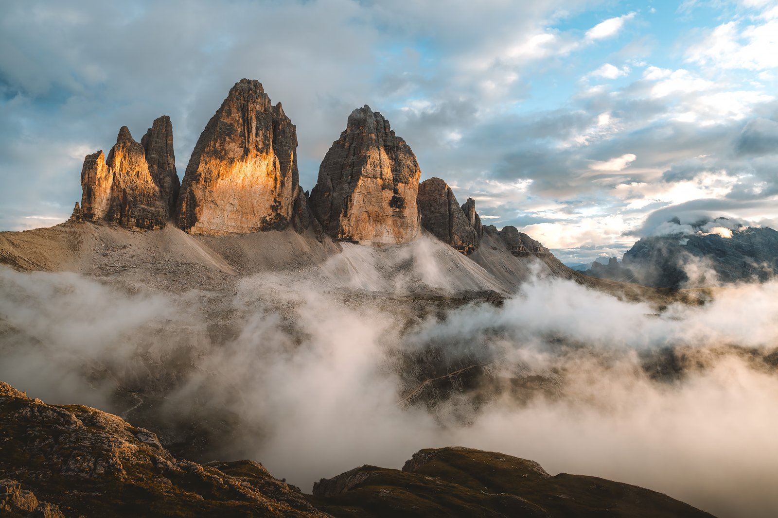
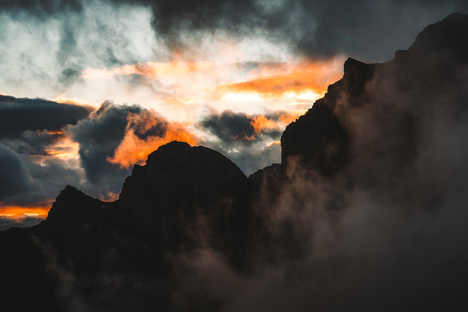
At various moments, it seemed as though the clouds were burning, absorbing light and dispersing it across the summits like suspended flame. It did not last long, but it did not need to.
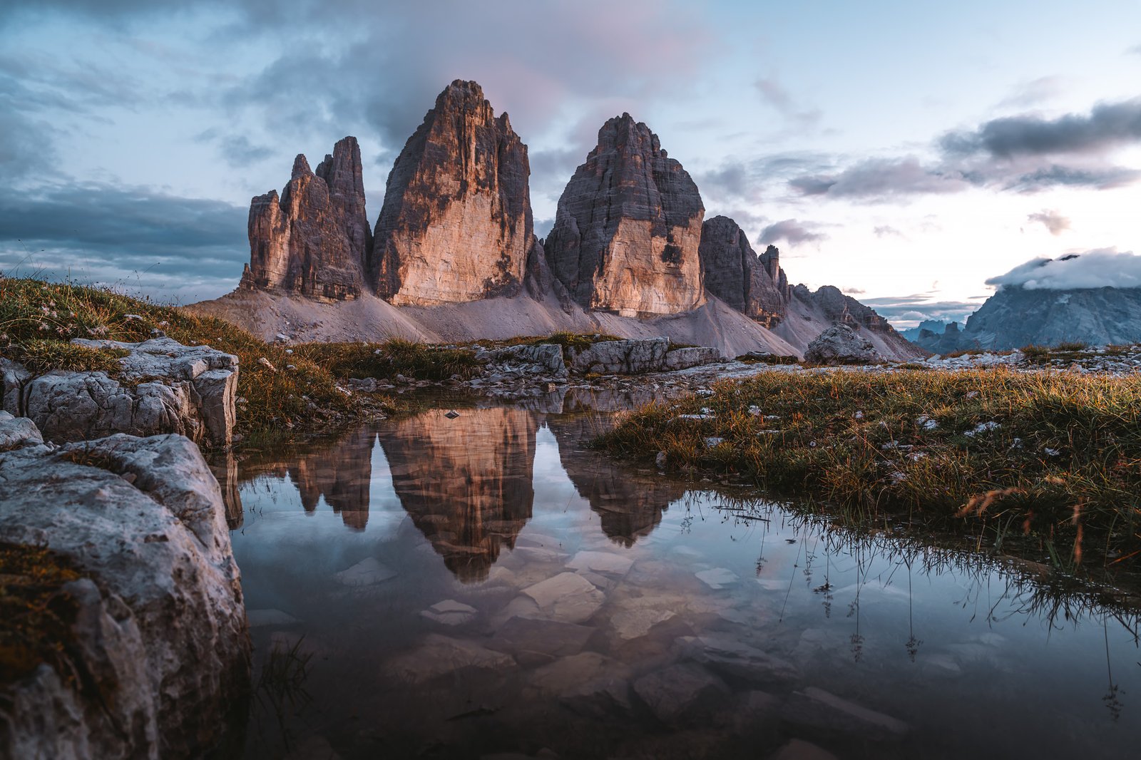
Once the light dissipated, the atmosphere shifted again. Blue hour set in, and while returning to the refuge, temporary ponds, formed in shallow depressions in the rock, captured the last reflections of the towers.
Stage 9. Rifugio Locatelli – Auronzo
Distance: 5.59 km · Elevation Gain: +198 m · Elevation Loss: +274 m · Technical Difficulty: Easy
The day following was different. A cloudless blue sky with steady light.
The Laghi dei Piani reflected a completely different version of the same landscape. The reflections were more defined. The geometric clarity of the towers is more visible, clean edges, vertical lines, clear separation between each tower.
There was almost no movement, only geometry.
Walking around the massif from the other side showed another level. The terrain relaxed gradually with more grass and less exposed rock. Gradual transition from high-alpine terrain to lower-elevation meadows. While descending toward Auronzo, people became more abundant.
Accessibility defines this place as much as the mountains themselves.
A brief stop in Misurina Lake framed by trees and smaller peaks. Less dramatic, but connected to the larger system. It started to feel like the experience was about to end.
The Return
The train from Belluno to Venice was the final transition.
When I arrived at Santa Lucia station, the change was total. Heat and large crowds moving in every direction. Sound bouncing off surfaces rather than disappearing into open space.
The Alta Via 1 should not be confined to a begin and an end location. Tre Cime represents a type of closure to the route that is difficult to replicate elsewhere. Seeing it at the end, and not at the beginning, changes its meaning completely.
By then, the Dolomites are no longer something to discover, but an experience that even after leaving, remains.
